Radelfingen elevation
Radelfingen (Bern, Seeland District), Switzerland elevation is 501 meters and Radelfingen elevation in feet is 1644 ft above sea level [src 1]. Radelfingen is a populated place (feature code) with elevation that is 47 meters (154 ft) smaller than average city elevation in Switzerland.
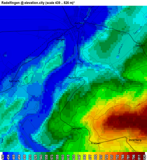
Below is the Elevation map of Radelfingen, which displays elevation range with different colors. Scale of the first map is from 439 to 826 m (1440 to 2710 ft) with average elevation of 535.7 meters (=1758 ft) [note 1]
These maps also provides idea of topography and contour of this city, they are displayed at different zoom levels. More info about maps, scale and edge coordinates you can find below images.
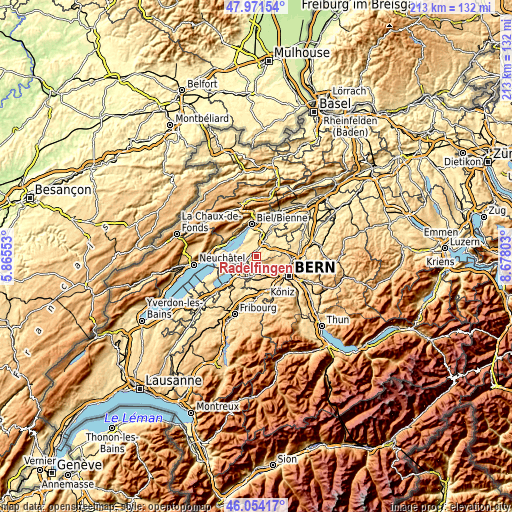
| \ | Map #1 | Topo.Map |
| Scale [m] | 439..826 m | × |
| Scale [ft] | 1440..2710 ft | × |
| Average | 535.7 m = 1758 ft | × |
| Width | 6.66 km = 4.1 mi | 213.2 km = 132.5 mi |
| Height | 6.66 km = 4.1 mi | 213.2 km = 132.5 mi |
| ↑Max Latitude | 47.05141° | 47.97154° |
| Latitude at center | 47.02146° | 47.02146° |
| ↓Min Latitude | 46.991493° | 46.05417° |
| ← Min Longitude | 7.227835° | 5.86553° |
| Longitude center | 7.27178° | 7.27178° |
| →Max Longitude | 7.315725° | 8.67803° |
Nearby cities:
Cities around Radelfingen sort by population:
• Lyss elevation 445 m
6.4 km,  24°
24°
• Wohlen 546 m
8.5 km,  130°
130°
• Kerzers 455 m
7.7 km,  228°
228°
• Aarberg 458 m
2.6 km,  6°
6°
• Schüpfen 532 m
8.2 km,  78°
78°
• Seedorf 566 m
3.4 km,  64°
64°
• Grossaffoltern 508 m
8.1 km,  52°
52°
• Mühleberg 553 m
7.5 km,  186°
186°
• Täuffelen 490 m
7.4 km,  312°
312°
• Kallnach 464 m
2.8 km,  267°
267°
• Frauenkappelen 602 m
9 km,  145°
145°
• Kappelen 447 m
4.3 km,  356°
356°
Multilingual:
 En español:
Radelfingen elevación 501 m.
 En France:
Radelfingen élévation 501 m.
 Auf Deutsch:
Radelfingen, Radelfingen b. Aarberg höhe über dem Meeresspiegel ist 501 m.

Sources and notes:
- [note 1] Map square and city borders are not equal. Map elevation data is calculated only from area inside that square.
- [src 1] Elevation data from geonames database provided with same terms of usage.
- [src 2] The elevation map of Radelfingen is generated using elevation data from NASA's 3 arcsec (90m) resolution SRTM data.
- [src 3] Base (background) map © OpenStreetMap contributors tiles are generated by Geofabrik and OpenTopoMap.
Copyright & License:
This Radelfingen Elevation Map is licensed under CC BY-SA. You may reuse any part from this page, if you give a proper credit by linking to this URL:
 More info on terms of use page.