Rothrist elevation
Rothrist (Aargau, Bezirk Zofingen), Switzerland elevation is 410 meters and Rothrist elevation in feet is 1345 ft above sea level [src 1]. Rothrist is a populated place (feature code) with elevation that is 138 meters (453 ft) smaller than average city elevation in Switzerland.
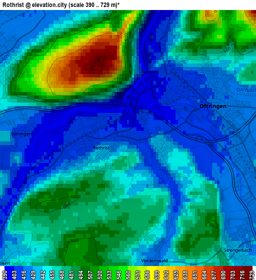
Below is the Elevation map of Rothrist, which displays elevation range with different colors. Scale of the first map is from 390 to 729 m (1280 to 2392 ft) with average elevation of 460.5 meters (=1511 ft) [note 1]
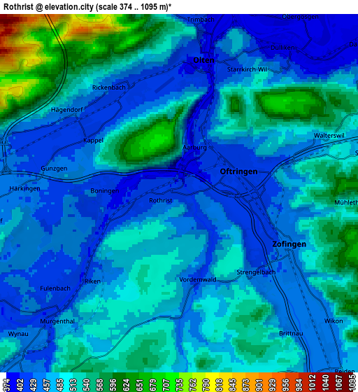
These maps also provides idea of topography and contour of this city, they are displayed at different zoom levels. More info about maps, scale and edge coordinates you can find below images.
| \ | Map #1 | Map #2 | Topo.Map |
| Scale [m] | 390..729 m | 374..1095 m | × |
| Scale [ft] | 1280..2392 ft | 1227..3593 ft | × |
| Average | 460.5 m = 1511 ft | 488.6 m = 1603 ft | × |
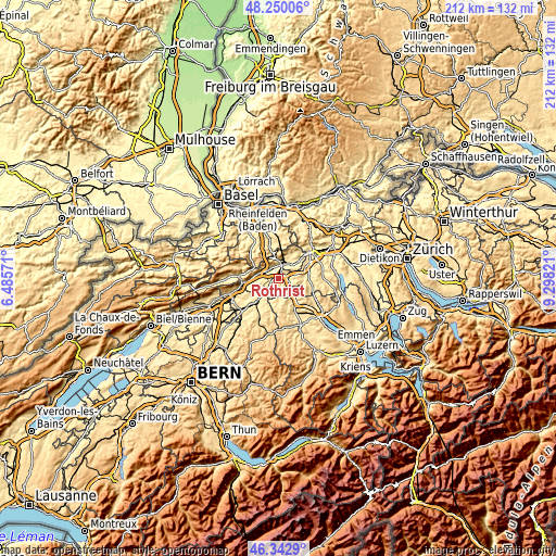
| Width | 6.63 km = 4.1 mi | 13.25 km = 8.2 mi | 212.1 km = 131.8 mi |
| Height | 6.63 km = 4.1 mi | 13.25 km = 8.2 mi | 212 km = 131.7 mi |
| ↑Max Latitude | 47.334871° | 47.364645° | 48.25006° |
| Latitude at center | 47.30508° | 47.30508° | 47.30508° |
| ↓Min Latitude | 47.275273° | 47.245448° | 46.3429° |
| ← Min Longitude | 7.848015° | 7.804069° | 6.48571° |
| Longitude center | 7.89196° | 7.89196° | 7.89196° |
| →Max Longitude | 7.935905° | 7.979851° | 9.29821° |
Nearby cities:
Cities around Rothrist sort by population:
• Olten elevation 406 m
5.1 km,  9°
9°
• Zofingen 441 m
4.5 km,  115°
115°
• Oftringen 416 m
2.7 km,  68°
68°
• Aarburg 408 m
1.8 km,  18°
18°
• Wangen 420 m
4.6 km,  338°
338°
• Strengelbach 433 m
4 km,  135°
135°
• Hägendorf 439 m
5.1 km,  311°
311°
• Brittnau 452 m
6.5 km, 140°
• Murgenthal 409 m
5.5 km,  226°
226°
• Vordemwald 428 m
3.3 km,  167°
167°
• Gunzgen 437 m
4.7 km,  281°
281°
• Fulenbach 406 m
5.9 km, 230°
Multilingual:
 En español:
Rothrist elevación 410 m.
 En France:
Rothrist élévation 410 m.
 Auf Deutsch:
Rothrist höhe über dem Meeresspiegel ist 410 m.

Sources and notes:
- [note 1] Map square and city borders are not equal. Map elevation data is calculated only from area inside that square.
- [src 1] Elevation data from geonames database provided with same terms of usage.
- [src 2] The elevation map of Rothrist is generated using elevation data from NASA's 3 arcsec (90m) resolution SRTM data.
- [src 3] Base (background) map © OpenStreetMap contributors tiles are generated by Geofabrik and OpenTopoMap.
Copyright & License:
This Rothrist Elevation Map is licensed under CC BY-SA. You may reuse any part from this page, if you give a proper credit by linking to this URL:
 More info on terms of use page.