Saillon elevation
Saillon (Valais, Martigny District), Switzerland elevation is 466 meters and Saillon elevation in feet is 1529 ft above sea level [src 1]. Saillon is a populated place (feature code) with elevation that is 82 meters (269 ft) smaller than average city elevation in Switzerland.
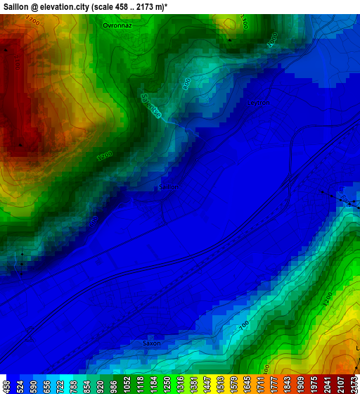
Below is the Elevation map of Saillon, which displays elevation range with different colors. Scale of the first map is from 458 to 2173 m (1503 to 7129 ft) with average elevation of 836.7 meters (=2745 ft) [note 1]
These maps also provides idea of topography and contour of this city, they are displayed at different zoom levels. More info about maps, scale and edge coordinates you can find below images.
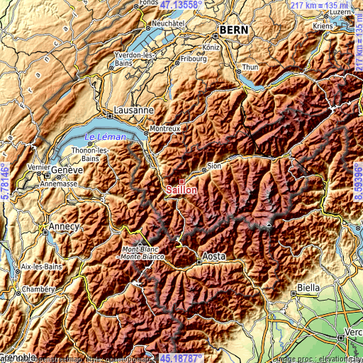
| \ | Map #1 | Topo.Map |
| Scale [m] | 458..2173 m | × |
| Scale [ft] | 1503..7129 ft | × |
| Average | 836.7 m = 2745 ft | × |
| Width | 6.77 km = 4.2 mi | 216.6 km = 134.6 mi |
| Height | 6.77 km = 4.2 mi | 216.6 km = 134.6 mi |
| ↑Max Latitude | 46.200774° | 47.13558° |
| Latitude at center | 46.17035° | 46.17035° |
| ↓Min Latitude | 46.139909° | 45.18787° |
| ← Min Longitude | 7.143765° | 5.78146° |
| Longitude center | 7.18771° | 7.18771° |
| →Max Longitude | 7.231655° | 8.59396° |
Nearby cities:
Cities around Saillon sort by population:
• Conthey elevation 491 m
10.7 km,  56°
56°
• Bagnes 924 m
9.9 km,  167°
167°
• Fully 471 m
6.6 km,  237°
237°
• Basse-Nendaz 1004 m
9.8 km,  77°
77°
• Vétroz 482 m
9 km,  50°
50°
• Saxon 470 m
2.5 km,  202°
202°
• Chamoson 650 m
4.5 km,  37°
37°
• Ardon 487 m
7.1 km, 52°
• Riddes 499 m
2.8 km, 84°
• Leytron 491 m
2.4 km, 40°
• Verbier 1515 m
8.4 km,  159°
159°
• Charrat 461 m
6.7 km,  220°
220°
Multilingual:
 En español:
Saillon elevación 466 m.
 En France:
Saillon élévation 466 m.


Sources and notes:
- [note 1] Map square and city borders are not equal. Map elevation data is calculated only from area inside that square.
- [src 1] Elevation data from geonames database provided with same terms of usage.
- [src 2] The elevation map of Saillon is generated using elevation data from NASA's 3 arcsec (90m) resolution SRTM data.
- [src 3] Base (background) map © OpenStreetMap contributors tiles are generated by Geofabrik and OpenTopoMap.
Copyright & License:
This Saillon Elevation Map is licensed under CC BY-SA. You may reuse any part from this page, if you give a proper credit by linking to this URL:
 More info on terms of use page.