Sainte-Croix elevation
Sainte-Croix (Vaud, Jura-Nord vaudois District), Switzerland elevation is 1082 meters and Sainte-Croix elevation in feet is 3550 ft above sea level [src 1]. Sainte-Croix is a populated place (feature code) with elevation that is 534 meters (1752 ft) bigger than average city elevation in Switzerland.
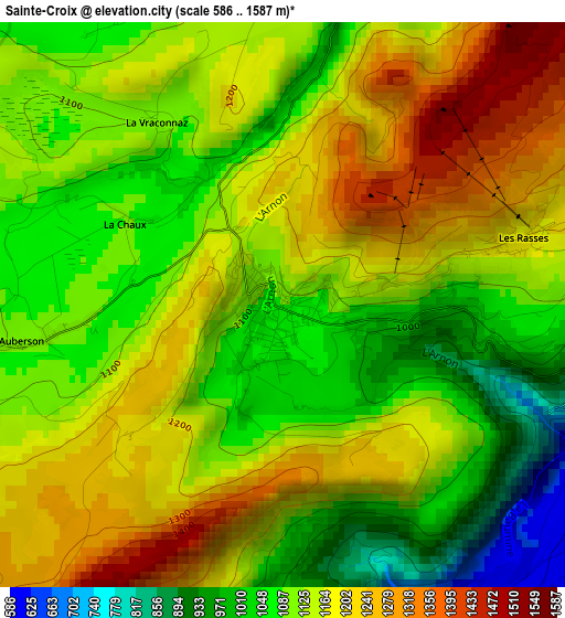
Below is the Elevation map of Sainte-Croix, which displays elevation range with different colors. Scale of the first map is from 586 to 1587 m (1923 to 5207 ft) with average elevation of 1140.7 meters (=3742 ft) [note 1]
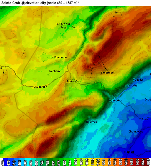
These maps also provides idea of topography and contour of this city, they are displayed at different zoom levels. More info about maps, scale and edge coordinates you can find below images.
| \ | Map #1 | Map #2 | Topo.Map |
| Scale [m] | 586..1587 m | 430..1587 m | × |
| Scale [ft] | 1923..5207 ft | 1411..5207 ft | × |
| Average | 1140.7 m = 3742 ft | 1043.8 m = 3425 ft | × |
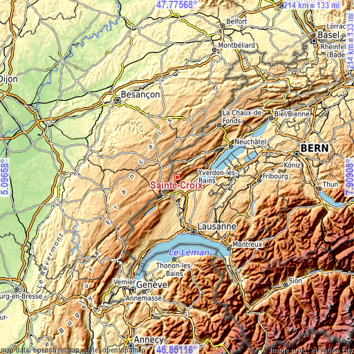
| Width | 6.69 km = 4.2 mi | 13.37 km = 8.3 mi | 214 km = 133 mi |
| Height | 6.69 km = 4.2 mi | 13.37 km = 8.3 mi | 214 km = 133 mi |
| ↑Max Latitude | 46.852092° | 46.882137° | 47.77568° |
| Latitude at center | 46.82203° | 46.82203° | 46.82203° |
| ↓Min Latitude | 46.791951° | 46.761856° | 45.85116° |
| ← Min Longitude | 6.458885° | 6.414939° | 5.09658° |
| Longitude center | 6.50283° | 6.50283° | 6.50283° |
| →Max Longitude | 6.546775° | 6.590721° | 7.90908° |
Nearby cities:
Cities around Sainte-Croix sort by population:
• Yverdon-les-Bains elevation 438 m
11.6 km,  114°
114°
• Orbe 477 m
11 km,  168°
168°
• Fleurier 744 m
10.8 km,  34°
34°
• Vallorbe 757 m
15.4 km,  217°
217°
• Chavornay 455 m
14.2 km,  159°
159°
• Couvet 744 m
15.1 km,  40°
40°
• Grandson 445 m
11 km,  97°
97°
• Montagny 462 m
8.9 km, 111°
• Bavois 462 m
16.1 km, 162°
• Cheseaux-Noréaz 567 m
13.5 km, 109°
• Les Clées 629 m
10.5 km,  197°
197°
• Valeyres-sous-Montagny 442 m
8.6 km, 107°
Multilingual:
 En español:
Sainte-Croix elevación 1082 m.
 En France:
Sainte-Croix élévation 1082 m.
 Auf Deutsch:
Sainte-Croix VD höhe über dem Meeresspiegel ist 1082 m.

Sources and notes:
- [note 1] Map square and city borders are not equal. Map elevation data is calculated only from area inside that square.
- [src 1] Elevation data from geonames database provided with same terms of usage.
- [src 2] The elevation map of Sainte-Croix is generated using elevation data from NASA's 3 arcsec (90m) resolution SRTM data.
- [src 3] Base (background) map © OpenStreetMap contributors tiles are generated by Geofabrik and OpenTopoMap.
Copyright & License:
This Sainte-Croix Elevation Map is licensed under CC BY-SA. You may reuse any part from this page, if you give a proper credit by linking to this URL:
 More info on terms of use page.