Yverdon-les-Bains elevation
Yverdon-les-Bains (Vaud, Jura-Nord vaudois District), Switzerland elevation is 438 meters and Yverdon-les-Bains elevation in feet is 1437 ft above sea level [src 1]. Yverdon-les-Bains is a seat of a second-order administrative division (feature code) with elevation that is 110 meters (361 ft) smaller than average city elevation in Switzerland.
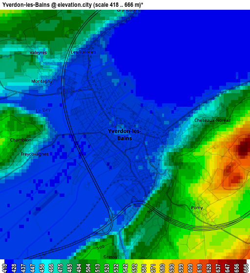
Below is the Elevation map of Yverdon-les-Bains, which displays elevation range with different colors. Scale of the first map is from 418 to 666 m (1371 to 2185 ft) with average elevation of 464.8 meters (=1525 ft) [note 1]
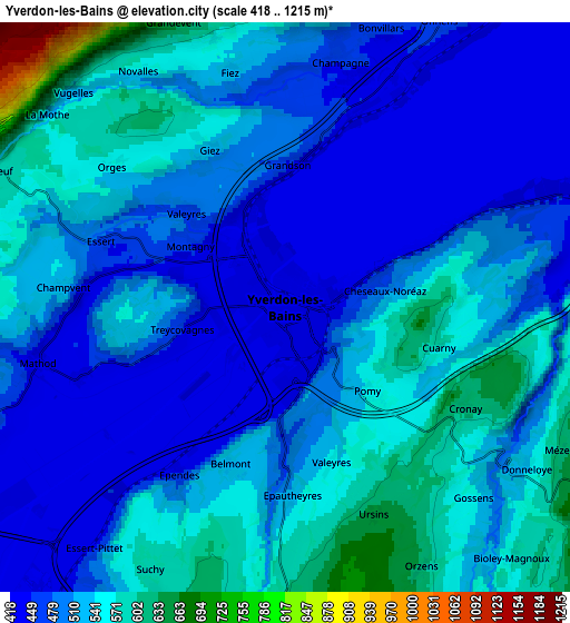
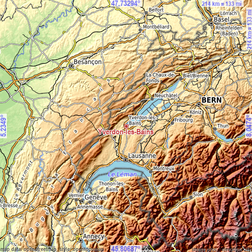
These maps also provides idea of topography and contour of this city, they are displayed at different zoom levels. More info about maps, scale and edge coordinates you can find below images.
| \ | Map #1 | Map #2 | Topo.Map |
| Scale [m] | 418..666 m | 418..1215 m | × |
| Scale [ft] | 1371..2185 ft | 1371..3986 ft | × |
| Average | 464.8 m = 1525 ft | 511.2 m = 1677 ft | × |
| Width | 6.69 km = 4.2 mi | 13.38 km = 8.3 mi | 214.2 km = 133.1 mi |
| Height | 6.69 km = 4.2 mi | 13.38 km = 8.3 mi | 214.1 km = 133 mi |
| ↑Max Latitude | 46.808606° | 46.838676° | 47.73294° |
| Latitude at center | 46.77852° | 46.77852° | 46.77852° |
| ↓Min Latitude | 46.748417° | 46.718297° | 45.80687° |
| ← Min Longitude | 6.597205° | 6.553259° | 5.2349° |
| Longitude center | 6.64115° | 6.64115° | 6.64115° |
| →Max Longitude | 6.685095° | 6.729041° | 8.0474° |
Nearby cities:
Cities around Yverdon-les-Bains sort by population:
• Orbe elevation 477 m
10.3 km,  234°
234°
• Sainte-Croix 1082 m
11.6 km,  294°
294°
• Chavornay 455 m
10.1 km,  212°
212°
• Grandson 445 m
3.5 km,  6°
6°
• Yvonand 433 m
8.1 km,  72°
72°
• Montagny 462 m
2.7 km,  305°
305°
• Pailly 644 m
9 km,  163°
163°
• Penthéréaz 623 m
11.1 km,  194°
194°
• Vuarrens 688 m
10.3 km,  177°
177°
• Rueyres 617 m
10.2 km, 157°
• Valeyres-sous-Montagny 442 m
3.2 km, 314°
• Cheseaux-Noréaz 567 m
2.2 km,  80°
80°
Multilingual:
 En español:
Yverdon-les-Bains elevación 438 m.
 En France:
Yverdon-les-Bains élévation 438 m.
 Auf Deutsch:
Yverdon-les-Bains höhe über dem Meeresspiegel ist 438 m.
 На русском:
Ивердон-ле-Бен, Ивердон-Ле-Бен высота над уровнем моря 438 м
Sources and notes:
- [note 1] Map square and city borders are not equal. Map elevation data is calculated only from area inside that square.
- [src 1] Elevation data from geonames database provided with same terms of usage.
- [src 2] The elevation map of Yverdon-les-Bains is generated using elevation data from NASA's 3 arcsec (90m) resolution SRTM data.
- [src 3] Base (background) map © OpenStreetMap contributors tiles are generated by Geofabrik and OpenTopoMap.
Copyright & License:
This Yverdon-les-Bains Elevation Map is licensed under CC BY-SA. You may reuse any part from this page, if you give a proper credit by linking to this URL:
 More info on terms of use page.