Staffelbach elevation
Staffelbach (Aargau, Bezirk Zofingen), Switzerland elevation is 486 meters and Staffelbach elevation in feet is 1594 ft above sea level [src 1]. Staffelbach is a populated place (feature code) with elevation that is 62 meters (203 ft) smaller than average city elevation in Switzerland.
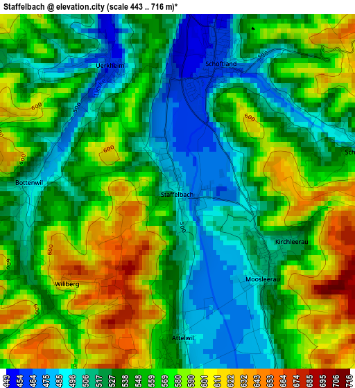
Below is the Elevation map of Staffelbach, which displays elevation range with different colors. Scale of the first map is from 443 to 716 m (1453 to 2349 ft) with average elevation of 549.6 meters (=1803 ft) [note 1]
These maps also provides idea of topography and contour of this city, they are displayed at different zoom levels. More info about maps, scale and edge coordinates you can find below images.
| \ | Map #1 | Topo.Map |
| Scale [m] | 443..716 m | × |
| Scale [ft] | 1453..2349 ft | × |
| Average | 549.6 m = 1803 ft | × |
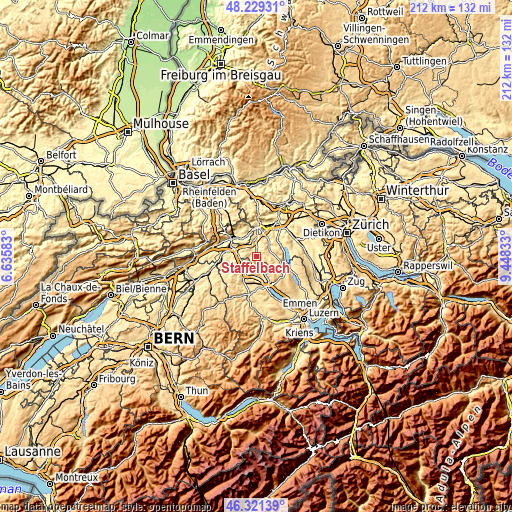
| Width | 6.63 km = 4.1 mi | 212.1 km = 131.8 mi |
| Height | 6.63 km = 4.1 mi | 212.1 km = 131.8 mi |
| ↑Max Latitude | 47.313753° | 48.22931° |
| Latitude at center | 47.28395° | 47.28395° |
| ↓Min Latitude | 47.254131° | 46.32139° |
| ← Min Longitude | 7.998135° | 6.63583° |
| Longitude center | 8.04208° | 8.04208° |
| →Max Longitude | 8.086025° | 9.44833° |
Nearby cities:
Cities around Staffelbach sort by population:
• Zofingen elevation 441 m
7.3 km,  273°
273°
• Triengen 629 m
6 km,  154°
154°
• Kölliken 426 m
5.7 km,  344°
344°
• Reiden 458 m
6.7 km,  232°
232°
• Muhen 430 m
5.8 km,  9°
9°
• Schöftland 462 m
2.5 km,  15°
15°
• Safenwil 475 m
6.1 km,  313°
313°
• Unterkulm 464 m
6.1 km,  61°
61°
• Uerkheim 455 m
2.6 km,  326°
326°
• Wikon 463 m
6 km,  247°
247°
• Oberkulm 489 m
6.3 km,  74°
74°
• Kirchleerau 509 m
2 km,  116°
116°
Multilingual:
 En español:
Staffelbach elevación 486 m.
 En France:
Staffelbach élévation 486 m.
 Auf Deutsch:
Staffelbach höhe über dem Meeresspiegel ist 486 m.

Sources and notes:
- [note 1] Map square and city borders are not equal. Map elevation data is calculated only from area inside that square.
- [src 1] Elevation data from geonames database provided with same terms of usage.
- [src 2] The elevation map of Staffelbach is generated using elevation data from NASA's 3 arcsec (90m) resolution SRTM data.
- [src 3] Base (background) map © OpenStreetMap contributors tiles are generated by Geofabrik and OpenTopoMap.
Copyright & License:
This Staffelbach Elevation Map is licensed under CC BY-SA. You may reuse any part from this page, if you give a proper credit by linking to this URL:
 More info on terms of use page.