Bunia elevation
Bunia (Ituri), Democratic Republic of the Congo elevation is 1265 meters and Bunia elevation in feet is 4150 ft above sea level [src 1]. Bunia is a seat of a first-order administrative division (feature code) with elevation that is 609 meters (1998 ft) bigger than average city elevation in Democratic Republic of the Congo.
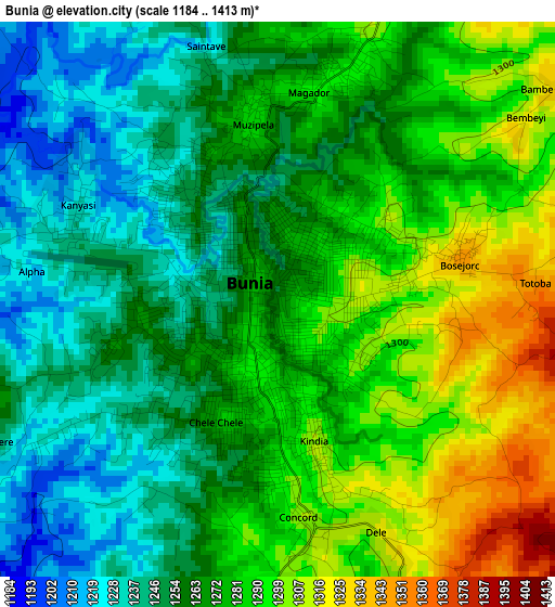
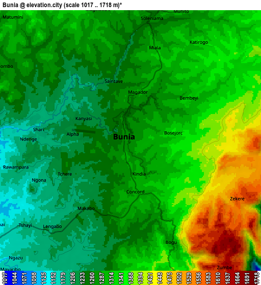
Below is the Elevation map of Bunia, which displays elevation range with different colors. Scale of the first map is from 1184 to 1413 m (3885 to 4636 ft) with average elevation of 1271.3 meters (=4171 ft) [note 1]
These maps also provides idea of topography and contour of this city, they are displayed at different zoom levels. More info about maps, scale and edge coordinates you can find below images.
| \ | Map #1 | Map #2 | Topo.Map |
| Scale [m] | 1184..1413 m | 1017..1718 m | × |
| Scale [ft] | 3885..4636 ft | 3337..5636 ft | × |
| Average | 1271.3 m = 4171 ft | 1299.6 m = 4264 ft | × |
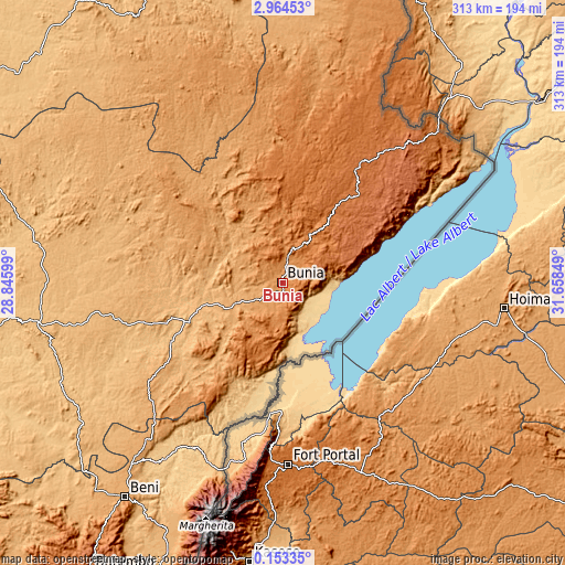
| Width | 9.77 km = 6.1 mi | 19.54 km = 12.1 mi | 312.6 km = 194.2 mi |
| Height | 9.77 km = 6.1 mi | 19.54 km = 12.1 mi | 312.6 km = 194.2 mi |
| ↑Max Latitude | 1.603339° | 1.647266° | 2.96453° |
| Latitude at center | 1.55941° | 1.55941° | 1.55941° |
| ↓Min Latitude | 1.515481° | 1.47155° | 0.15335° |
| ← Min Longitude | 30.208295° | 30.164349° | 28.84599° |
| Longitude center | 30.25224° | 30.25224° | 30.25224° |
| →Max Longitude | 30.296185° | 30.340131° | 31.65849° |
Nearby cities:
Cities around Bunia sort by population:
• Beni elevation 1161 m
147 km,  216°
216°
• Butembo 1736 m
190.4 km,  214°
214°
• Goma 1518 m
377.1 km,  197°
197°
• Isiro 761 m
322.5 km,  294°
294°
• Watsa 1018 m
182.6 km,  334°
334°
• Wamba 796 m
259.3 km,  284°
284°
• Sake 1468 m
373.4 km, 201°
Multilingual:
 En español:
Bunia elevación 1265 m.
 En France:
Bunia élévation 1265 m.


Sources and notes:
- [note 1] Map square and city borders are not equal. Map elevation data is calculated only from area inside that square.
- [src 1] Elevation data from geonames database provided with same terms of usage.
- [src 2] The elevation map of Bunia is generated using elevation data from NASA's 3 arcsec (90m) resolution SRTM data.
- [src 3] Base (background) map © OpenStreetMap contributors tiles are generated by Geofabrik and OpenTopoMap.
Copyright & License:
This Bunia Elevation Map is licensed under CC BY-SA. You may reuse any part from this page, if you give a proper credit by linking to this URL:
 More info on terms of use page.