Château-Richer elevation
Château-Richer (Quebec, Capitale-Nationale), Canada elevation is 6 meters and Château-Richer elevation in feet is 20 ft above sea level [src 1]. Château-Richer is a populated place (feature code) with elevation that is 252 meters (827 ft) smaller than average city elevation in Canada.
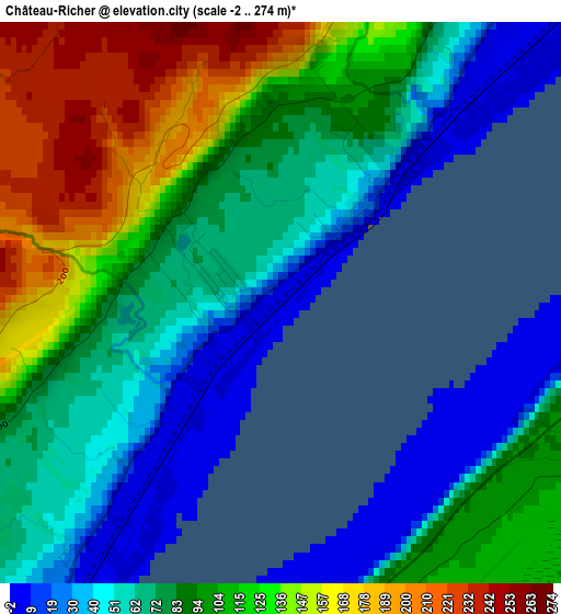
Below is the Elevation map of Château-Richer, which displays elevation range with different colors. Scale of the first map is from -2 to 274 m (-7 to 899 ft) with average elevation of 91.7 meters (=301 ft) [note 1]
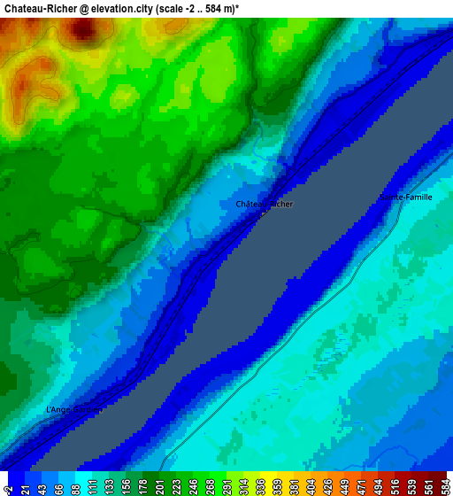
These maps also provides idea of topography and contour of this city, they are displayed at different zoom levels. More info about maps, scale and edge coordinates you can find below images.
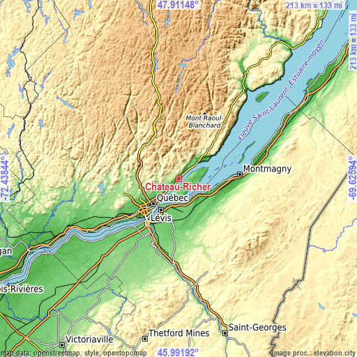
| \ | Map #1 | Map #2 | Topo.Map |
| Scale [m] | -2..274 m | -2..584 m | × |
| Scale [ft] | -7..899 ft | -7..1916 ft | × |
| Average | 91.7 m = 301 ft | 139.9 m = 459 ft | × |
| Width | 6.67 km = 4.1 mi | 13.34 km = 8.3 mi | 213.4 km = 132.6 mi |
| Height | 6.67 km = 4.1 mi | 13.34 km = 8.3 mi | 213.4 km = 132.6 mi |
| ↑Max Latitude | 46.990294° | 47.020262° | 47.91148° |
| Latitude at center | 46.96031° | 46.96031° | 46.96031° |
| ↓Min Latitude | 46.930309° | 46.900291° | 45.99192° |
| ← Min Longitude | -71.076135° | -71.120081° | -72.43844° |
| Longitude center | -71.03219° | -71.03219° | -71.03219° |
| →Max Longitude | -70.988245° | -70.944299° | -69.62594° |
Nearby cities:
Cities around Château-Richer sort by population:
• Québec elevation 54 m
21.5 km,  220°
220°
• Lévis 87 m
20.7 km,  212°
212°
• La Haute-Saint-Charles 151 m
27 km,  253°
253°
• Saint-Augustin-de-Desmaures 78 m
40.2 km,  232°
232°
• L'Ancienne-Lorette 27 m
30.5 km, 232°
• Montmagny 15 m
36.3 km,  86°
86°
• Shannon 170 m
37.7 km,  256°
256°
• Saint-Henri 87 m
29.8 km,  185°
185°
• Breakeyville 98 m
34.4 km, 205°
• L'Ange-Gardien 20 m
5.9 km, 220°
• Beaupré 21 m
14 km,  48°
48°
• Saint-Anselme 164 m
37.1 km,  173°
173°
Multilingual:
 En español:
Château-Richer elevación 6 m.
 En France:
Château-Richer élévation 6 m.
 Auf Deutsch:
Château-Richer höhe über dem Meeresspiegel ist 6 m.

Sources and notes:
- [note 1] Map square and city borders are not equal. Map elevation data is calculated only from area inside that square.
- [src 1] Elevation data from geonames database provided with same terms of usage.
- [src 2] The elevation map of Château-Richer is generated using elevation data from NASA's 3 arcsec (90m) resolution SRTM data.
- [src 3] Base (background) map © OpenStreetMap contributors tiles are generated by Geofabrik and OpenTopoMap.
Copyright & License:
This Château-Richer Elevation Map is licensed under CC BY-SA. You may reuse any part from this page, if you give a proper credit by linking to this URL:
 More info on terms of use page.