Thorold elevation
Thorold (Ontario), Canada elevation is 178 meters and Thorold elevation in feet is 584 ft above sea level [src 1]. Thorold is a populated place (feature code) with elevation that is 80 meters (262 ft) smaller than average city elevation in Canada.
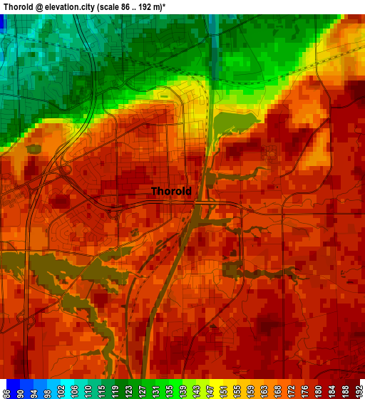
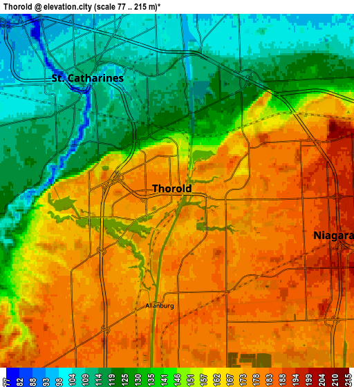
Below is the Elevation map of Thorold, which displays elevation range with different colors. Scale of the first map is from 86 to 192 m (282 to 630 ft) with average elevation of 162.9 meters (=534 ft) [note 1]
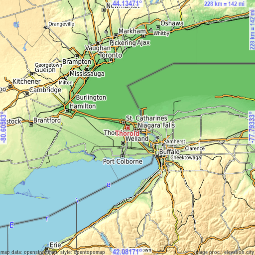
These maps also provides idea of topography and contour of this city, they are displayed at different zoom levels. More info about maps, scale and edge coordinates you can find below images.
| \ | Map #1 | Map #2 | Topo.Map |
| Scale [m] | 86..192 m | 77..215 m | × |
| Scale [ft] | 282..630 ft | 253..705 ft | × |
| Average | 162.9 m = 534 ft | 152.7 m = 501 ft | × |
| Width | 7.13 km = 4.4 mi | 14.27 km = 8.9 mi | 228.3 km = 141.9 mi |
| Height | 7.13 km = 4.4 mi | 14.27 km = 8.9 mi | 228.3 km = 141.9 mi |
| ↑Max Latitude | 43.14889° | 43.180943° | 44.13471° |
| Latitude at center | 43.11682° | 43.11682° | 43.11682° |
| ↓Min Latitude | 43.084733° | 43.05263° | 42.08171° |
| ← Min Longitude | -79.243525° | -79.287471° | -80.60583° |
| Longitude center | -79.19958° | -79.19958° | -79.19958° |
| →Max Longitude | -79.155635° | -79.111689° | -77.79333° |
Nearby cities:
Cities around Thorold sort by population:
• Hamilton elevation 95 m
54.7 km,  285°
285°
• Oakville 99 m
53.9 km,  313°
313°
• St. Catharines 102 m
7 km,  329°
329°
• Thunder Bay 184 m
29.5 km,  152°
152°
• Niagara Falls 184 m
11 km,  99°
99°
• Welland 180 m
15.4 km,  195°
195°
• Port Colborne 188 m
24.2 km,  186°
186°
• Fort Erie 183 m
32.4 km,  138°
138°
• Binbrook 216 m
49.6 km,  270°
270°
• Mississauga Beach 73 m
19.2 km,  29°
29°
• Vineland 127 m
16.6 km,  282°
282°
• Virgil 92 m
12.4 km, 25°
Multilingual:
 En español:
Thorold elevación 178 m.
 En France:
Thorold élévation 178 m.


Sources and notes:
- [note 1] Map square and city borders are not equal. Map elevation data is calculated only from area inside that square.
- [src 1] Elevation data from geonames database provided with same terms of usage.
- [src 2] The elevation map of Thorold is generated using elevation data from NASA's 3 arcsec (90m) resolution SRTM data.
- [src 3] Base (background) map © OpenStreetMap contributors tiles are generated by Geofabrik and OpenTopoMap.
Copyright & License:
This Thorold Elevation Map is licensed under CC BY-SA. You may reuse any part from this page, if you give a proper credit by linking to this URL:
 More info on terms of use page.