Rosthern elevation
Rosthern (Saskatchewan), Canada elevation is 507 meters and Rosthern elevation in feet is 1663 ft above sea level [src 1]. Rosthern is a populated place (feature code) with elevation that is 249 meters (817 ft) bigger than average city elevation in Canada.
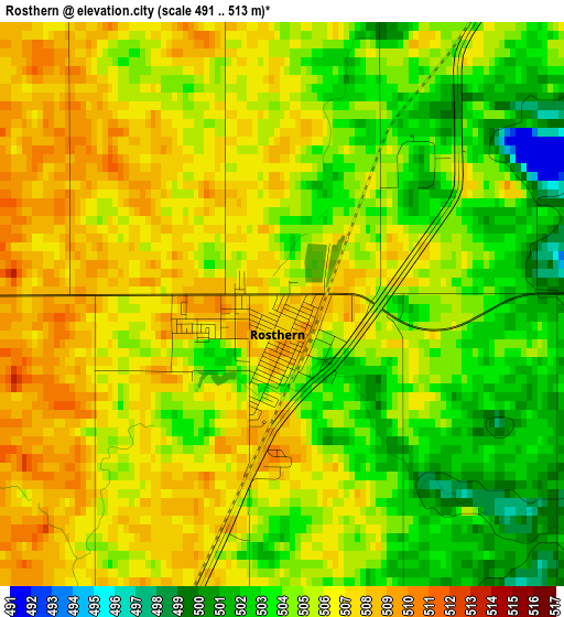
Below is the Elevation map of Rosthern, which displays elevation range with different colors. Scale of the first map is from 491 to 513 m (1611 to 1683 ft) with average elevation of 504.9 meters (=1656 ft) [note 1]
These maps also provides idea of topography and contour of this city, they are displayed at different zoom levels. More info about maps, scale and edge coordinates you can find below images.
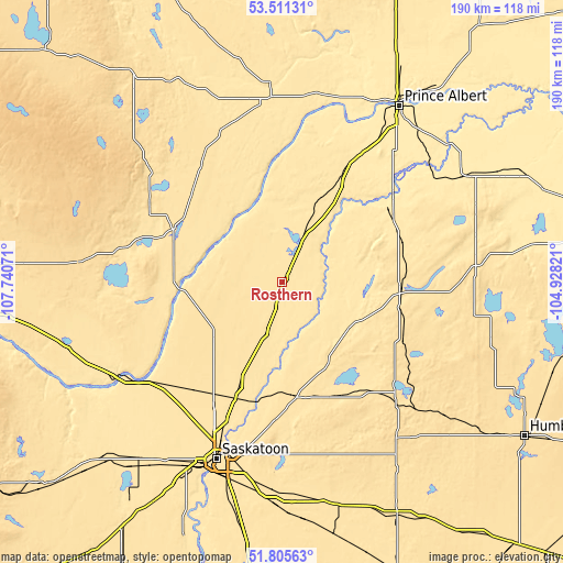
| \ | Map #1 | Topo.Map |
| Scale [m] | 491..513 m | × |
| Scale [ft] | 1611..1683 ft | × |
| Average | 504.9 m = 1656 ft | × |
| Width | 5.93 km = 3.7 mi | 189.7 km = 117.9 mi |
| Height | 5.93 km = 3.7 mi | 189.6 km = 117.8 mi |
| ↑Max Latitude | 52.693432° | 53.51131° |
| Latitude at center | 52.66679° | 52.66679° |
| ↓Min Latitude | 52.640131° | 51.80563° |
| ← Min Longitude | -106.378405° | -107.74071° |
| Longitude center | -106.33446° | -106.33446° |
| →Max Longitude | -106.290515° | -104.92821° |
Nearby cities:
Cities around Rosthern sort by population:
• Saskatoon elevation 484 m
63.6 km,  200°
200°
• Prince Albert 431 m
70.4 km,  32°
32°
• Warman 507 m
42 km, 202°
• Melfort 457 m
117.6 km,  79°
79°
• Humboldt 568 m
97 km,  122°
122°
• Martensville 513 m
48.2 km,  207°
207°
• Biggar 661 m
131.4 km,  239°
239°
• Watrous 543 m
125.9 km,  152°
152°
• Dalmeny 520 m
47.3 km,  218°
218°
• Lanigan 534 m
126.8 km,  135°
135°
• Shellbrook 494 m
61.3 km,  355°
355°
• Langham 512 m
54.3 km,  232°
232°
Multilingual:
 En español:
Rosthern elevación 507 m.
 En France:
Rosthern élévation 507 m.
 Auf Deutsch:
Rosthern höhe über dem Meeresspiegel ist 507 m.

Sources and notes:
- [note 1] Map square and city borders are not equal. Map elevation data is calculated only from area inside that square.
- [src 1] Elevation data from geonames database provided with same terms of usage.
- [src 2] The elevation map of Rosthern is generated using elevation data from NASA's 3 arcsec (90m) resolution SRTM data.
- [src 3] Base (background) map © OpenStreetMap contributors tiles are generated by Geofabrik and OpenTopoMap.
Copyright & License:
This Rosthern Elevation Map is licensed under CC BY-SA. You may reuse any part from this page, if you give a proper credit by linking to this URL:
 More info on terms of use page.