Rimbey elevation
Rimbey (Alberta), Canada elevation is 913 meters and Rimbey elevation in feet is 2995 ft above sea level [src 1]. Rimbey is a populated place (feature code) with elevation that is 655 meters (2149 ft) bigger than average city elevation in Canada.
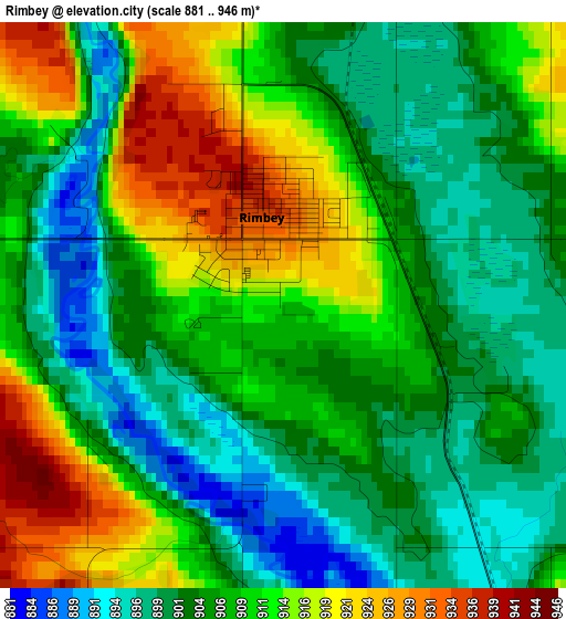
Below is the Elevation map of Rimbey, which displays elevation range with different colors. Scale of the first map is from 881 to 946 m (2890 to 3104 ft) with average elevation of 907 meters (=2976 ft) [note 1]
These maps also provides idea of topography and contour of this city, they are displayed at different zoom levels. More info about maps, scale and edge coordinates you can find below images.
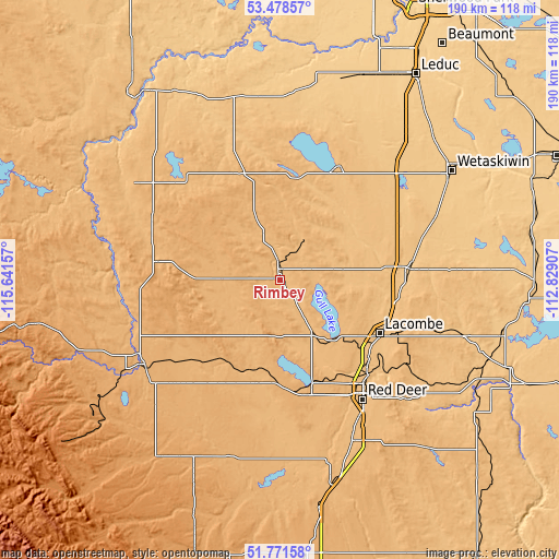
| \ | Map #1 | Topo.Map |
| Scale [m] | 881..946 m | × |
| Scale [ft] | 2890..3104 ft | × |
| Average | 907 m = 2976 ft | × |
| Width | 5.93 km = 3.7 mi | 189.8 km = 117.9 mi |
| Height | 5.93 km = 3.7 mi | 189.8 km = 117.9 mi |
| ↑Max Latitude | 52.660063° | 53.47857° |
| Latitude at center | 52.6334° | 52.6334° |
| ↓Min Latitude | 52.606721° | 51.77158° |
| ← Min Longitude | -114.279265° | -115.64157° |
| Longitude center | -114.23532° | -114.23532° |
| →Max Longitude | -114.191375° | -112.82907° |
Nearby cities:
Cities around Rimbey sort by population:
• Red Deer elevation 856 m
50.2 km,  144°
144°
• Wetaskiwin 758 m
69.1 km,  57°
57°
• Sylvan Lake 961 m
37.3 km,  164°
164°
• Lacombe 853 m
38.5 km,  118°
118°
• Ponoka 806 m
44.4 km,  83°
83°
• Rocky Mountain House 982 m
54.9 km,  237°
237°
• Drayton Valley 846 m
82.1 km,  322°
322°
• Blackfalds 876 m
41.2 km,  132°
132°
• Calmar 725 m
75.8 km,  21°
21°
• Millet 753 m
73.1 km,  44°
44°
• Penhold 895 m
60.9 km, 155°
• Springbrook 899 m
56 km,  154°
154°
Multilingual:
 En español:
Rimbey elevación 913 m.
 En France:
Rimbey élévation 913 m.


Sources and notes:
- [note 1] Map square and city borders are not equal. Map elevation data is calculated only from area inside that square.
- [src 1] Elevation data from geonames database provided with same terms of usage.
- [src 2] The elevation map of Rimbey is generated using elevation data from NASA's 3 arcsec (90m) resolution SRTM data.
- [src 3] Base (background) map © OpenStreetMap contributors tiles are generated by Geofabrik and OpenTopoMap.
Copyright & License:
This Rimbey Elevation Map is licensed under CC BY-SA. You may reuse any part from this page, if you give a proper credit by linking to this URL:
 More info on terms of use page.