Pincher Creek elevation
Pincher Creek (Alberta), Canada elevation is 1151 meters and Pincher Creek elevation in feet is 3776 ft above sea level [src 1]. Pincher Creek is a populated place (feature code) with elevation that is 893 meters (2930 ft) bigger than average city elevation in Canada.
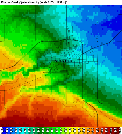
Below is the Elevation map of Pincher Creek, which displays elevation range with different colors. Scale of the first map is from 1103 to 1251 m (3619 to 4104 ft) with average elevation of 1165.6 meters (=3824 ft) [note 1]
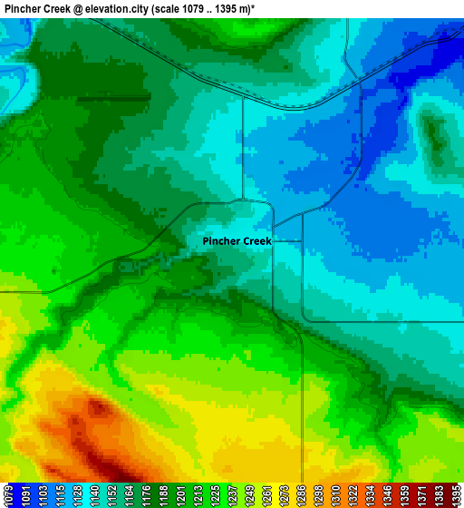
These maps also provides idea of topography and contour of this city, they are displayed at different zoom levels. More info about maps, scale and edge coordinates you can find below images.
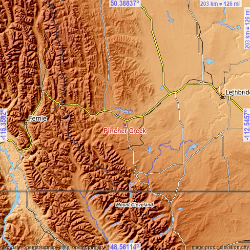
| \ | Map #1 | Map #2 | Topo.Map |
| Scale [m] | 1103..1251 m | 1079..1395 m | × |
| Scale [ft] | 3619..4104 ft | 3540..4577 ft | × |
| Average | 1165.6 m = 3824 ft | 1186.6 m = 3893 ft | × |
| Width | 6.35 km = 3.9 mi | 12.7 km = 7.9 mi | 203.2 km = 126.3 mi |
| Height | 6.35 km = 3.9 mi | 12.7 km = 7.9 mi | 203.2 km = 126.3 mi |
| ↑Max Latitude | 49.511822° | 49.540347° | 50.38837° |
| Latitude at center | 49.48328° | 49.48328° | 49.48328° |
| ↓Min Latitude | 49.454722° | 49.426147° | 48.56114° |
| ← Min Longitude | -113.995895° | -114.039841° | -115.3582° |
| Longitude center | -113.95195° | -113.95195° | -113.95195° |
| →Max Longitude | -113.908005° | -113.864059° | -112.5457° |
Nearby cities:
Cities around Pincher Creek sort by population:
• Lethbridge elevation 907 m
85.2 km,  73°
73°
• Fernie 996 m
80.7 km,  271°
271°
• Claresholm 1034 m
66.6 km,  23°
23°
• Cardston 1136 m
56.7 km,  123°
123°
• Sparwood 1140 m
72.8 km,  292°
292°
• Raymond 964 m
94 km,  92°
92°
• Fort Macleod 952 m
46.4 km,  55°
55°
• Elkford 1518 m
92 km,  313°
313°
• Magrath 980 m
78.7 km,  95°
95°
• Nanton 1019 m
97.3 km,  7°
7°
• Picture Butte 906 m
95 km, 62°
• Coalhurst 933 m
79.1 km, 68°
Multilingual:
 En español:
Pincher Creek elevación 1151 m.
 En France:
Pincher Creek élévation 1151 m.
 Auf Deutsch:
Pincher Creek höhe über dem Meeresspiegel ist 1151 m.

Sources and notes:
- [note 1] Map square and city borders are not equal. Map elevation data is calculated only from area inside that square.
- [src 1] Elevation data from geonames database provided with same terms of usage.
- [src 2] The elevation map of Pincher Creek is generated using elevation data from NASA's 3 arcsec (90m) resolution SRTM data.
- [src 3] Base (background) map © OpenStreetMap contributors tiles are generated by Geofabrik and OpenTopoMap.
Copyright & License:
This Pincher Creek Elevation Map is licensed under CC BY-SA. You may reuse any part from this page, if you give a proper credit by linking to this URL:
 More info on terms of use page.