Okotoks elevation
Okotoks (Alberta), Canada elevation is 1071 meters and Okotoks elevation in feet is 3514 ft above sea level [src 1]. Okotoks is a populated place (feature code) with elevation that is 813 meters (2667 ft) bigger than average city elevation in Canada.
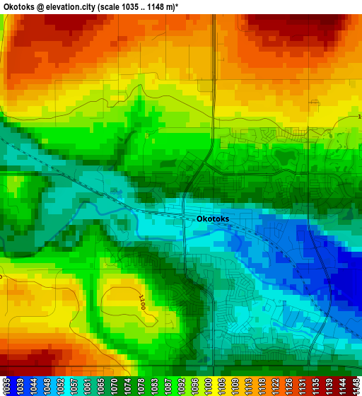
Below is the Elevation map of Okotoks, which displays elevation range with different colors. Scale of the first map is from 1035 to 1148 m (3396 to 3766 ft) with average elevation of 1087.4 meters (=3568 ft) [note 1]
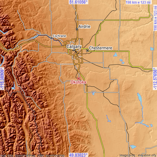
These maps also provides idea of topography and contour of this city, they are displayed at different zoom levels. More info about maps, scale and edge coordinates you can find below images.
| \ | Map #1 | Map #2 | Topo.Map |
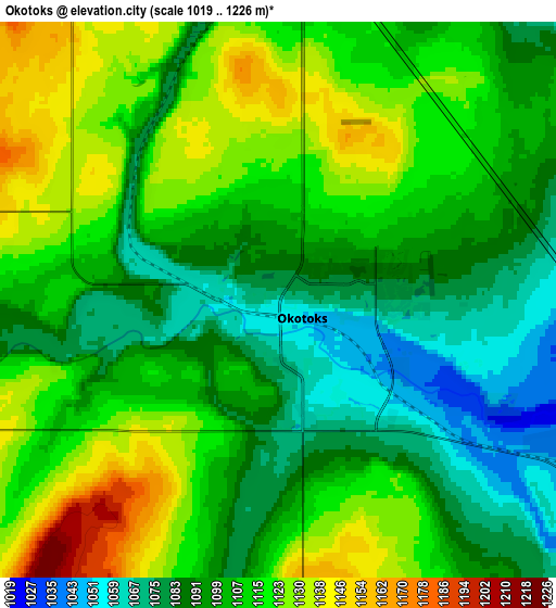
| Scale [m] | 1035..1148 m | 1019..1226 m | × |
| Scale [ft] | 3396..3766 ft | 3343..4022 ft | × |
| Average | 1087.4 m = 3568 ft | 1104.7 m = 3624 ft | × |
| Width | 6.19 km = 3.8 mi | 12.37 km = 7.7 mi | 198 km = 123 mi |
| Height | 6.19 km = 3.8 mi | 12.37 km = 7.7 mi | 197.9 km = 123 mi |
| ↑Max Latitude | 50.756659° | 50.784451° | 51.61056° |
| Latitude at center | 50.72885° | 50.72885° | 50.72885° |
| ↓Min Latitude | 50.701025° | 50.673183° | 49.83023° |
| ← Min Longitude | -114.026755° | -114.070701° | -115.38906° |
| Longitude center | -113.98281° | -113.98281° | -113.98281° |
| →Max Longitude | -113.938865° | -113.894919° | -112.57656° |
Nearby cities:
Cities around Okotoks sort by population:
• Calgary elevation 1042 m
36.4 km,  348°
348°
• Airdrie 1086 m
63.6 km,  356°
356°
• Cochrane 1143 m
60.9 km,  326°
326°
• Strathmore 976 m
55.1 km,  49°
49°
• High River 1034 m
18.1 km,  153°
153°
• Black Diamond 1167 m
18.1 km,  259°
259°
• Chestermere 1022 m
35.8 km,  18°
18°
• Crossfield 1117 m
78.4 km, 357°
• Heritage Pointe 1014 m
12.7 km, 352°
• Nanton 1019 m
44.8 km,  160°
160°
• Vulcan 1043 m
63.3 km,  125°
125°
• Irricana 931 m
71.2 km, 21°
Multilingual:
 En español:
Okotoks elevación 1071 m.
 En France:
Okotoks élévation 1071 m.
 Auf Deutsch:
Okotoks höhe über dem Meeresspiegel ist 1071 m.

Sources and notes:
- [note 1] Map square and city borders are not equal. Map elevation data is calculated only from area inside that square.
- [src 1] Elevation data from geonames database provided with same terms of usage.
- [src 2] The elevation map of Okotoks is generated using elevation data from NASA's 3 arcsec (90m) resolution SRTM data.
- [src 3] Base (background) map © OpenStreetMap contributors tiles are generated by Geofabrik and OpenTopoMap.
Copyright & License:
This Okotoks Elevation Map is licensed under CC BY-SA. You may reuse any part from this page, if you give a proper credit by linking to this URL:
 More info on terms of use page.