Napierville elevation
Napierville (Quebec, Montérégie), Canada elevation is 57 meters and Napierville elevation in feet is 187 ft above sea level [src 1]. Napierville is a populated place (feature code) with elevation that is 201 meters (659 ft) smaller than average city elevation in Canada.
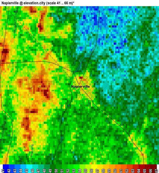
Below is the Elevation map of Napierville, which displays elevation range with different colors. Scale of the first map is from 41 to 66 m (135 to 217 ft) with average elevation of 51.3 meters (=168 ft) [note 1]
These maps also provides idea of topography and contour of this city, they are displayed at different zoom levels. More info about maps, scale and edge coordinates you can find below images.
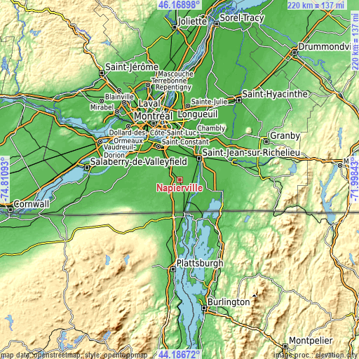
| \ | Map #1 | Topo.Map |
| Scale [m] | 41..66 m | × |
| Scale [ft] | 135..217 ft | × |
| Average | 51.3 m = 168 ft | × |
| Width | 6.89 km = 4.3 mi | 220.4 km = 136.9 mi |
| Height | 6.89 km = 4.3 mi | 220.4 km = 136.9 mi |
| ↑Max Latitude | 45.217444° | 46.16898° |
| Latitude at center | 45.18648° | 45.18648° |
| ↓Min Latitude | 45.155499° | 44.18672° |
| ← Min Longitude | -73.448625° | -74.81093° |
| Longitude center | -73.40468° | -73.40468° |
| →Max Longitude | -73.360735° | -71.99843° |
Nearby cities:
Cities around Napierville sort by population:
• Saint-Jean-sur-Richelieu elevation 32 m
17.4 km,  39°
39°
• Saint-Constant 26 m
23.7 km,  327°
327°
• Candiac 25 m
23.6 km,  338°
338°
• Delson 27 m
23 km, 330°
• Saint-Rémi 55 m
18.8 km,  298°
298°
• Saint-Mathieu 36 m
16.9 km, 329°
• Saint-Jacques-le-Mineur 47 m
10.8 km,  355°
355°
• Saint-Édouard 53 m
10.2 km, 300°
• Venise-en-Québec 29 m
24.2 km,  118°
118°
• Lacolle 40 m
11.9 km,  165°
165°
• Parc-Boutin 30 m
16.2 km, 43°
• Saint-Philippe-de-La Prairie 33 m
19.8 km, 343°
Multilingual:
 En español:
Napierville elevación 57 m.
 En France:
Napierville élévation 57 m.
 Auf Deutsch:
Napierville höhe über dem Meeresspiegel ist 57 m.

Sources and notes:
- [note 1] Map square and city borders are not equal. Map elevation data is calculated only from area inside that square.
- [src 1] Elevation data from geonames database provided with same terms of usage.
- [src 2] The elevation map of Napierville is generated using elevation data from NASA's 3 arcsec (90m) resolution SRTM data.
- [src 3] Base (background) map © OpenStreetMap contributors tiles are generated by Geofabrik and OpenTopoMap.
Copyright & License:
This Napierville Elevation Map is licensed under CC BY-SA. You may reuse any part from this page, if you give a proper credit by linking to this URL:
 More info on terms of use page.