Mont-Saint-Grégoire elevation
Mont-Saint-Grégoire (Quebec, Montérégie), Canada elevation is 40 meters and Mont-Saint-Grégoire elevation in feet is 131 ft above sea level [src 1]. Mont-Saint-Grégoire is a populated place (feature code) with elevation that is 218 meters (715 ft) smaller than average city elevation in Canada.
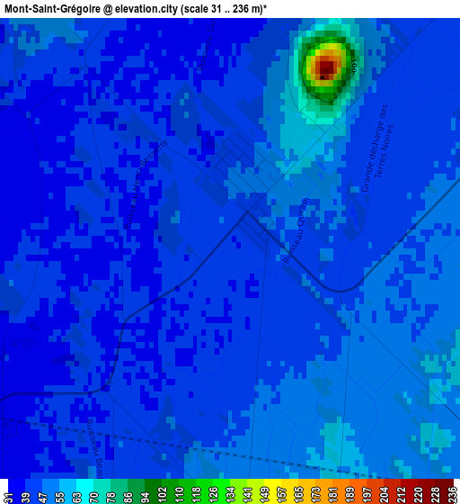
Below is the Elevation map of Mont-Saint-Grégoire, which displays elevation range with different colors. Scale of the first map is from 31 to 236 m (102 to 774 ft) with average elevation of 44.8 meters (=147 ft) [note 1]
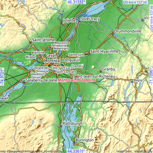
These maps also provides idea of topography and contour of this city, they are displayed at different zoom levels. More info about maps, scale and edge coordinates you can find below images.
| \ | Map #1 | Topo.Map |
| Scale [m] | 31..236 m | × |
| Scale [ft] | 102..774 ft | × |
| Average | 44.8 m = 147 ft | × |
| Width | 6.87 km = 4.3 mi | 219.8 km = 136.6 mi |
| Height | 6.87 km = 4.3 mi | 219.8 km = 136.6 mi |
| ↑Max Latitude | 45.364264° | 46.31332° |
| Latitude at center | 45.33338° | 45.33338° |
| ↓Min Latitude | 45.302479° | 44.33619° |
| ← Min Longitude | -73.209795° | -74.5721° |
| Longitude center | -73.16585° | -73.16585° |
| →Max Longitude | -73.121905° | -71.7596° |
Nearby cities:
Cities around Mont-Saint-Grégoire sort by population:
• Saint-Jean-sur-Richelieu elevation 32 m
8.1 km,  248°
248°
• Chambly 4 m
15.9 km,  324°
324°
• Otterburn Park 13 m
22.6 km,  350°
350°
• Carignan 10 m
16.6 km, 321°
• Farnham 55 m
15.4 km,  111°
111°
• Marieville 34 m
11.1 km,  0°
0°
• Richelieu 29 m
13.7 km,  332°
332°
• Saint-Césaire 32 m
16 km,  54°
54°
• Ange-Gardien 71 m
18.3 km,  84°
84°
• Saint-Jacques-le-Mineur 47 m
20.3 km, 254°
• Rougemont 49 m
14.4 km,  39°
39°
• Parc-Boutin 30 m
8.8 km,  238°
238°
Multilingual:
 En español:
Mont-Saint-Grégoire elevación 40 m.
 En France:
Mont-Saint-Grégoire élévation 40 m.
 Auf Deutsch:
Mont-Saint-Grégoire höhe über dem Meeresspiegel ist 40 m.
 На русском:
Mont-Saint-Grégoire высота над уровнем моря 40 м
Sources and notes:
- [note 1] Map square and city borders are not equal. Map elevation data is calculated only from area inside that square.
- [src 1] Elevation data from geonames database provided with same terms of usage.
- [src 2] The elevation map of Mont-Saint-Grégoire is generated using elevation data from NASA's 3 arcsec (90m) resolution SRTM data.
- [src 3] Base (background) map © OpenStreetMap contributors tiles are generated by Geofabrik and OpenTopoMap.
Copyright & License:
This Mont-Saint-Grégoire Elevation Map is licensed under CC BY-SA. You may reuse any part from this page, if you give a proper credit by linking to this URL:
 More info on terms of use page.