Keswick elevation
Keswick (Ontario), Canada elevation is 230 meters and Keswick elevation in feet is 755 ft above sea level [src 1]. Keswick is a section of populated place (feature code) with elevation that is 28 meters (92 ft) smaller than average city elevation in Canada.
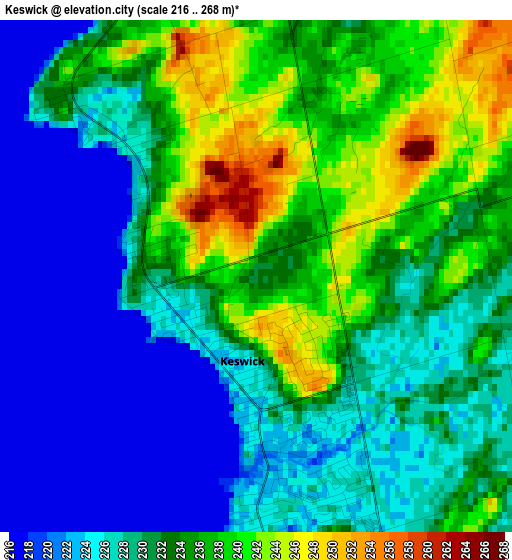
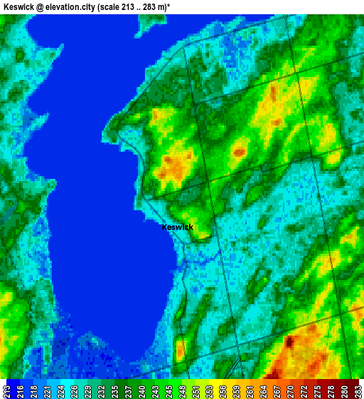
Below is the Elevation map of Keswick, which displays elevation range with different colors. Scale of the first map is from 216 to 268 m (709 to 879 ft) with average elevation of 230.6 meters (=757 ft) [note 1]
These maps also provides idea of topography and contour of this city, they are displayed at different zoom levels. More info about maps, scale and edge coordinates you can find below images.
| \ | Map #1 | Map #2 | Topo.Map |
| Scale [m] | 216..268 m | 213..283 m | × |
| Scale [ft] | 709..879 ft | 699..928 ft | × |
| Average | 230.6 m = 757 ft | 229.9 m = 754 ft | × |
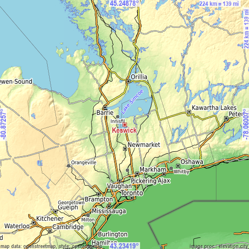
| Width | 7 km = 4.3 mi | 14 km = 8.7 mi | 224 km = 139.2 mi |
| Height | 7 km = 4.3 mi | 14 km = 8.7 mi | 224 km = 139.2 mi |
| ↑Max Latitude | 44.28158° | 44.313032° | 45.24878° |
| Latitude at center | 44.25011° | 44.25011° | 44.25011° |
| ↓Min Latitude | 44.218624° | 44.18712° | 43.23419° |
| ← Min Longitude | -79.510265° | -79.554211° | -80.87257° |
| Longitude center | -79.46632° | -79.46632° | -79.46632° |
| →Max Longitude | -79.422375° | -79.378429° | -78.06007° |
Nearby cities:
Cities around Keswick sort by population:
• Barrie elevation 269 m
23.1 km,  316°
316°
• Newmarket 250 m
22.2 km,  179°
179°
• Aurora 266 m
27.8 km, 180°
• East Gwillimbury 256 m
16.7 km,  172°
172°
• Alliston 223 m
33.8 km,  250°
250°
• Uxbridge 274 m
32.5 km,  120°
120°
• Innisfil 266 m
15.6 km,  290°
290°
• King 311 m
33.2 km,  197°
197°
• Mount Albert 243 m
17.6 km,  137°
137°
• Ballantrae 338 m
27.5 km,  151°
151°
• Cookstown 237 m
20 km, 248°
• Stoney Point 216 m
5.6 km, 289°
Multilingual:
 En español:
Keswick elevación 230 m.
 En France:
Keswick élévation 230 m.


Sources and notes:
- [note 1] Map square and city borders are not equal. Map elevation data is calculated only from area inside that square.
- [src 1] Elevation data from geonames database provided with same terms of usage.
- [src 2] The elevation map of Keswick is generated using elevation data from NASA's 3 arcsec (90m) resolution SRTM data.
- [src 3] Base (background) map © OpenStreetMap contributors tiles are generated by Geofabrik and OpenTopoMap.
Copyright & License:
This Keswick Elevation Map is licensed under CC BY-SA. You may reuse any part from this page, if you give a proper credit by linking to this URL:
 More info on terms of use page.