Beloeil elevation
Beloeil (Quebec, Montérégie), Canada elevation is 13 meters and Beloeil elevation in feet is 43 ft above sea level [src 1]. Beloeil is a populated place (feature code) with elevation that is 245 meters (804 ft) smaller than average city elevation in Canada.
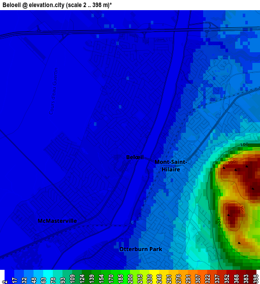
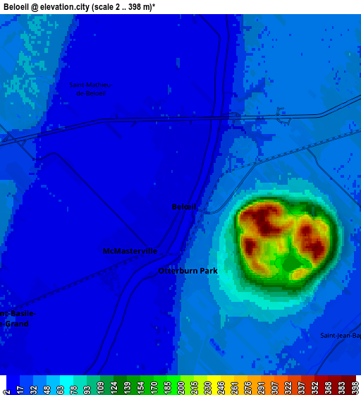
Below is the Elevation map of Beloeil, which displays elevation range with different colors. Scale of the first map is from 2 to 398 m (7 to 1306 ft) with average elevation of 40.7 meters (=134 ft) [note 1]
These maps also provides idea of topography and contour of this city, they are displayed at different zoom levels. More info about maps, scale and edge coordinates you can find below images.
| \ | Map #1 | Map #2 | Topo.Map |
| Scale [m] | 2..398 m | 2..398 m | × |
| Scale [ft] | 7..1306 ft | 7..1306 ft | × |
| Average | 40.7 m = 134 ft | 38.1 m = 125 ft | × |
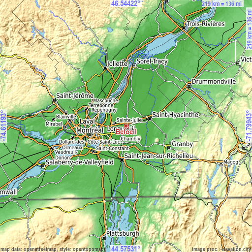
| Width | 6.84 km = 4.3 mi | 13.68 km = 8.5 mi | 218.9 km = 136 mi |
| Height | 6.84 km = 4.3 mi | 13.68 km = 8.5 mi | 218.9 km = 136 mi |
| ↑Max Latitude | 45.599146° | 45.629885° | 46.54422° |
| Latitude at center | 45.56839° | 45.56839° | 45.56839° |
| ↓Min Latitude | 45.537617° | 45.506828° | 44.57531° |
| ← Min Longitude | -73.249625° | -73.293571° | -74.61193° |
| Longitude center | -73.20568° | -73.20568° | -73.20568° |
| →Max Longitude | -73.161735° | -73.117789° | -71.79943° |
Nearby cities:
Cities around Beloeil sort by population:
• Sainte-Julie elevation 37 m
10 km,  279°
279°
• Saint-Bruno-de-Montarville 41 m
11.8 km,  250°
250°
• Chambly 4 m
14.5 km,  204°
204°
• Mont-Saint-Hilaire 39 m
1.5 km,  103°
103°
• Saint-Basile-le-Grand 13 m
7.1 km,  236°
236°
• Saint-Amable 44 m
11.6 km,  321°
321°
• Otterburn Park 13 m
4 km,  191°
191°
• Carignan 10 m
15 km,  208°
208°
• Marieville 34 m
15.3 km,  168°
168°
• Richelieu 29 m
14.3 km, 192°
• Sainte-Madeleine 30 m
9 km,  66°
66°
• Saint-Damase 30 m
16.5 km, 103°
Multilingual:
 En español:
Beloeil elevación 13 m.
 En France:
Beloeil élévation 13 m.


Sources and notes:
- [note 1] Map square and city borders are not equal. Map elevation data is calculated only from area inside that square.
- [src 1] Elevation data from geonames database provided with same terms of usage.
- [src 2] The elevation map of Beloeil is generated using elevation data from NASA's 3 arcsec (90m) resolution SRTM data.
- [src 3] Base (background) map © OpenStreetMap contributors tiles are generated by Geofabrik and OpenTopoMap.
Copyright & License:
This Beloeil Elevation Map is licensed under CC BY-SA. You may reuse any part from this page, if you give a proper credit by linking to this URL:
 More info on terms of use page.