Dubrowna elevation
Dubrowna (Vitebsk), Belarus elevation is 182 meters and Dubrowna elevation in feet is 597 ft above sea level [src 1]. Dubrowna is a seat of a second-order administrative division (feature code) with elevation that is 15 meters (49 ft) bigger than average city elevation in Belarus.
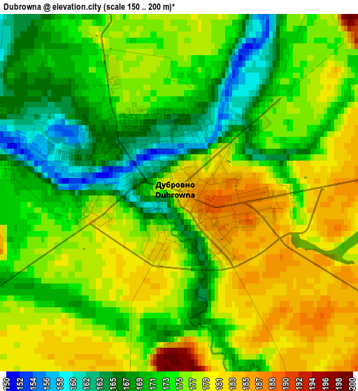
Below is the Elevation map of Dubrowna, which displays elevation range with different colors. Scale of the first map is from 150 to 200 m (492 to 656 ft) with average elevation of 174.7 meters (=573 ft) [note 1]
These maps also provides idea of topography and contour of this city, they are displayed at different zoom levels. More info about maps, scale and edge coordinates you can find below images.
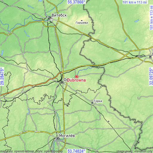
| \ | Map #1 | Map #2 | Topo.Map |
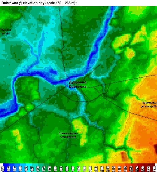
| Scale [m] | 150..200 m | 150..236 m | × |
| Scale [ft] | 492..656 ft | 492..774 ft | × |
| Average | 174.7 m = 573 ft | 181.8 m = 596 ft | × |
| Width | 5.66 km = 3.5 mi | 11.33 km = 7 mi | 181.3 km = 112.7 mi |
| Height | 5.66 km = 3.5 mi | 11.33 km = 7 mi | 181.3 km = 112.7 mi |
| ↑Max Latitude | 54.597066° | 54.622517° | 55.37866° |
| Latitude at center | 54.5716° | 54.5716° | 54.5716° |
| ↓Min Latitude | 54.546118° | 54.520619° | 53.74824° |
| ← Min Longitude | 30.647055° | 30.603109° | 29.28475° |
| Longitude center | 30.691° | 30.691° | 30.691° |
| →Max Longitude | 30.734945° | 30.778891° | 32.09725° |
Nearby cities:
Cities around Dubrowna sort by population:
• Orsha elevation 159 m
19 km,  248°
248°
• Horki 182 m
37 km,  148°
148°
• Shklow 158 m
47.7 km,  213°
213°
• Baran’ 162 m
26.3 km, 246°
• Talachyn 199 m
66.8 km, 254°
• Kruhlaye 195 m
68 km,  238°
238°
• Lyozna 188 m
50.8 km,  7°
7°
• Kokhanava 216 m
46.1 km, 254°
• Balbasava 202 m
30.8 km, 236°
• Drybin 179 m
56.7 km, 152°
• Kamyennyya Lavy 186 m
59.4 km, 205°
• Horad Orsha 179 m
19.5 km, 251°
Multilingual:
 En español:
Dubrowna elevación 182 m.
 En France:
Dubrowna élévation 182 m.
 Auf Deutsch:
Dubrowna höhe über dem Meeresspiegel ist 182 m.

Sources and notes:
- [note 1] Map square and city borders are not equal. Map elevation data is calculated only from area inside that square.
- [src 1] Elevation data from geonames database provided with same terms of usage.
- [src 2] The elevation map of Dubrowna is generated using elevation data from NASA's 3 arcsec (90m) resolution SRTM data.
- [src 3] Base (background) map © OpenStreetMap contributors tiles are generated by Geofabrik and OpenTopoMap.
Copyright & License:
This Dubrowna Elevation Map is licensed under CC BY-SA. You may reuse any part from this page, if you give a proper credit by linking to this URL:
 More info on terms of use page.