Horki elevation
Horki (Mogilev), Belarus elevation is 182 meters and Horki elevation in feet is 597 ft above sea level [src 1]. Horki is a seat of a second-order administrative division (feature code) with elevation that is 15 meters (49 ft) bigger than average city elevation in Belarus.
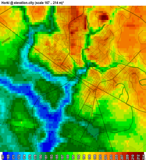
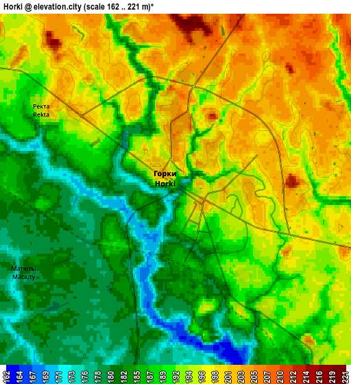
Below is the Elevation map of Horki, which displays elevation range with different colors. Scale of the first map is from 167 to 214 m (548 to 702 ft) with average elevation of 189.4 meters (=621 ft) [note 1]
These maps also provides idea of topography and contour of this city, they are displayed at different zoom levels. More info about maps, scale and edge coordinates you can find below images.
| \ | Map #1 | Map #2 | Topo.Map |
| Scale [m] | 167..214 m | 162..221 m | × |
| Scale [ft] | 548..702 ft | 531..725 ft | × |
| Average | 189.4 m = 621 ft | 190.8 m = 626 ft | × |
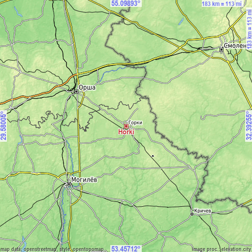
| Width | 5.7 km = 3.5 mi | 11.41 km = 7.1 mi | 182.6 km = 113.5 mi |
| Height | 5.7 km = 3.5 mi | 11.41 km = 7.1 mi | 182.5 km = 113.4 mi |
| ↑Max Latitude | 54.311845° | 54.337473° | 55.09893° |
| Latitude at center | 54.2862° | 54.2862° | 54.2862° |
| ↓Min Latitude | 54.26054° | 54.234863° | 53.45712° |
| ← Min Longitude | 30.942355° | 30.898409° | 29.58005° |
| Longitude center | 30.9863° | 30.9863° | 30.9863° |
| →Max Longitude | 31.030245° | 31.074191° | 32.39255° |
Nearby cities:
Cities around Horki sort by population:
• Orsha elevation 159 m
44.3 km,  303°
303°
• Shklow 158 m
46.1 km,  259°
259°
• Baran’ 162 m
48.4 km, 296°
• Chavusy 176 m
53 km,  181°
181°
• Dubrowna 182 m
37 km,  328°
328°
• Balbasava 202 m
47.5 km,  288°
288°
• Drybin 179 m
19.8 km,  159°
159°
• Khodasy 202 m
51.2 km,  141°
141°
• Kadino 179 m
54.1 km,  214°
214°
• Palykavichy Pyershyya 156 m
52.8 km,  230°
230°
• Kamyennyya Lavy 186 m
49.9 km,  244°
244°
• Horad Orsha 179 m
45.4 km, 304°
Multilingual:
 En español:
Horki elevación 182 m.
 En France:
Horki élévation 182 m.


Sources and notes:
- [note 1] Map square and city borders are not equal. Map elevation data is calculated only from area inside that square.
- [src 1] Elevation data from geonames database provided with same terms of usage.
- [src 2] The elevation map of Horki is generated using elevation data from NASA's 3 arcsec (90m) resolution SRTM data.
- [src 3] Base (background) map © OpenStreetMap contributors tiles are generated by Geofabrik and OpenTopoMap.
Copyright & License:
This Horki Elevation Map is licensed under CC BY-SA. You may reuse any part from this page, if you give a proper credit by linking to this URL:
 More info on terms of use page.