Sena Madureira elevation
Sena Madureira (Acre), Brazil elevation is 144 meters and Sena Madureira elevation in feet is 472 ft above sea level [src 1]. Sena Madureira is a populated place (feature code) with elevation that is 238 meters (781 ft) smaller than average city elevation in Brazil.
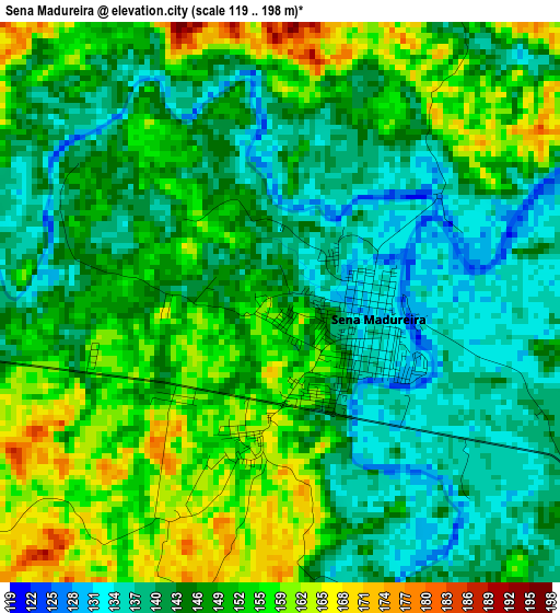
Below is the Elevation map of Sena Madureira, which displays elevation range with different colors. Scale of the first map is from 119 to 198 m (390 to 650 ft) with average elevation of 147.9 meters (=485 ft) [note 1]
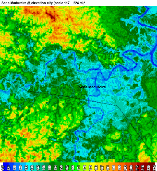
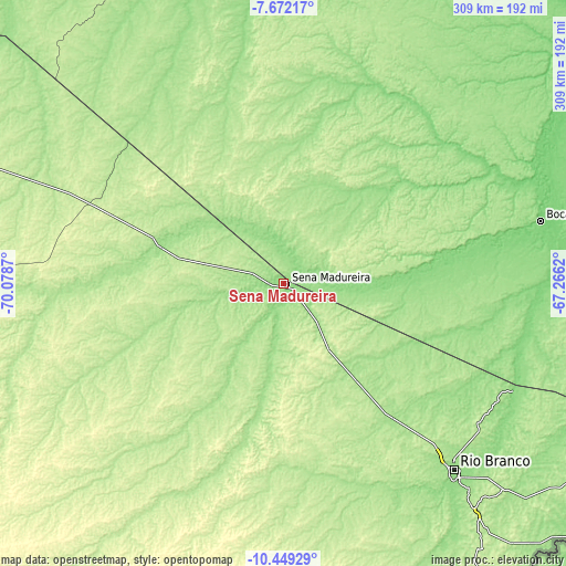
These maps also provides idea of topography and contour of this city, they are displayed at different zoom levels. More info about maps, scale and edge coordinates you can find below images.
| \ | Map #1 | Map #2 | Topo.Map |
| Scale [m] | 119..198 m | 117..224 m | × |
| Scale [ft] | 390..650 ft | 384..735 ft | × |
| Average | 147.9 m = 485 ft | 156.3 m = 513 ft | × |
| Width | 9.65 km = 6 mi | 19.3 km = 12 mi | 308.8 km = 191.9 mi |
| Height | 9.65 km = 6 mi | 19.3 km = 12 mi | 308.8 km = 191.9 mi |
| ↑Max Latitude | -9.020011° | -8.976606° | -7.67217° |
| Latitude at center | -9.06341° | -9.06341° | -9.06341° |
| ↓Min Latitude | -9.106804° | -9.150193° | -10.44929° |
| ← Min Longitude | -68.716395° | -68.760341° | -70.0787° |
| Longitude center | -68.67245° | -68.67245° | -68.67245° |
| →Max Longitude | -68.628505° | -68.584559° | -67.2662° |
Nearby cities:
Cities around Sena Madureira sort by population:
• Rio Branco elevation 153 m
138.6 km,  136°
136°
• Tarauacá 173 m
251 km,  293°
293°
• Boca do Acre 107 m
144.2 km,  76°
76°
• Feijó 160 m
210.2 km,  298°
298°
• Plácido de Castro 136 m
215.8 km,  130°
130°
• Senador Guiomard 207 m
158.4 km, 139°
• Brasiléia 188 m
217.3 km,  182°
182°
• Envira 196 m
259.5 km,  319°
319°
• Pauini 104 m
239.4 km,  51°
51°
• Extrema 144 m
266 km,  107°
107°
• Xapuri 171 m
177.6 km,  174°
174°
• Manoel Urbano 165 m
69.2 km, 291°
Multilingual:
 En español:
Sena Madureira elevación 144 m.
 En France:
Sena Madureira élévation 144 m.
 Auf Deutsch:
Sena Madureira höhe über dem Meeresspiegel ist 144 m.

Sources and notes:
- [note 1] Map square and city borders are not equal. Map elevation data is calculated only from area inside that square.
- [src 1] Elevation data from geonames database provided with same terms of usage.
- [src 2] The elevation map of Sena Madureira is generated using elevation data from NASA's 3 arcsec (90m) resolution SRTM data.
- [src 3] Base (background) map © OpenStreetMap contributors tiles are generated by Geofabrik and OpenTopoMap.
Copyright & License:
This Sena Madureira Elevation Map is licensed under CC BY-SA. You may reuse any part from this page, if you give a proper credit by linking to this URL:
 More info on terms of use page.