Aracruz elevation
Aracruz (Espírito Santo), Brazil elevation is 73 meters and Aracruz elevation in feet is 240 ft above sea level [src 1]. Aracruz is a populated place (feature code) with elevation that is 309 meters (1014 ft) smaller than average city elevation in Brazil.
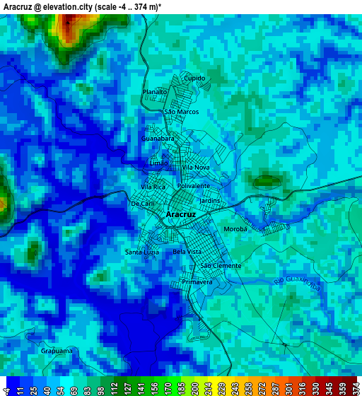
Below is the Elevation map of Aracruz, which displays elevation range with different colors. Scale of the first map is from -4 to 374 m (-13 to 1227 ft) with average elevation of 51.3 meters (=168 ft) [note 1]
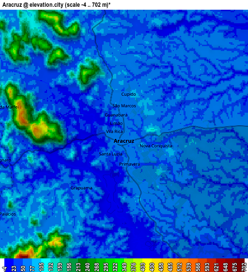
These maps also provides idea of topography and contour of this city, they are displayed at different zoom levels. More info about maps, scale and edge coordinates you can find below images.
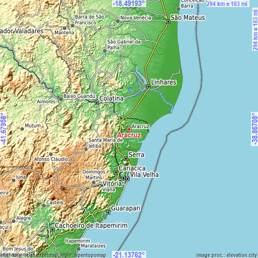
| \ | Map #1 | Map #2 | Topo.Map |
| Scale [m] | -4..374 m | -4..702 m | × |
| Scale [ft] | -13..1227 ft | -13..2303 ft | × |
| Average | 51.3 m = 168 ft | 71.7 m = 235 ft | × |
| Width | 9.19 km = 5.7 mi | 18.39 km = 11.4 mi | 294.2 km = 182.8 mi |
| Height | 9.19 km = 5.7 mi | 18.39 km = 11.4 mi | 294.2 km = 182.8 mi |
| ↑Max Latitude | -19.778933° | -19.737574° | -18.49193° |
| Latitude at center | -19.82028° | -19.82028° | -19.82028° |
| ↓Min Latitude | -19.861617° | -19.902943° | -21.13762° |
| ← Min Longitude | -40.317275° | -40.361221° | -41.67958° |
| Longitude center | -40.27333° | -40.27333° | -40.27333° |
| →Max Longitude | -40.229385° | -40.185439° | -38.86708° |
Nearby cities:
Cities around Aracruz sort by population:
• Serra elevation 57 m
34.5 km,  185°
185°
• Vitória 16 m
55.9 km, 186°
• Linhares 36 m
52.2 km,  23°
23°
• Colatina 82 m
48.7 km,  309°
309°
• Santa Maria de Jetibá 819 m
54.3 km,  244°
244°
• Fundão 37 m
18.7 km,  227°
227°
• João Neiva 57 m
13.7 km,  300°
300°
• Santa Teresa 656 m
36.5 km,  249°
249°
• Ibiraçu 58 m
10.2 km,  262°
262°
• Jetibá 678 m
48.1 km, 242°
• Marilândia 88 m
53.3 km,  328°
328°
• Santa Leopoldina 54 m
41.1 km,  220°
220°
Multilingual:
 En español:
Aracruz elevación 73 m.
 En France:
Aracruz élévation 73 m.


Sources and notes:
- [note 1] Map square and city borders are not equal. Map elevation data is calculated only from area inside that square.
- [src 1] Elevation data from geonames database provided with same terms of usage.
- [src 2] The elevation map of Aracruz is generated using elevation data from NASA's 3 arcsec (90m) resolution SRTM data.
- [src 3] Base (background) map © OpenStreetMap contributors tiles are generated by Geofabrik and OpenTopoMap.
Copyright & License:
This Aracruz Elevation Map is licensed under CC BY-SA. You may reuse any part from this page, if you give a proper credit by linking to this URL:
 More info on terms of use page.