Carandaí elevation
Carandaí (Minas Gerais), Brazil elevation is 1096 meters and Carandaí elevation in feet is 3596 ft above sea level [src 1]. Carandaí is a populated place (feature code) with elevation that is 714 meters (2343 ft) bigger than average city elevation in Brazil.
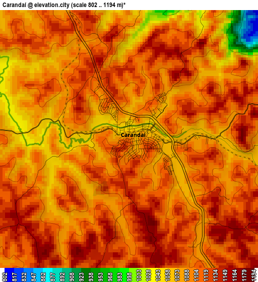
Below is the Elevation map of Carandaí, which displays elevation range with different colors. Scale of the first map is from 802 to 1194 m (2631 to 3917 ft) with average elevation of 1098.5 meters (=3604 ft) [note 1]
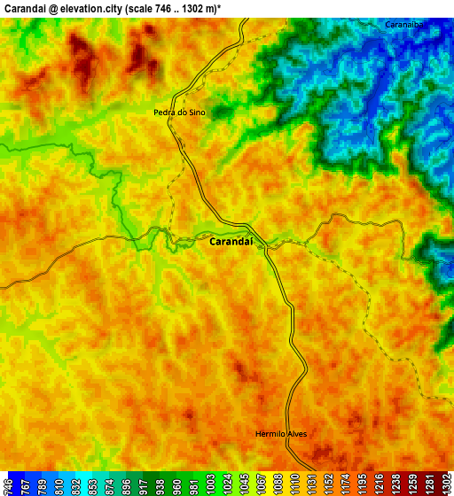
These maps also provides idea of topography and contour of this city, they are displayed at different zoom levels. More info about maps, scale and edge coordinates you can find below images.
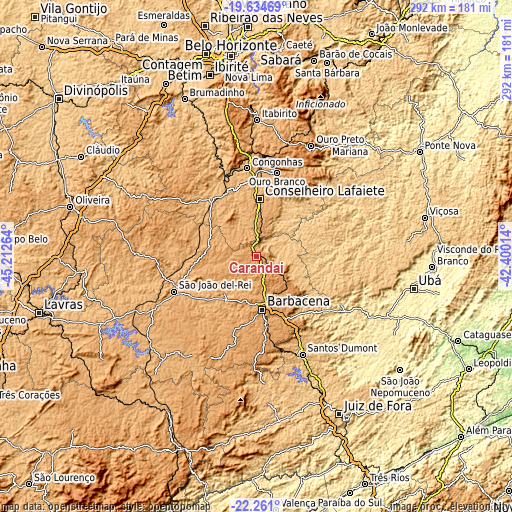
| \ | Map #1 | Map #2 | Topo.Map |
| Scale [m] | 802..1194 m | 746..1302 m | × |
| Scale [ft] | 2631..3917 ft | 2448..4272 ft | × |
| Average | 1098.5 m = 3604 ft | 1076.2 m = 3531 ft | × |
| Width | 9.13 km = 5.7 mi | 18.25 km = 11.3 mi | 292 km = 181.4 mi |
| Height | 9.13 km = 5.7 mi | 18.25 km = 11.3 mi | 292 km = 181.4 mi |
| ↑Max Latitude | -20.912565° | -20.871509° | -19.63469° |
| Latitude at center | -20.95361° | -20.95361° | -20.95361° |
| ↓Min Latitude | -20.994644° | -21.035666° | -22.261° |
| ← Min Longitude | -43.850335° | -43.894281° | -45.21264° |
| Longitude center | -43.80639° | -43.80639° | -43.80639° |
| →Max Longitude | -43.762445° | -43.718499° | -42.40014° |
Nearby cities:
Cities around Carandaí sort by population:
• Barbacena elevation 1171 m
30.5 km,  173°
173°
• Conselheiro Lafaiete 998 m
32.7 km,  3°
3°
• São João del Rei 911 m
51.4 km,  246°
246°
• Ouro Preto 1201 m
69.6 km,  26°
26°
• Congonhas 884 m
50.1 km,  353°
353°
• Mariana 707 m
75.8 km, 32°
• Santos Dumont 844 m
61.8 km,  154°
154°
• Itabirito 852 m
77.9 km, 0°
• Ouro Branco 1039 m
49.2 km,  13°
13°
• Barroso 927 m
31.3 km,  214°
214°
• Rio Pomba 448 m
74.2 km,  118°
118°
• Tiradentes 930 m
42.3 km, 245°
Multilingual:
 En español:
Carandaí elevación 1096 m.
 En France:
Carandaí élévation 1096 m.
 Auf Deutsch:
Carandaí höhe über dem Meeresspiegel ist 1096 m.

Sources and notes:
- [note 1] Map square and city borders are not equal. Map elevation data is calculated only from area inside that square.
- [src 1] Elevation data from geonames database provided with same terms of usage.
- [src 2] The elevation map of Carandaí is generated using elevation data from NASA's 3 arcsec (90m) resolution SRTM data.
- [src 3] Base (background) map © OpenStreetMap contributors tiles are generated by Geofabrik and OpenTopoMap.
Copyright & License:
This Carandaí Elevation Map is licensed under CC BY-SA. You may reuse any part from this page, if you give a proper credit by linking to this URL:
 More info on terms of use page.