Giruá elevation
Giruá (Rio Grande do Sul), Brazil elevation is 432 meters and Giruá elevation in feet is 1417 ft above sea level [src 1]. Giruá is a populated place (feature code) with elevation that is 50 meters (164 ft) bigger than average city elevation in Brazil.
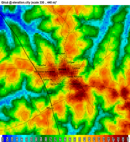
Below is the Elevation map of Giruá, which displays elevation range with different colors. Scale of the first map is from 330 to 440 m (1083 to 1444 ft) with average elevation of 385.3 meters (=1264 ft) [note 1]
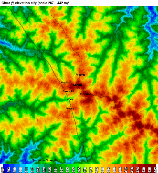
These maps also provides idea of topography and contour of this city, they are displayed at different zoom levels. More info about maps, scale and edge coordinates you can find below images.
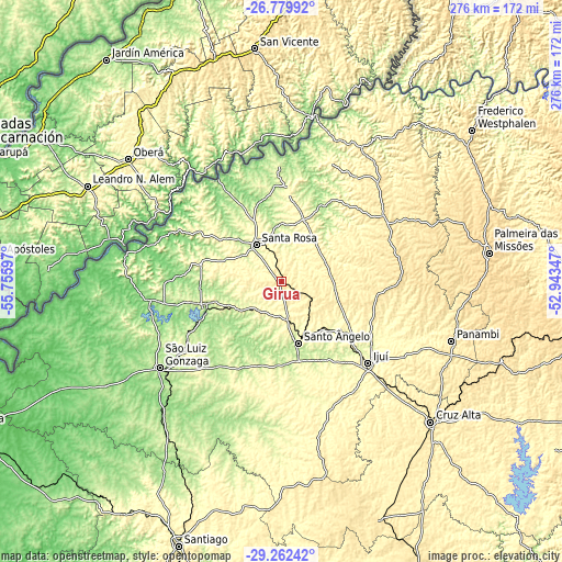
| \ | Map #1 | Map #2 | Topo.Map |
| Scale [m] | 330..440 m | 287..442 m | × |
| Scale [ft] | 1083..1444 ft | 942..1450 ft | × |
| Average | 385.3 m = 1264 ft | 370.6 m = 1216 ft | × |
| Width | 8.63 km = 5.4 mi | 17.25 km = 10.7 mi | 276 km = 171.5 mi |
| Height | 8.63 km = 5.4 mi | 17.25 km = 10.7 mi | 276 km = 171.5 mi |
| ↑Max Latitude | -27.989532° | -27.95072° | -26.77992° |
| Latitude at center | -28.02833° | -28.02833° | -28.02833° |
| ↓Min Latitude | -28.067114° | -28.105884° | -29.26242° |
| ← Min Longitude | -54.393665° | -54.437611° | -55.75597° |
| Longitude center | -54.34972° | -54.34972° | -54.34972° |
| →Max Longitude | -54.305775° | -54.261829° | -52.94347° |
Nearby cities:
Cities around Giruá sort by population:
• Ijuí elevation 329 m
58.4 km,  133°
133°
• Cruz Alta 475 m
99.9 km, 133°
• Santo Ângelo 295 m
31.3 km,  164°
164°
• Santa Rosa 284 m
21.8 km,  323°
323°
• São Luiz Gonzaga 264 m
73.3 km,  234°
234°
• Panambi 421 m
88.2 km,  109°
109°
• Três de Maio 351 m
30.3 km,  20°
20°
• Três Passos 449 m
75.8 km,  32°
32°
• Horizontina 323 m
44.9 km,  5°
5°
• Santo Augusto 533 m
59.6 km,  70°
70°
• Cerro Largo 200 m
40.4 km,  250°
250°
• Butia Inferior 192 m
52.8 km,  264°
264°
Multilingual:
 En español:
Giruá elevación 432 m.
 En France:
Giruá élévation 432 m.


Sources and notes:
- [note 1] Map square and city borders are not equal. Map elevation data is calculated only from area inside that square.
- [src 1] Elevation data from geonames database provided with same terms of usage.
- [src 2] The elevation map of Giruá is generated using elevation data from NASA's 3 arcsec (90m) resolution SRTM data.
- [src 3] Base (background) map © OpenStreetMap contributors tiles are generated by Geofabrik and OpenTopoMap.
Copyright & License:
This Giruá Elevation Map is licensed under CC BY-SA. You may reuse any part from this page, if you give a proper credit by linking to this URL:
 More info on terms of use page.