Indaial elevation
Indaial (Santa Catarina), Brazil elevation is 66 meters and Indaial elevation in feet is 217 ft above sea level [src 1]. Indaial is a populated place (feature code) with elevation that is 316 meters (1037 ft) smaller than average city elevation in Brazil.
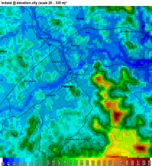
Below is the Elevation map of Indaial, which displays elevation range with different colors. Scale of the first map is from 29 to 335 m (95 to 1099 ft) with average elevation of 94.7 meters (=311 ft) [note 1]
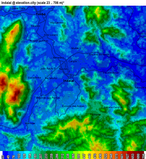
These maps also provides idea of topography and contour of this city, they are displayed at different zoom levels. More info about maps, scale and edge coordinates you can find below images.
| \ | Map #1 | Map #2 | Topo.Map |
| Scale [m] | 29..335 m | 23..706 m | × |
| Scale [ft] | 95..1099 ft | 75..2316 ft | × |
| Average | 94.7 m = 311 ft | 162.1 m = 532 ft | × |
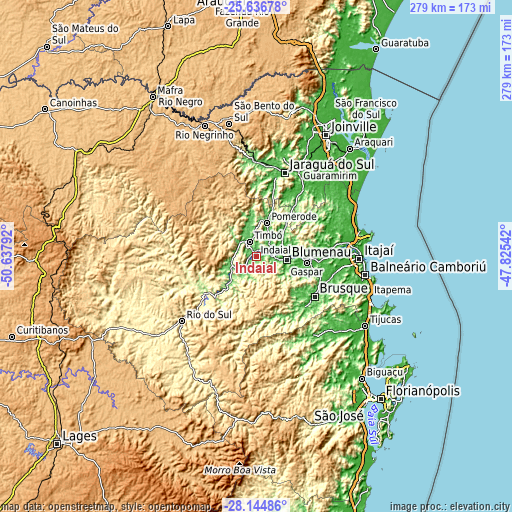
| Width | 8.72 km = 5.4 mi | 17.43 km = 10.8 mi | 278.9 km = 173.3 mi |
| Height | 8.72 km = 5.4 mi | 17.43 km = 10.8 mi | 278.9 km = 173.3 mi |
| ↑Max Latitude | -26.858582° | -26.819371° | -25.63678° |
| Latitude at center | -26.89778° | -26.89778° | -26.89778° |
| ↓Min Latitude | -26.936964° | -26.976135° | -28.14486° |
| ← Min Longitude | -49.275615° | -49.319561° | -50.63792° |
| Longitude center | -49.23167° | -49.23167° | -49.23167° |
| →Max Longitude | -49.187725° | -49.143779° | -47.82542° |
Nearby cities:
Cities around Indaial sort by population:
• Blumenau elevation 20 m
16.6 km,  98°
98°
• Jaraguá do Sul 27 m
48.6 km,  19°
19°
• Brusque 22 m
38.6 km,  125°
125°
• Rio do Sul 346 m
53.8 km,  229°
229°
• Timbó 69 m
9.2 km,  334°
334°
• Gaspar 12 m
27.3 km, 97°
• Pomerode 64 m
18.3 km, 17°
• Guaramirim 34 m
52.4 km,  25°
25°
• Ibirama 156 m
33.4 km,  238°
238°
• Corupá 66 m
52.5 km,  358°
358°
• Residencia Moacir PU5BHV 96 m
13.3 km,  264°
264°
• Rodeio 100 m
13.6 km, 258°
Multilingual:
 En español:
Indaial elevación 66 m.
 En France:
Indaial élévation 66 m.


Sources and notes:
- [note 1] Map square and city borders are not equal. Map elevation data is calculated only from area inside that square.
- [src 1] Elevation data from geonames database provided with same terms of usage.
- [src 2] The elevation map of Indaial is generated using elevation data from NASA's 3 arcsec (90m) resolution SRTM data.
- [src 3] Base (background) map © OpenStreetMap contributors tiles are generated by Geofabrik and OpenTopoMap.
Copyright & License:
This Indaial Elevation Map is licensed under CC BY-SA. You may reuse any part from this page, if you give a proper credit by linking to this URL:
 More info on terms of use page.