Mairinque elevation
Mairinque (São Paulo), Brazil elevation is 850 meters and Mairinque elevation in feet is 2789 ft above sea level [src 1]. Mairinque is a populated place (feature code) with elevation that is 468 meters (1535 ft) bigger than average city elevation in Brazil.
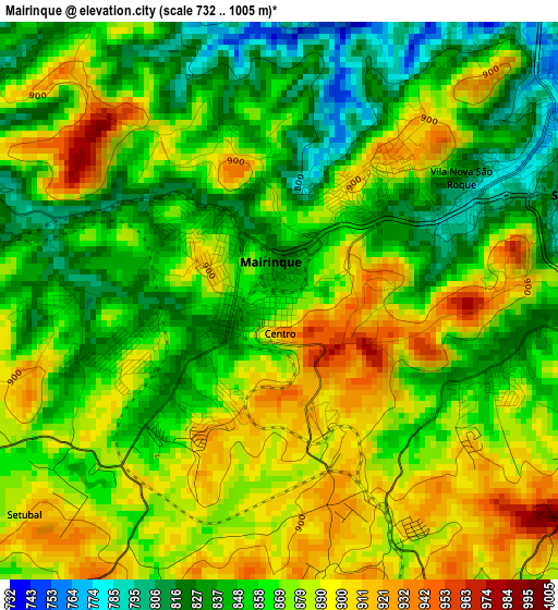
Below is the Elevation map of Mairinque, which displays elevation range with different colors. Scale of the first map is from 732 to 1005 m (2402 to 3297 ft) with average elevation of 866.5 meters (=2843 ft) [note 1]
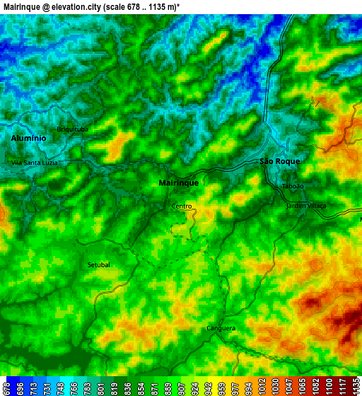
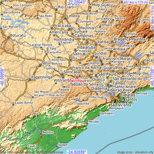
These maps also provides idea of topography and contour of this city, they are displayed at different zoom levels. More info about maps, scale and edge coordinates you can find below images.
| \ | Map #1 | Map #2 | Topo.Map |
| Scale [m] | 732..1005 m | 678..1135 m | × |
| Scale [ft] | 2402..3297 ft | 2224..3724 ft | × |
| Average | 866.5 m = 2843 ft | 863.9 m = 2834 ft | × |
| Width | 8.96 km = 5.6 mi | 17.92 km = 11.1 mi | 286.7 km = 178.1 mi |
| Height | 8.96 km = 5.6 mi | 17.92 km = 11.1 mi | 286.7 km = 178.1 mi |
| ↑Max Latitude | -23.505537° | -23.465232° | -22.25043° |
| Latitude at center | -23.54583° | -23.54583° | -23.54583° |
| ↓Min Latitude | -23.58611° | -23.626378° | -24.82859° |
| ← Min Longitude | -47.227275° | -47.271221° | -48.58958° |
| Longitude center | -47.18333° | -47.18333° | -47.18333° |
| →Max Longitude | -47.139385° | -47.095439° | -45.77708° |
Nearby cities:
Cities around Mairinque sort by population:
• Sorocaba elevation 602 m
28.4 km,  279°
279°
• Itapevi 772 m
25.4 km,  90°
90°
• Cotia 801 m
27.7 km,  103°
103°
• Jandira 733 m
28.7 km, 85°
• Votorantim 572 m
25.9 km,  269°
269°
• Santana de Parnaíba 711 m
29.3 km,  67°
67°
• São Roque 773 m
5.2 km, 69°
• Cabreúva 638 m
27 km,  11°
11°
• Piedade 795 m
31 km,  233°
233°
• Ibiúna 868 m
12.9 km,  197°
197°
• Pirapora do Bom Jesus 678 m
24.8 km,  48°
48°
• Vargem Grande Paulista 879 m
17.2 km,  111°
111°
Multilingual:
 En español:
Mairinque elevación 850 m.
 En France:
Mairinque élévation 850 m.
 Auf Deutsch:
Mairinque höhe über dem Meeresspiegel ist 850 m.

Sources and notes:
- [note 1] Map square and city borders are not equal. Map elevation data is calculated only from area inside that square.
- [src 1] Elevation data from geonames database provided with same terms of usage.
- [src 2] The elevation map of Mairinque is generated using elevation data from NASA's 3 arcsec (90m) resolution SRTM data.
- [src 3] Base (background) map © OpenStreetMap contributors tiles are generated by Geofabrik and OpenTopoMap.
Copyright & License:
This Mairinque Elevation Map is licensed under CC BY-SA. You may reuse any part from this page, if you give a proper credit by linking to this URL:
 More info on terms of use page.