Nazaré elevation
Nazaré (Bahia), Brazil elevation is 12 meters and Nazaré elevation in feet is 39 ft above sea level [src 1]. Nazaré is a populated place (feature code) with elevation that is 370 meters (1214 ft) smaller than average city elevation in Brazil.
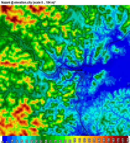
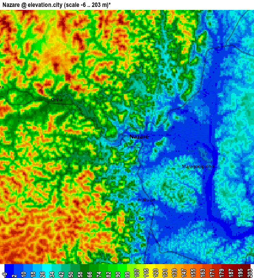
Below is the Elevation map of Nazaré, which displays elevation range with different colors. Scale of the first map is from 0 to 184 m (0 to 604 ft) with average elevation of 56.2 meters (=184 ft) [note 1]
These maps also provides idea of topography and contour of this city, they are displayed at different zoom levels. More info about maps, scale and edge coordinates you can find below images.
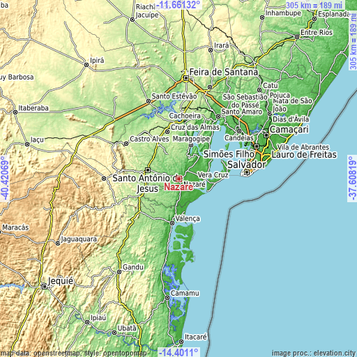
| \ | Map #1 | Map #2 | Topo.Map |
| Scale [m] | 0..184 m | -6..203 m | × |
| Scale [ft] | 0..604 ft | -20..666 ft | × |
| Average | 56.2 m = 184 ft | 70.4 m = 231 ft | × |
| Width | 9.52 km = 5.9 mi | 19.04 km = 11.8 mi | 304.6 km = 189.3 mi |
| Height | 9.52 km = 5.9 mi | 19.04 km = 11.8 mi | 304.7 km = 189.3 mi |
| ↑Max Latitude | -12.992183° | -12.949359° | -11.66132° |
| Latitude at center | -13.035° | -13.035° | -13.035° |
| ↓Min Latitude | -13.077809° | -13.120611° | -14.4011° |
| ← Min Longitude | -39.058385° | -39.102331° | -40.42069° |
| Longitude center | -39.01444° | -39.01444° | -39.01444° |
| →Max Longitude | -38.970495° | -38.926549° | -37.60819° |
Nearby cities:
Cities around Nazaré sort by population:
• Santo Antônio de Jesus elevation 214 m
27.7 km,  285°
285°
• Valença 9 m
37.8 km,  189°
189°
• Cruz das Almas 224 m
41.7 km,  346°
346°
• Muritiba 219 m
28.7 km,  297°
297°
• Maragogipe 13 m
30.4 km,  19°
19°
• Itaparica 20 m
39.9 km,  65°
65°
• Sobradinho 167 m
24.3 km,  337°
337°
• Cachoeira 8 m
48.5 km,  6°
6°
• Saubara 20 m
42.5 km,  38°
38°
• Madre de Deus 2 m
53.8 km,  52°
52°
• Castro Alves 255 m
53.9 km, 303°
• Conceição do Almeida 219 m
33 km,  329°
329°
Multilingual:
 En español:
Nazaré elevación 12 m.
 En France:
Nazaré élévation 12 m.


Sources and notes:
- [note 1] Map square and city borders are not equal. Map elevation data is calculated only from area inside that square.
- [src 1] Elevation data from geonames database provided with same terms of usage.
- [src 2] The elevation map of Nazaré is generated using elevation data from NASA's 3 arcsec (90m) resolution SRTM data.
- [src 3] Base (background) map © OpenStreetMap contributors tiles are generated by Geofabrik and OpenTopoMap.
Copyright & License:
This Nazaré Elevation Map is licensed under CC BY-SA. You may reuse any part from this page, if you give a proper credit by linking to this URL:
 More info on terms of use page.