Amontada elevation
Amontada (Ceará), Brazil elevation is 37 meters and Amontada elevation in feet is 121 ft above sea level [src 1]. Amontada is a populated place (feature code) with elevation that is 345 meters (1132 ft) smaller than average city elevation in Brazil.
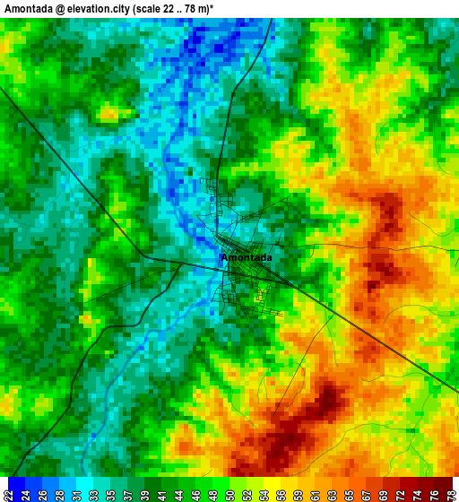
Below is the Elevation map of Amontada, which displays elevation range with different colors. Scale of the first map is from 22 to 78 m (72 to 256 ft) with average elevation of 46.1 meters (=151 ft) [note 1]
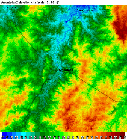
These maps also provides idea of topography and contour of this city, they are displayed at different zoom levels. More info about maps, scale and edge coordinates you can find below images.
| \ | Map #1 | Map #2 | Topo.Map |
| Scale [m] | 22..78 m | 15..88 m | × |
| Scale [ft] | 72..256 ft | 49..289 ft | × |
| Average | 46.1 m = 151 ft | 49.8 m = 163 ft | × |
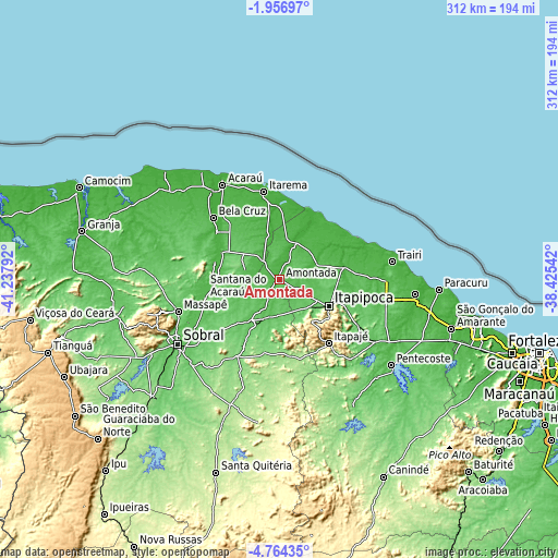
| Width | 9.76 km = 6.1 mi | 19.51 km = 12.1 mi | 312.2 km = 194 mi |
| Height | 9.76 km = 6.1 mi | 19.51 km = 12.1 mi | 312.2 km = 194 mi |
| ↑Max Latitude | -3.317799° | -3.273927° | -1.95697° |
| Latitude at center | -3.36167° | -3.36167° | -3.36167° |
| ↓Min Latitude | -3.405539° | -3.449405° | -4.76435° |
| ← Min Longitude | -39.875615° | -39.919561° | -41.23792° |
| Longitude center | -39.83167° | -39.83167° | -39.83167° |
| →Max Longitude | -39.787725° | -39.743779° | -38.42542° |
Nearby cities:
Cities around Amontada sort by population:
• Sobral elevation 75 m
67.9 km,  237°
237°
• Itapipoca 103 m
31.7 km,  117°
117°
• Itapagé 267 m
45.3 km,  142°
142°
• Acaraú 17 m
61.9 km,  328°
328°
• Trairi 9 m
63.2 km,  81°
81°
• Santana do Acaraú 46 m
43.6 km,  255°
255°
• Marco 22 m
43.8 km,  307°
307°
• Irauçuba 150 m
43.1 km,  172°
172°
• Bela Cruz 14 m
50.9 km, 312°
• Umirim 63 m
63.9 km, 123°
• Uruburetama 127 m
46.3 km,  129°
129°
• Cruz 24 m
62.1 km,  322°
322°
Multilingual:
 En español:
Amontada elevación 37 m.
 En France:
Amontada élévation 37 m.


Sources and notes:
- [note 1] Map square and city borders are not equal. Map elevation data is calculated only from area inside that square.
- [src 1] Elevation data from geonames database provided with same terms of usage.
- [src 2] The elevation map of Amontada is generated using elevation data from NASA's 3 arcsec (90m) resolution SRTM data.
- [src 3] Base (background) map © OpenStreetMap contributors tiles are generated by Geofabrik and OpenTopoMap.
Copyright & License:
This Amontada Elevation Map is licensed under CC BY-SA. You may reuse any part from this page, if you give a proper credit by linking to this URL:
 More info on terms of use page.