Granja elevation
Granja (Ceará), Brazil elevation is 8 meters and Granja elevation in feet is 26 ft above sea level [src 1]. Granja is a populated place (feature code) with elevation that is 374 meters (1227 ft) smaller than average city elevation in Brazil.
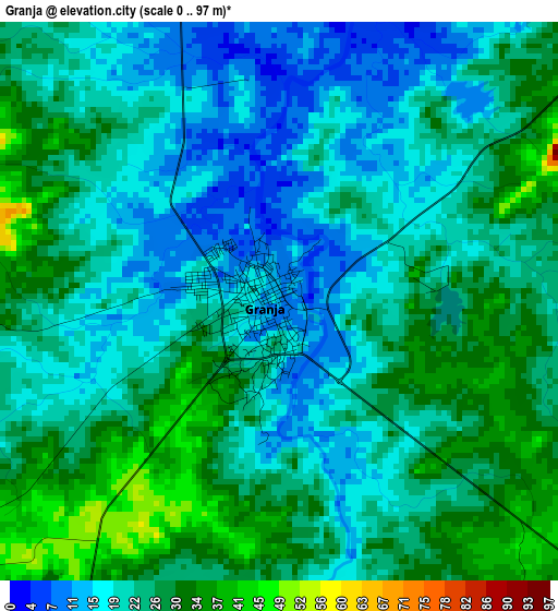
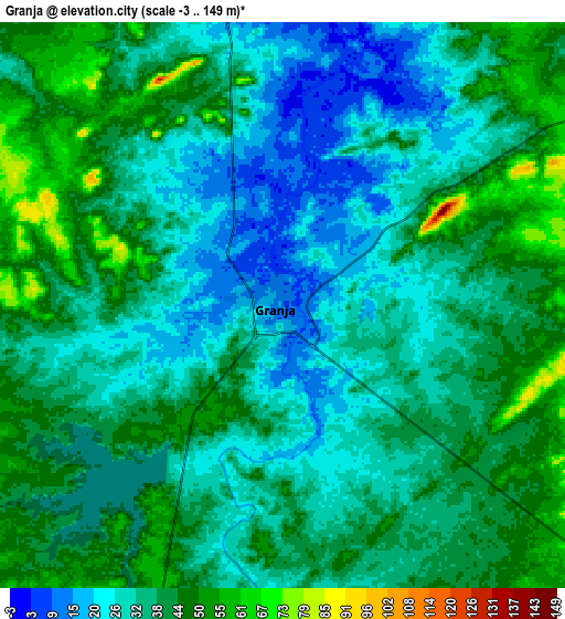
Below is the Elevation map of Granja, which displays elevation range with different colors. Scale of the first map is from 0 to 97 m (0 to 318 ft) with average elevation of 23.5 meters (=77 ft) [note 1]
These maps also provides idea of topography and contour of this city, they are displayed at different zoom levels. More info about maps, scale and edge coordinates you can find below images.
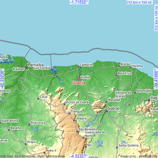
| \ | Map #1 | Map #2 | Topo.Map |
| Scale [m] | 0..97 m | -3..149 m | × |
| Scale [ft] | 0..318 ft | -10..489 ft | × |
| Average | 23.5 m = 77 ft | 36.2 m = 119 ft | × |
| Width | 9.76 km = 6.1 mi | 19.52 km = 12.1 mi | 312.2 km = 194 mi |
| Height | 9.76 km = 6.1 mi | 19.52 km = 12.1 mi | 312.3 km = 194.1 mi |
| ↑Max Latitude | -3.076399° | -3.032516° | -1.71532° |
| Latitude at center | -3.12028° | -3.12028° | -3.12028° |
| ↓Min Latitude | -3.164159° | -3.208037° | -4.52337° |
| ← Min Longitude | -40.870055° | -40.914001° | -42.23236° |
| Longitude center | -40.82611° | -40.82611° | -40.82611° |
| →Max Longitude | -40.782165° | -40.738219° | -39.41986° |
Nearby cities:
Cities around Granja sort by population:
• Sobral elevation 75 m
82.2 km,  139°
139°
• Tianguá 773 m
70.5 km,  195°
195°
• Camocim 6 m
24.3 km,  356°
356°
• Viçosa do Ceará 719 m
57.3 km,  211°
211°
• Santana do Acaraú 46 m
77.9 km,  119°
119°
• Marco 22 m
75.4 km,  90°
90°
• Ubajara 855 m
82.3 km,  187°
187°
• Bela Cruz 14 m
73.5 km,  83°
83°
• Barroquinha 20 m
36.2 km,  288°
288°
• Coreaú 165 m
49.6 km,  157°
157°
• Cruz 24 m
75.5 km,  72°
72°
• Juá dos Vieiras 516 m
69.8 km,  228°
228°
Multilingual:
 En español:
Granja elevación 8 m.
 En France:
Granja élévation 8 m.


Sources and notes:
- [note 1] Map square and city borders are not equal. Map elevation data is calculated only from area inside that square.
- [src 1] Elevation data from geonames database provided with same terms of usage.
- [src 2] The elevation map of Granja is generated using elevation data from NASA's 3 arcsec (90m) resolution SRTM data.
- [src 3] Base (background) map © OpenStreetMap contributors tiles are generated by Geofabrik and OpenTopoMap.
Copyright & License:
This Granja Elevation Map is licensed under CC BY-SA. You may reuse any part from this page, if you give a proper credit by linking to this URL:
 More info on terms of use page.