Horizonte elevation
Horizonte (Ceará), Brazil elevation is 75 meters and Horizonte elevation in feet is 246 ft above sea level [src 1]. Horizonte is a populated place (feature code) with elevation that is 307 meters (1007 ft) smaller than average city elevation in Brazil.
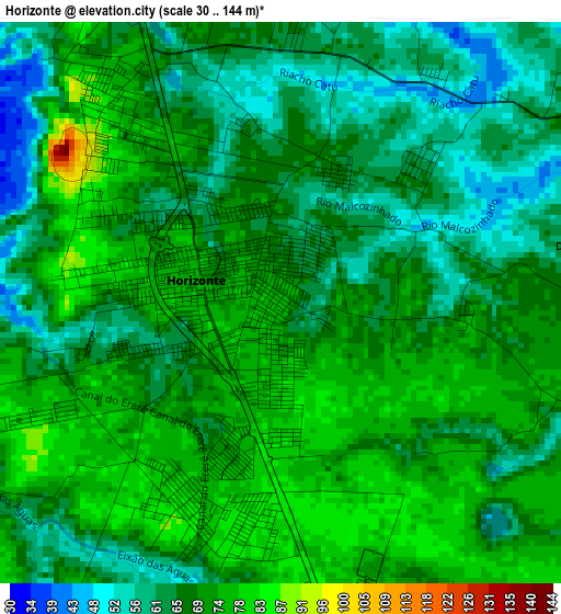
Below is the Elevation map of Horizonte, which displays elevation range with different colors. Scale of the first map is from 30 to 144 m (98 to 472 ft) with average elevation of 68.4 meters (=224 ft) [note 1]
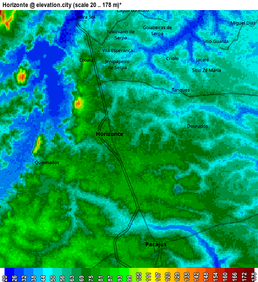
These maps also provides idea of topography and contour of this city, they are displayed at different zoom levels. More info about maps, scale and edge coordinates you can find below images.
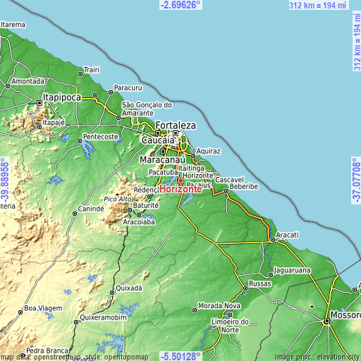
| \ | Map #1 | Map #2 | Topo.Map |
| Scale [m] | 30..144 m | 20..178 m | × |
| Scale [ft] | 98..472 ft | 66..584 ft | × |
| Average | 68.4 m = 224 ft | 61.6 m = 202 ft | × |
| Width | 9.75 km = 6.1 mi | 19.5 km = 12.1 mi | 311.9 km = 193.8 mi |
| Height | 9.75 km = 6.1 mi | 19.49 km = 12.1 mi | 311.9 km = 193.8 mi |
| ↑Max Latitude | -4.056166° | -4.01233° | -2.69626° |
| Latitude at center | -4.1° | -4.1° | -4.1° |
| ↓Min Latitude | -4.143832° | -4.187661° | -5.50128° |
| ← Min Longitude | -38.527275° | -38.571221° | -39.88958° |
| Longitude center | -38.48333° | -38.48333° | -38.48333° |
| →Max Longitude | -38.439385° | -38.395439° | -37.07708° |
Nearby cities:
Cities around Horizonte sort by population:
• Fortaleza elevation 18 m
43.1 km,  351°
351°
• Maracanaú 54 m
29.4 km,  327°
327°
• Aquiraz 21 m
24.3 km,  24°
24°
• Pacatuba 72 m
19.9 km,  310°
310°
• Cascavel 31 m
27 km,  97°
97°
• Pacajus 80 m
8.4 km,  162°
162°
• Eusébio 36 m
23.6 km,  8°
8°
• Beberibe 20 m
40.1 km, 102°
• Itaitinga 64 m
15.3 km,  341°
341°
• Guaiúba 75 m
18.3 km,  291°
291°
• Redenção 93 m
30.8 km,  242°
242°
• Chorozinho 56 m
22.3 km,  184°
184°
Multilingual:
 En español:
Horizonte elevación 75 m.
 En France:
Horizonte élévation 75 m.
 Auf Deutsch:
Horizonte höhe über dem Meeresspiegel ist 75 m.

Sources and notes:
- [note 1] Map square and city borders are not equal. Map elevation data is calculated only from area inside that square.
- [src 1] Elevation data from geonames database provided with same terms of usage.
- [src 2] The elevation map of Horizonte is generated using elevation data from NASA's 3 arcsec (90m) resolution SRTM data.
- [src 3] Base (background) map © OpenStreetMap contributors tiles are generated by Geofabrik and OpenTopoMap.
Copyright & License:
This Horizonte Elevation Map is licensed under CC BY-SA. You may reuse any part from this page, if you give a proper credit by linking to this URL:
 More info on terms of use page.