Itaquitinga elevation
Itaquitinga (Pernambuco), Brazil elevation is 72 meters and Itaquitinga elevation in feet is 236 ft above sea level [src 1]. Itaquitinga is a populated place (feature code) with elevation that is 310 meters (1017 ft) smaller than average city elevation in Brazil.
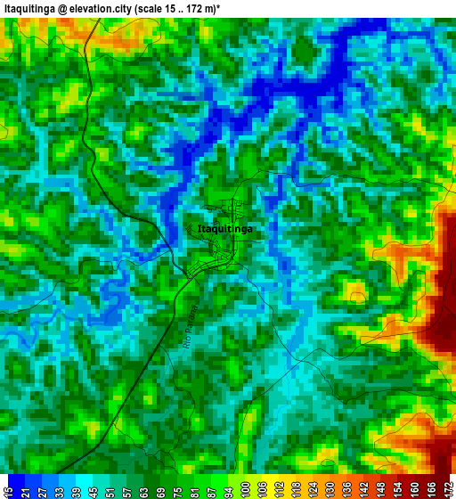
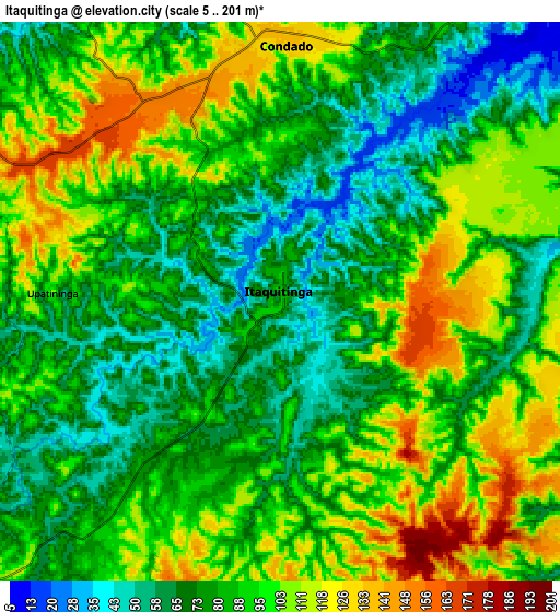
Below is the Elevation map of Itaquitinga, which displays elevation range with different colors. Scale of the first map is from 15 to 172 m (49 to 564 ft) with average elevation of 65.8 meters (=216 ft) [note 1]
These maps also provides idea of topography and contour of this city, they are displayed at different zoom levels. More info about maps, scale and edge coordinates you can find below images.
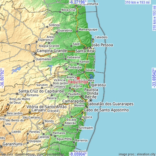
| \ | Map #1 | Map #2 | Topo.Map |
| Scale [m] | 15..172 m | 5..201 m | × |
| Scale [ft] | 49..564 ft | 16..659 ft | × |
| Average | 65.8 m = 216 ft | 88.1 m = 289 ft | × |
| Width | 9.69 km = 6 mi | 19.37 km = 12 mi | 309.9 km = 192.6 mi |
| Height | 9.69 km = 6 mi | 19.37 km = 12 mi | 309.9 km = 192.6 mi |
| ↑Max Latitude | -7.624225° | -7.580666° | -6.27196° |
| Latitude at center | -7.66778° | -7.66778° | -7.66778° |
| ↓Min Latitude | -7.71133° | -7.754876° | -9.05904° |
| ← Min Longitude | -35.145615° | -35.189561° | -36.50792° |
| Longitude center | -35.10167° | -35.10167° | -35.10167° |
| →Max Longitude | -35.057725° | -35.013779° | -33.69542° |
Nearby cities:
Cities around Itaquitinga sort by population:
• Igarassu elevation 22 m
28.4 km,  130°
130°
• Carpina 186 m
26.4 km,  219°
219°
• Timbaúba 136 m
29.9 km,  307°
307°
• Goiana 21 m
16.2 km,  42°
42°
• Nazaré da Mata 96 m
16.1 km,  239°
239°
• Condado 135 m
9.1 km,  357°
357°
• Itapissuma 13 m
26 km,  117°
117°
• Itamaracá 7 m
31.7 km,  106°
106°
• Pedras de Fogo 174 m
29.6 km, 356°
• Caaporã 32 m
27.2 km,  51°
51°
• Araçoiaba 166 m
13.7 km,  174°
174°
• Vicência 122 m
24.8 km,  272°
272°
Multilingual:
 En español:
Itaquitinga elevación 72 m.
 En France:
Itaquitinga élévation 72 m.
 Auf Deutsch:
Itaquitinga höhe über dem Meeresspiegel ist 72 m.

Sources and notes:
- [note 1] Map square and city borders are not equal. Map elevation data is calculated only from area inside that square.
- [src 1] Elevation data from geonames database provided with same terms of usage.
- [src 2] The elevation map of Itaquitinga is generated using elevation data from NASA's 3 arcsec (90m) resolution SRTM data.
- [src 3] Base (background) map © OpenStreetMap contributors tiles are generated by Geofabrik and OpenTopoMap.
Copyright & License:
This Itaquitinga Elevation Map is licensed under CC BY-SA. You may reuse any part from this page, if you give a proper credit by linking to this URL:
 More info on terms of use page.