Jardim elevation
Jardim (Ceará, Paracuru), Brazil elevation is 31 meters and Jardim elevation in feet is 102 ft above sea level [src 1]. Jardim is a populated locality (feature code) with elevation that is 351 meters (1152 ft) smaller than average city elevation in Brazil.
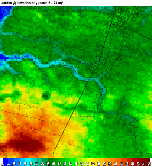
Below is the Elevation map of Jardim, which displays elevation range with different colors. Scale of the first map is from 5 to 74 m (16 to 243 ft) with average elevation of 35.5 meters (=116 ft) [note 1]
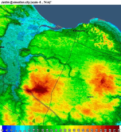
These maps also provides idea of topography and contour of this city, they are displayed at different zoom levels. More info about maps, scale and edge coordinates you can find below images.
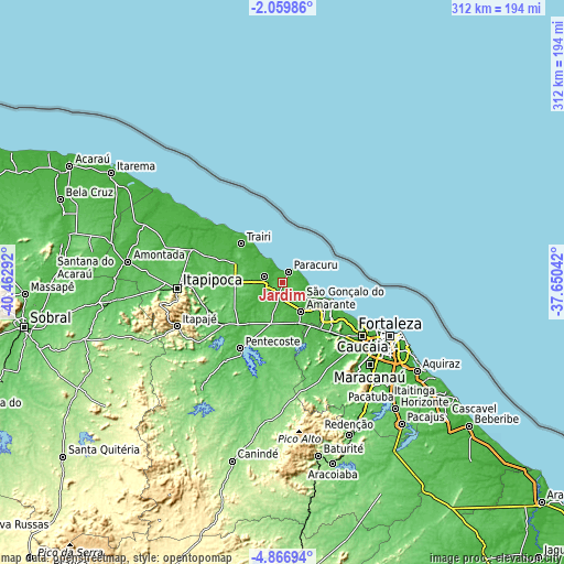
| \ | Map #1 | Map #2 | Topo.Map |
| Scale [m] | 5..74 m | -8..74 m | × |
| Scale [ft] | 16..243 ft | -26..243 ft | × |
| Average | 35.5 m = 116 ft | 30.3 m = 99 ft | × |
| Width | 9.75 km = 6.1 mi | 19.51 km = 12.1 mi | 312.1 km = 193.9 mi |
| Height | 9.75 km = 6.1 mi | 19.51 km = 12.1 mi | 312.1 km = 193.9 mi |
| ↑Max Latitude | -3.420574° | -3.376706° | -2.05986° |
| Latitude at center | -3.46444° | -3.46444° | -3.46444° |
| ↓Min Latitude | -3.508304° | -3.552166° | -4.86694° |
| ← Min Longitude | -39.100615° | -39.144561° | -40.46292° |
| Longitude center | -39.05667° | -39.05667° | -39.05667° |
| →Max Longitude | -39.012725° | -38.968779° | -37.65042° |
Nearby cities:
Cities around Jardim sort by population:
• Fortaleza elevation 18 m
63.5 km,  116°
116°
• Caucaia 35 m
54 km, 123°
• Itapipoca 103 m
58 km,  266°
266°
• Itapagé 267 m
63.7 km,  247°
247°
• São Gonçalo do Amarante 23 m
18.7 km,  148°
148°
• Trairi 9 m
31.4 km,  311°
311°
• Paracuru 23 m
6.7 km,  25°
25°
• Pentecoste 59 m
43.5 km,  212°
212°
• Paraipaba 34 m
10.5 km,  285°
285°
• Umirim 63 m
40.3 km,  234°
234°
• Uruburetama 127 m
53.2 km, 250°
• Cambebba 41 m
30.7 km, 124°
Multilingual:
 En español:
Jardim elevación 31 m.
 En France:
Jardim élévation 31 m.


Sources and notes:
- [note 1] Map square and city borders are not equal. Map elevation data is calculated only from area inside that square.
- [src 1] Elevation data from geonames database provided with same terms of usage.
- [src 2] The elevation map of Jardim is generated using elevation data from NASA's 3 arcsec (90m) resolution SRTM data.
- [src 3] Base (background) map © OpenStreetMap contributors tiles are generated by Geofabrik and OpenTopoMap.
Copyright & License:
This Jardim Elevation Map is licensed under CC BY-SA. You may reuse any part from this page, if you give a proper credit by linking to this URL:
 More info on terms of use page.