Morros elevation
Morros (Maranhão, Alto Parnaíba), Brazil elevation is 484 meters and Morros elevation in feet is 1588 ft above sea level [src 1]. Morros is a populated place (feature code) with elevation that is 102 meters (335 ft) bigger than average city elevation in Brazil.
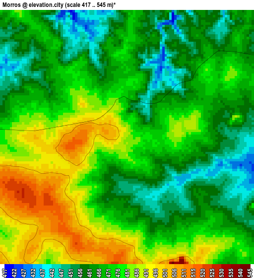
Below is the Elevation map of Morros, which displays elevation range with different colors. Scale of the first map is from 417 to 545 m (1368 to 1788 ft) with average elevation of 472.1 meters (=1549 ft) [note 1]
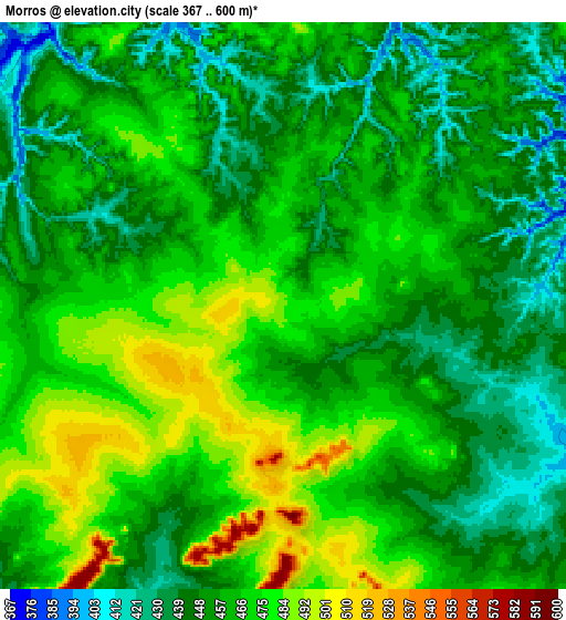
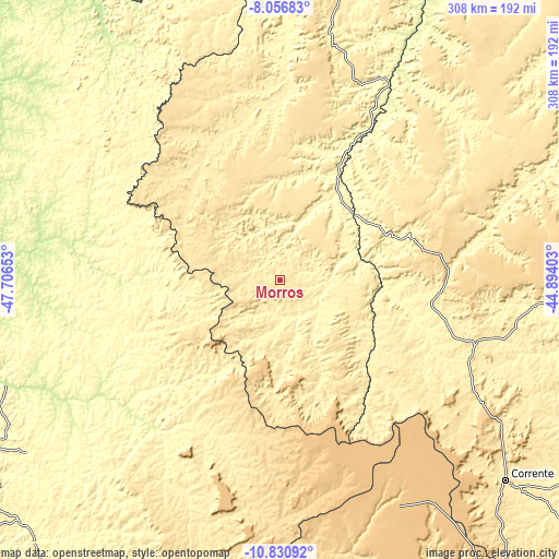
These maps also provides idea of topography and contour of this city, they are displayed at different zoom levels. More info about maps, scale and edge coordinates you can find below images.
| \ | Map #1 | Map #2 | Topo.Map |
| Scale [m] | 417..545 m | 367..600 m | × |
| Scale [ft] | 1368..1788 ft | 1204..1969 ft | × |
| Average | 472.1 m = 1549 ft | 459.4 m = 1507 ft | × |
| Width | 9.64 km = 6 mi | 19.28 km = 12 mi | 308.4 km = 191.6 mi |
| Height | 9.64 km = 6 mi | 19.28 km = 12 mi | 308.5 km = 191.7 mi |
| ↑Max Latitude | -9.403318° | -9.35996° | -8.05683° |
| Latitude at center | -9.44667° | -9.44667° | -9.44667° |
| ↓Min Latitude | -9.490017° | -9.533358° | -10.83092° |
| ← Min Longitude | -46.344225° | -46.388171° | -47.70653° |
| Longitude center | -46.30028° | -46.30028° | -46.30028° |
| →Max Longitude | -46.256335° | -46.212389° | -44.89403° |
Nearby cities:
Cities around Morros sort by population:
• Palmas elevation 271 m
236.1 km,  250°
250°
• Balsas 254 m
214.8 km,  7°
7°
• Santa Luzia 197 m
224.5 km,  333°
333°
• Miracema do Tocantins 195 m
229.7 km,  266°
266°
• Carolina 175 m
267.3 km, 331°
• Formosa do Rio Preto 495 m
215.4 km,  145°
145°
• Bom Jesus 281 m
217.1 km,  79°
79°
• Riachão 385 m
234.4 km,  351°
351°
• Bom Jardim 426 m
270.9 km,  355°
355°
• Riachão das Neves 503 m
297.4 km, 149°
• São Raimundo das Mangabeiras 241 m
284.3 km,  18°
18°
• Gilbués 481 m
113.2 km,  112°
112°
Multilingual:
 En español:
Morros elevación 484 m.
 En France:
Morros élévation 484 m.


Sources and notes:
- [note 1] Map square and city borders are not equal. Map elevation data is calculated only from area inside that square.
- [src 1] Elevation data from geonames database provided with same terms of usage.
- [src 2] The elevation map of Morros is generated using elevation data from NASA's 3 arcsec (90m) resolution SRTM data.
- [src 3] Base (background) map © OpenStreetMap contributors tiles are generated by Geofabrik and OpenTopoMap.
Copyright & License:
This Morros Elevation Map is licensed under CC BY-SA. You may reuse any part from this page, if you give a proper credit by linking to this URL:
 More info on terms of use page.