Pirapemas elevation
Pirapemas (Maranhão), Brazil elevation is 36 meters and Pirapemas elevation in feet is 118 ft above sea level [src 1]. Pirapemas is a populated place (feature code) with elevation that is 346 meters (1135 ft) smaller than average city elevation in Brazil.
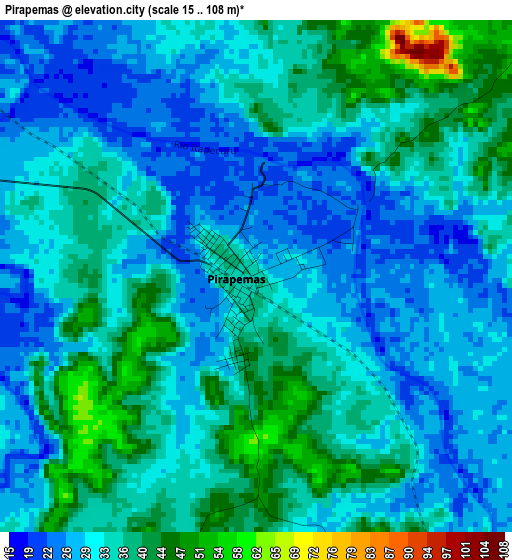
Below is the Elevation map of Pirapemas, which displays elevation range with different colors. Scale of the first map is from 15 to 108 m (49 to 354 ft) with average elevation of 33.2 meters (=109 ft) [note 1]
These maps also provides idea of topography and contour of this city, they are displayed at different zoom levels. More info about maps, scale and edge coordinates you can find below images.
| \ | Map #1 | Map #2 | Topo.Map |
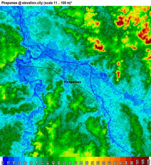
| Scale [m] | 15..108 m | 11..109 m | × |
| Scale [ft] | 49..354 ft | 36..358 ft | × |
| Average | 33.2 m = 109 ft | 39.1 m = 128 ft | × |
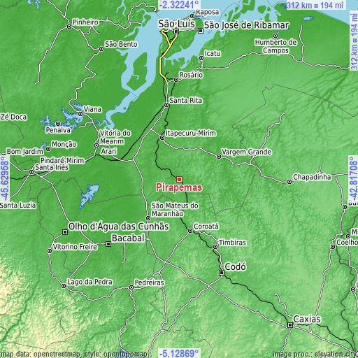
| Width | 9.75 km = 6.1 mi | 19.5 km = 12.1 mi | 312 km = 193.9 mi |
| Height | 9.75 km = 6.1 mi | 19.5 km = 12.1 mi | 312.1 km = 193.9 mi |
| ↑Max Latitude | -3.682817° | -3.638961° | -2.32241° |
| Latitude at center | -3.72667° | -3.72667° | -3.72667° |
| ↓Min Latitude | -3.770521° | -3.81437° | -5.12869° |
| ← Min Longitude | -44.267275° | -44.311221° | -45.62958° |
| Longitude center | -44.22333° | -44.22333° | -44.22333° |
| →Max Longitude | -44.179385° | -44.135439° | -42.81708° |
Nearby cities:
Cities around Pirapemas sort by population:
• Bacabal elevation 28 m
89 km,  225°
225°
• Itapecuru Mirim 20 m
40.1 km,  337°
337°
• Coroatá 37 m
46.2 km,  166°
166°
• São Mateus do Maranhão 47 m
44.8 km,  218°
218°
• Vargem Grande 44 m
39.8 km,  59°
59°
• Timbiras 36 m
66.6 km,  151°
151°
• Arari 9 m
68.8 km,  296°
296°
• Vitória do Mearim 15 m
77.6 km,  292°
292°
• Santa Rita 44 m
43.1 km,  110°
110°
• São Benedito do Rio Preto 34 m
88.7 km, 60°
• Cantanhede 25 m
19.9 km, 301°
• Anajatuba 11 m
67.7 km,  319°
319°
Multilingual:
 En español:
Pirapemas elevación 36 m.
 En France:
Pirapemas élévation 36 m.
 Auf Deutsch:
Pirapemas höhe über dem Meeresspiegel ist 36 m.

Sources and notes:
- [note 1] Map square and city borders are not equal. Map elevation data is calculated only from area inside that square.
- [src 1] Elevation data from geonames database provided with same terms of usage.
- [src 2] The elevation map of Pirapemas is generated using elevation data from NASA's 3 arcsec (90m) resolution SRTM data.
- [src 3] Base (background) map © OpenStreetMap contributors tiles are generated by Geofabrik and OpenTopoMap.
Copyright & License:
This Pirapemas Elevation Map is licensed under CC BY-SA. You may reuse any part from this page, if you give a proper credit by linking to this URL:
 More info on terms of use page.