Santa Helena elevation
Santa Helena (Maranhão), Brazil elevation is 12 meters and Santa Helena elevation in feet is 39 ft above sea level [src 1]. Santa Helena is a populated place (feature code) with elevation that is 370 meters (1214 ft) smaller than average city elevation in Brazil.
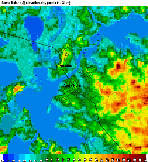
Below is the Elevation map of Santa Helena, which displays elevation range with different colors. Scale of the first map is from 0 to 31 m (0 to 102 ft) with average elevation of 9.5 meters (=31 ft) [note 1]
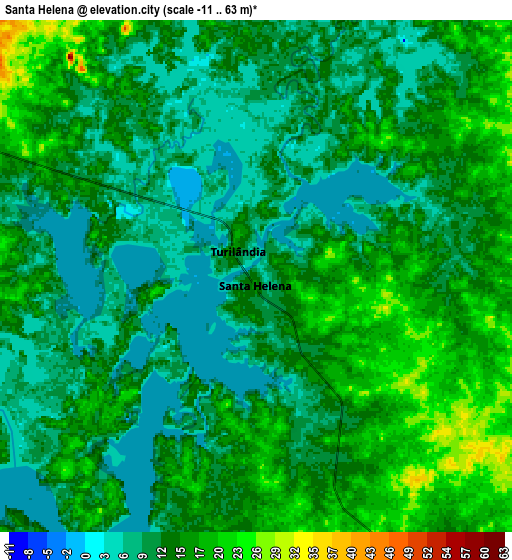
These maps also provides idea of topography and contour of this city, they are displayed at different zoom levels. More info about maps, scale and edge coordinates you can find below images.
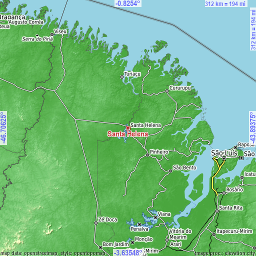
| \ | Map #1 | Map #2 | Topo.Map |
| Scale [m] | 0..31 m | -11..63 m | × |
| Scale [ft] | 0..102 ft | -36..207 ft | × |
| Average | 9.5 m = 31 ft | 13 m = 43 ft | × |
| Width | 9.77 km = 6.1 mi | 19.53 km = 12.1 mi | 312.5 km = 194.2 mi |
| Height | 9.77 km = 6.1 mi | 19.53 km = 12.1 mi | 312.5 km = 194.2 mi |
| ↑Max Latitude | -2.187197° | -2.143283° | -0.8254° |
| Latitude at center | -2.23111° | -2.23111° | -2.23111° |
| ↓Min Latitude | -2.275021° | -2.318931° | -3.63548° |
| ← Min Longitude | -45.343945° | -45.387891° | -46.70625° |
| Longitude center | -45.3° | -45.3° | -45.3° |
| →Max Longitude | -45.256055° | -45.212109° | -43.89375° |
Nearby cities:
Cities around Santa Helena sort by population:
• Pinheiro elevation 9 m
40.3 km,  143°
143°
• Cururupu 7 m
65.6 km,  46°
46°
• São Bento 10 m
74.1 km,  134°
134°
• Maracaçumé 33 m
76.2 km,  285°
285°
• Turiaçu 34 m
63.6 km,  352°
352°
• Cândido Mendes 6 m
98.8 km,  332°
332°
• Matinha 30 m
101.1 km,  162°
162°
• Bequimão 15 m
62.4 km,  112°
112°
• Alcântara 32 m
100 km,  101°
101°
• São João Batista 6 m
97.4 km,  145°
145°
• Araguanã 35 m
89.1 km,  206°
206°
• Nova Olina do Marnhao 24 m
81 km, 213°
Multilingual:
 En español:
Santa Helena elevación 12 m.
 En France:
Santa Helena élévation 12 m.
 Auf Deutsch:
Santa Helena höhe über dem Meeresspiegel ist 12 m.

Sources and notes:
- [note 1] Map square and city borders are not equal. Map elevation data is calculated only from area inside that square.
- [src 1] Elevation data from geonames database provided with same terms of usage.
- [src 2] The elevation map of Santa Helena is generated using elevation data from NASA's 3 arcsec (90m) resolution SRTM data.
- [src 3] Base (background) map © OpenStreetMap contributors tiles are generated by Geofabrik and OpenTopoMap.
Copyright & License:
This Santa Helena Elevation Map is licensed under CC BY-SA. You may reuse any part from this page, if you give a proper credit by linking to this URL:
 More info on terms of use page.