Kresna elevation
Kresna (Blagoevgrad, Obshtina Kresna), Bulgaria elevation is 316 meters and Kresna elevation in feet is 1037 ft above sea level [src 1]. Kresna is a populated place (feature code) with elevation that is 3 meters (10 ft) smaller than average city elevation in Bulgaria.
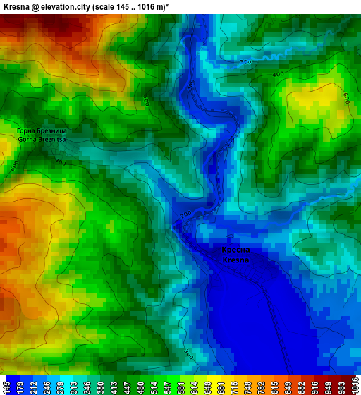
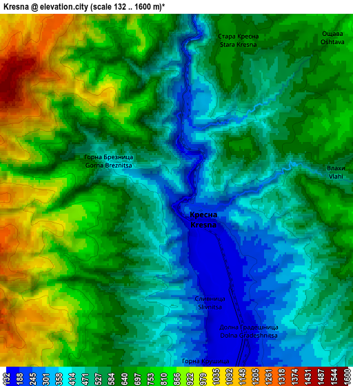
Below is the Elevation map of Kresna, which displays elevation range with different colors. Scale of the first map is from 145 to 1016 m (476 to 3333 ft) with average elevation of 429.3 meters (=1408 ft) [note 1]
These maps also provides idea of topography and contour of this city, they are displayed at different zoom levels. More info about maps, scale and edge coordinates you can find below images.
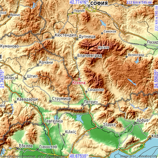
| \ | Map #1 | Map #2 | Topo.Map |
| Scale [m] | 145..1016 m | 132..1600 m | × |
| Scale [ft] | 476..3333 ft | 433..5249 ft | × |
| Average | 429.3 m = 1408 ft | 614.1 m = 2015 ft | × |
| Width | 7.29 km = 4.5 mi | 14.59 km = 9.1 mi | 233.4 km = 145 mi |
| Height | 7.29 km = 4.5 mi | 14.59 km = 9.1 mi | 233.4 km = 145 mi |
| ↑Max Latitude | 41.766116° | 41.798885° | 42.77416° |
| Latitude at center | 41.73333° | 41.73333° | 41.73333° |
| ↓Min Latitude | 41.700527° | 41.667708° | 40.67535° |
| ← Min Longitude | 23.106055° | 23.062109° | 21.74375° |
| Longitude center | 23.15° | 23.15° | 23.15° |
| →Max Longitude | 23.193945° | 23.237891° | 24.55625° |
Nearby cities:
Cities around Kresna sort by population:
• Blagoevgrad elevation 390 m
31.8 km,  352°
352°
• Petrich 185 m
37.5 km,  172°
172°
• Sandanski 246 m
21.6 km,  149°
149°
• Razlog 829 m
31.3 km,  57°
57°
• Bansko 929 m
30.4 km,  67°
67°
• Simitli 280 m
16.9 km, 350°
• Stara Kresna 561 m
7.9 km,  20°
20°
• Belitsa 966 m
42.9 km,  54°
54°
• Rila 621 m
44.5 km,  358°
358°
• Kocherinovo 407 m
39.8 km, 348°
• Kolarovo 396 m
41.2 km,  185°
185°
• Strumyani 130 m
11.9 km,  159°
159°
Multilingual:
 En español:
Kresna elevación 316 m.
 En France:
Krésna élévation 316 m.


Sources and notes:
- [note 1] Map square and city borders are not equal. Map elevation data is calculated only from area inside that square.
- [src 1] Elevation data from geonames database provided with same terms of usage.
- [src 2] The elevation map of Kresna is generated using elevation data from NASA's 3 arcsec (90m) resolution SRTM data.
- [src 3] Base (background) map © OpenStreetMap contributors tiles are generated by Geofabrik and OpenTopoMap.
Copyright & License:
This Kresna Elevation Map is licensed under CC BY-SA. You may reuse any part from this page, if you give a proper credit by linking to this URL:
 More info on terms of use page.