Krichim elevation
Krichim (Plovdiv, Obshtina Krichim), Bulgaria elevation is 228 meters and Krichim elevation in feet is 748 ft above sea level [src 1]. Krichim is a populated place (feature code) with elevation that is 91 meters (299 ft) smaller than average city elevation in Bulgaria.
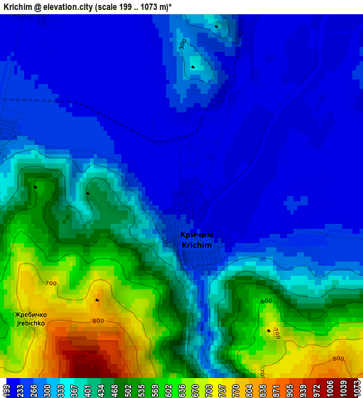
Below is the Elevation map of Krichim, which displays elevation range with different colors. Scale of the first map is from 199 to 1073 m (653 to 3520 ft) with average elevation of 377.5 meters (=1239 ft) [note 1]
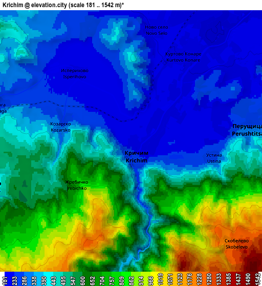
These maps also provides idea of topography and contour of this city, they are displayed at different zoom levels. More info about maps, scale and edge coordinates you can find below images.
| \ | Map #1 | Map #2 | Topo.Map |
| Scale [m] | 199..1073 m | 181..1542 m | × |
| Scale [ft] | 653..3520 ft | 594..5059 ft | × |
| Average | 377.5 m = 1239 ft | 495.3 m = 1625 ft | × |
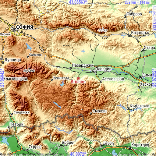
| Width | 7.26 km = 4.5 mi | 14.51 km = 9 mi | 232.2 km = 144.3 mi |
| Height | 7.26 km = 4.5 mi | 14.51 km = 9 mi | 232.2 km = 144.3 mi |
| ↑Max Latitude | 42.082624° | 42.115231° | 43.08563° |
| Latitude at center | 42.05° | 42.05° | 42.05° |
| ↓Min Latitude | 42.01736° | 41.984702° | 40.9972° |
| ← Min Longitude | 24.422725° | 24.378779° | 23.06042° |
| Longitude center | 24.46667° | 24.46667° | 24.46667° |
| →Max Longitude | 24.510615° | 24.554561° | 25.87292° |
Nearby cities:
Cities around Krichim sort by population:
• Plovdiv elevation 169 m
25.9 km,  64°
64°
• Pazardzhik 213 m
20 km,  326°
326°
• Asenovgrad 226 m
33.2 km,  96°
96°
• Peshtera 440 m
13.9 km,  262°
262°
• Stamboliyski 188 m
10.8 km,  30°
30°
• Septemvri 235 m
33.1 km,  302°
302°
• Rakitovo 833 m
32 km, 258°
• Devin 723 m
34.5 km,  189°
189°
• Saedinenie 203 m
25.1 km,  15°
15°
• Perushtitsa 407 m
6.9 km,  90°
90°
• Bratsigovo 572 m
9.1 km,  245°
245°
• Batak 1037 m
23.8 km,  239°
239°
Multilingual:
 En español:
Krichim elevación 228 m.
 En France:
Krichim élévation 228 m.


Sources and notes:
- [note 1] Map square and city borders are not equal. Map elevation data is calculated only from area inside that square.
- [src 1] Elevation data from geonames database provided with same terms of usage.
- [src 2] The elevation map of Krichim is generated using elevation data from NASA's 3 arcsec (90m) resolution SRTM data.
- [src 3] Base (background) map © OpenStreetMap contributors tiles are generated by Geofabrik and OpenTopoMap.
Copyright & License:
This Krichim Elevation Map is licensed under CC BY-SA. You may reuse any part from this page, if you give a proper credit by linking to this URL:
 More info on terms of use page.