Krumovgrad elevation
Krumovgrad (Kardzhali, Obshtina Krumovgrad), Bulgaria elevation is 224 meters and Krumovgrad elevation in feet is 735 ft above sea level [src 1]. Krumovgrad is a seat of a second-order administrative division (feature code) with elevation that is 95 meters (312 ft) smaller than average city elevation in Bulgaria.
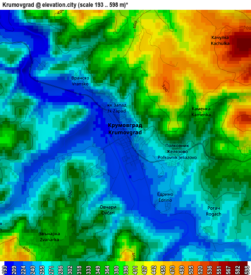
Below is the Elevation map of Krumovgrad, which displays elevation range with different colors. Scale of the first map is from 193 to 598 m (633 to 1962 ft) with average elevation of 318.1 meters (=1044 ft) [note 1]
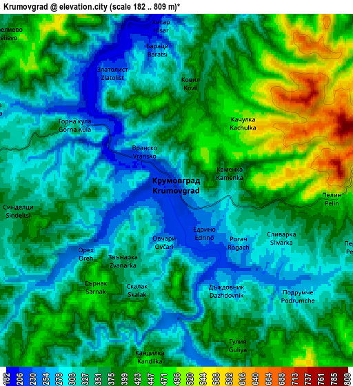
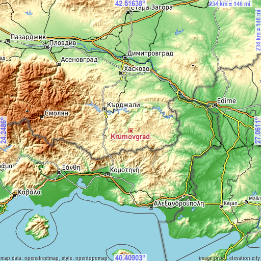
These maps also provides idea of topography and contour of this city, they are displayed at different zoom levels. More info about maps, scale and edge coordinates you can find below images.
| \ | Map #1 | Map #2 | Topo.Map |
| Scale [m] | 193..598 m | 182..809 m | × |
| Scale [ft] | 633..1962 ft | 597..2654 ft | × |
| Average | 318.1 m = 1044 ft | 368.3 m = 1208 ft | × |
| Width | 7.32 km = 4.5 mi | 14.64 km = 9.1 mi | 234.3 km = 145.6 mi |
| Height | 7.32 km = 4.5 mi | 14.64 km = 9.1 mi | 234.3 km = 145.6 mi |
| ↑Max Latitude | 41.504189° | 41.537092° | 42.51638° |
| Latitude at center | 41.47127° | 41.47127° | 41.47127° |
| ↓Min Latitude | 41.438334° | 41.405381° | 40.40903° |
| ← Min Longitude | 25.610905° | 25.566959° | 24.2486° |
| Longitude center | 25.65485° | 25.65485° | 25.65485° |
| →Max Longitude | 25.698795° | 25.742741° | 27.0611° |
Nearby cities:
Cities around Krumovgrad sort by population:
• Haskovo elevation 195 m
52.1 km,  350°
350°
• Kardzhali 278 m
31.1 km,  309°
309°
• Harmanli 74 m
55.3 km,  21°
21°
• Lyubimets 68 m
53.7 km,  41°
41°
• Zlatograd 435 m
47.7 km,  257°
257°
• Nedelino 497 m
47.9 km,  267°
267°
• Ivaylovgrad 178 m
39.6 km,  81°
81°
• Ardino 602 m
45.2 km,  286°
286°
• Dzhebel 321 m
29.4 km,  275°
275°
• Madzharovo 171 m
25.2 km, 43°
• Kirkovo 346 m
29.1 km,  236°
236°
• Gabrovo 654 m
48.8 km,  318°
318°
Multilingual:
 En español:
Krumovgrad elevación 224 m.
 En France:
Krumovgrad élévation 224 m.
 Auf Deutsch:
Krumovgrad höhe über dem Meeresspiegel ist 224 m.

Sources and notes:
- [note 1] Map square and city borders are not equal. Map elevation data is calculated only from area inside that square.
- [src 1] Elevation data from geonames database provided with same terms of usage.
- [src 2] The elevation map of Krumovgrad is generated using elevation data from NASA's 3 arcsec (90m) resolution SRTM data.
- [src 3] Base (background) map © OpenStreetMap contributors tiles are generated by Geofabrik and OpenTopoMap.
Copyright & License:
This Krumovgrad Elevation Map is licensed under CC BY-SA. You may reuse any part from this page, if you give a proper credit by linking to this URL:
 More info on terms of use page.