Kyustendil elevation
Kyustendil, Bulgaria elevation is 519 meters and Kyustendil elevation in feet is 1703 ft above sea level [src 1]. Kyustendil is a seat of a first-order administrative division (feature code) with elevation that is 200 meters (656 ft) bigger than average city elevation in Bulgaria.
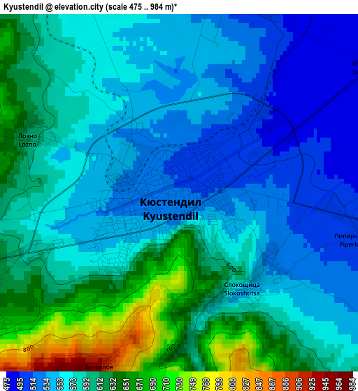
Below is the Elevation map of Kyustendil, which displays elevation range with different colors. Scale of the first map is from 475 to 984 m (1558 to 3228 ft) with average elevation of 581.3 meters (=1907 ft) [note 1]
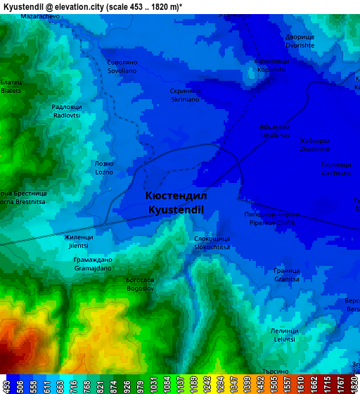
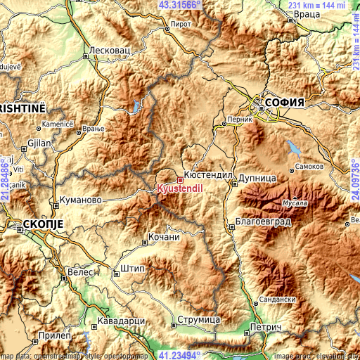
These maps also provides idea of topography and contour of this city, they are displayed at different zoom levels. More info about maps, scale and edge coordinates you can find below images.
| \ | Map #1 | Map #2 | Topo.Map |
| Scale [m] | 475..984 m | 453..1820 m | × |
| Scale [ft] | 1558..3228 ft | 1486..5971 ft | × |
| Average | 581.3 m = 1907 ft | 695 m = 2280 ft | × |
| Width | 7.23 km = 4.5 mi | 14.46 km = 9 mi | 231.4 km = 143.8 mi |
| Height | 7.23 km = 4.5 mi | 14.46 km = 9 mi | 231.3 km = 143.7 mi |
| ↑Max Latitude | 42.316393° | 42.34888° | 43.31566° |
| Latitude at center | 42.28389° | 42.28389° | 42.28389° |
| ↓Min Latitude | 42.25137° | 42.218833° | 41.23494° |
| ← Min Longitude | 22.647165° | 22.603219° | 21.28486° |
| Longitude center | 22.69111° | 22.69111° | 22.69111° |
| →Max Longitude | 22.735055° | 22.779001° | 24.09736° |
Nearby cities:
Cities around Kyustendil sort by population:
• Pernik elevation 712 m
45 km,  38°
38°
• Blagoevgrad 390 m
44.9 km,  131°
131°
• Dupnitsa 512 m
35.1 km,  93°
93°
• Radomir 683 m
36.8 km, 37°
• Bobov Dol 648 m
27.1 km,  71°
71°
• Sapareva Banya 855 m
47.3 km, 90°
• Rila 621 m
40.1 km,  114°
114°
• Kocherinovo 407 m
37.4 km, 126°
• Batanovtsi 661 m
41 km,  32°
32°
• Zemen 600 m
22.2 km,  12°
12°
• Boboshevo 376 m
29.4 km,  119°
119°
• Nevestino 411 m
13.6 km,  103°
103°
Multilingual:
 En español:
Kyustendil elevación 519 m.
 En France:
Kyustendil élévation 519 m.
 Auf Deutsch:
Kjustendil höhe über dem Meeresspiegel ist 519 m.

Sources and notes:
- [note 1] Map square and city borders are not equal. Map elevation data is calculated only from area inside that square.
- [src 1] Elevation data from geonames database provided with same terms of usage.
- [src 2] The elevation map of Kyustendil is generated using elevation data from NASA's 3 arcsec (90m) resolution SRTM data.
- [src 3] Base (background) map © OpenStreetMap contributors tiles are generated by Geofabrik and OpenTopoMap.
Copyright & License:
This Kyustendil Elevation Map is licensed under CC BY-SA. You may reuse any part from this page, if you give a proper credit by linking to this URL:
 More info on terms of use page.