Batié elevation
Batié (Sud-Ouest, Province du Noumbièl), Burkina Faso elevation is 307 meters and Batié elevation in feet is 1007 ft above sea level [src 1]. Batié is a seat of a second-order administrative division (feature code) with elevation that is 3 meters (10 ft) bigger than average city elevation in Burkina Faso.
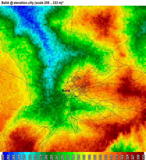
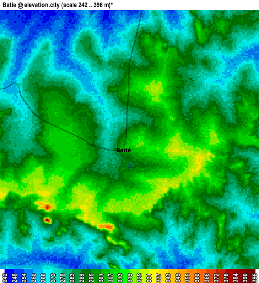
Below is the Elevation map of Batié, which displays elevation range with different colors. Scale of the first map is from 259 to 333 m (850 to 1093 ft) with average elevation of 300.5 meters (=986 ft) [note 1]
These maps also provides idea of topography and contour of this city, they are displayed at different zoom levels. More info about maps, scale and edge coordinates you can find below images.
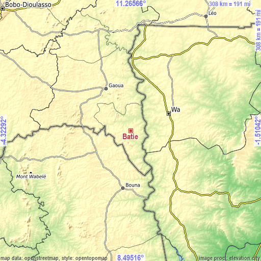
| \ | Map #1 | Map #2 | Topo.Map |
| Scale [m] | 259..333 m | 242..396 m | × |
| Scale [ft] | 850..1093 ft | 794..1299 ft | × |
| Average | 300.5 m = 986 ft | 288.3 m = 946 ft | × |
| Width | 9.63 km = 6 mi | 19.26 km = 12 mi | 308.1 km = 191.4 mi |
| Height | 9.63 km = 6 mi | 19.26 km = 12 mi | 308.1 km = 191.4 mi |
| ↑Max Latitude | 9.92662° | 9.969905° | 11.26566° |
| Latitude at center | 9.88333° | 9.88333° | 9.88333° |
| ↓Min Latitude | 9.840034° | 9.796732° | 8.49516° |
| ← Min Longitude | -2.960615° | -3.004561° | -4.32292° |
| Longitude center | -2.91667° | -2.91667° | -2.91667° |
| →Max Longitude | -2.872725° | -2.828779° | -1.51042° |
Nearby cities:
Cities around Batié sort by population:
• Bobo-Dioulasso elevation 423 m
208.5 km,  313°
313°
• Koudougou 303 m
270.3 km,  12°
12°
• Banfora 299 m
218.9 km,  292°
292°
• Houndé 349 m
191.3 km,  339°
339°
• Léo 349 m
161.7 km,  33°
33°
• Pô 319 m
240.8 km,  53°
53°
• Boromo 263 m
207.1 km,  359°
359°
• Diébougou 290 m
125.4 km, 343°
• Dano 285 m
141.3 km,  353°
353°
• Sindou 370 m
261.1 km, 289°
• Sapouy 336 m
223.9 km, 33°
• Kayao 317 m
264.3 km, 26°
Multilingual:
 En español:
Batié elevación 307 m.
 En France:
Batié élévation 307 m.


Sources and notes:
- [note 1] Map square and city borders are not equal. Map elevation data is calculated only from area inside that square.
- [src 1] Elevation data from geonames database provided with same terms of usage.
- [src 2] The elevation map of Batié is generated using elevation data from NASA's 3 arcsec (90m) resolution SRTM data.
- [src 3] Base (background) map © OpenStreetMap contributors tiles are generated by Geofabrik and OpenTopoMap.
Copyright & License:
This Batié Elevation Map is licensed under CC BY-SA. You may reuse any part from this page, if you give a proper credit by linking to this URL:
 More info on terms of use page.