Manga elevation
Manga (Centre-Sud, Zoundweogo Province), Burkina Faso elevation is 286 meters and Manga elevation in feet is 938 ft above sea level [src 1]. Manga is a seat of a first-order administrative division (feature code) with elevation that is 18 meters (59 ft) smaller than average city elevation in Burkina Faso.
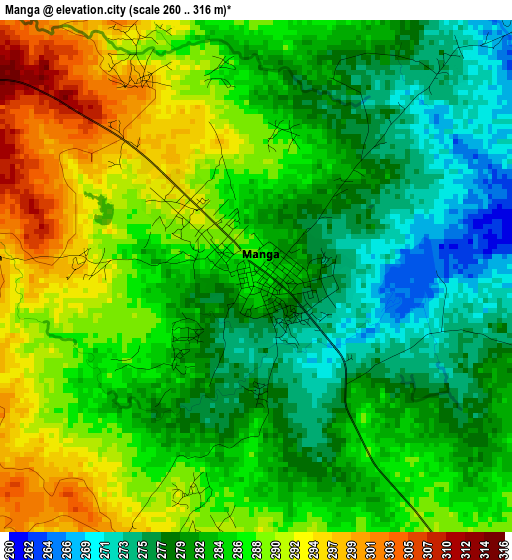
Below is the Elevation map of Manga, which displays elevation range with different colors. Scale of the first map is from 260 to 316 m (853 to 1037 ft) with average elevation of 284.4 meters (=933 ft) [note 1]
These maps also provides idea of topography and contour of this city, they are displayed at different zoom levels. More info about maps, scale and edge coordinates you can find below images.
| \ | Map #1 | Map #2 | Topo.Map |
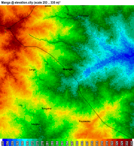
| Scale [m] | 260..316 m | 253..335 m | × |
| Scale [ft] | 853..1037 ft | 830..1099 ft | × |
| Average | 284.4 m = 933 ft | 292.1 m = 958 ft | × |
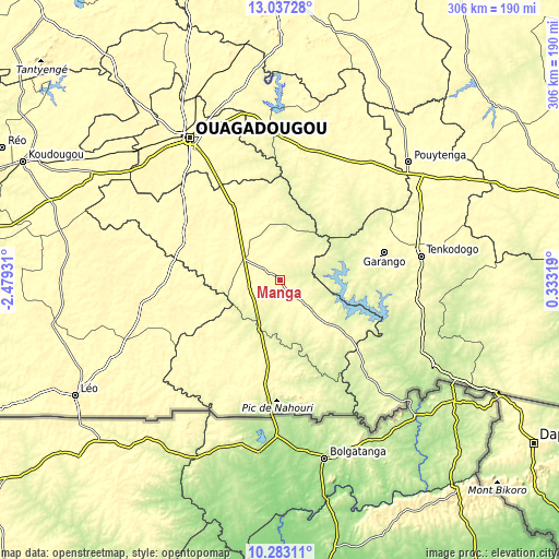
| Width | 9.57 km = 5.9 mi | 19.14 km = 11.9 mi | 306.2 km = 190.3 mi |
| Height | 9.57 km = 5.9 mi | 19.14 km = 11.9 mi | 306.3 km = 190.3 mi |
| ↑Max Latitude | 11.706645° | 11.749672° | 13.03728° |
| Latitude at center | 11.66361° | 11.66361° | 11.66361° |
| ↓Min Latitude | 11.620569° | 11.577521° | 10.28311° |
| ← Min Longitude | -1.117005° | -1.160951° | -2.47931° |
| Longitude center | -1.07306° | -1.07306° | -1.07306° |
| →Max Longitude | -1.029115° | -0.985169° | 0.33319° |
Nearby cities:
Cities around Manga sort by population:
• Tenkodogo elevation 304 m
77.7 km,  80°
80°
• Kombissiri 304 m
53.4 km,  327°
327°
• Garango 304 m
58.9 km, 75°
• Zorgo 312 m
82 km,  37°
37°
• Pô 319 m
55.5 km,  188°
188°
• Sapouy 336 m
77.3 km,  260°
260°
• Nagréongo 270 m
91.7 km,  351°
351°
• Saaba 297 m
87 km, 334°
• Komsilga 305 m
84.3 km,  313°
313°
• Saponé 305 m
72.3 km, 306°
• Koubri 290 m
69.6 km, 328°
• Gaongo 306 m
39.2 km, 345°
Multilingual:
 En español:
Manga elevación 286 m.
 En France:
Manga élévation 286 m.


Sources and notes:
- [note 1] Map square and city borders are not equal. Map elevation data is calculated only from area inside that square.
- [src 1] Elevation data from geonames database provided with same terms of usage.
- [src 2] The elevation map of Manga is generated using elevation data from NASA's 3 arcsec (90m) resolution SRTM data.
- [src 3] Base (background) map © OpenStreetMap contributors tiles are generated by Geofabrik and OpenTopoMap.
Copyright & License:
This Manga Elevation Map is licensed under CC BY-SA. You may reuse any part from this page, if you give a proper credit by linking to this URL:
 More info on terms of use page.