Beloeil elevation
Beloeil (Wallonia, Province du Hainaut), Belgium elevation is 59 meters and Beloeil elevation in feet is 194 ft above sea level [src 1]. Beloeil is a populated place (feature code) with elevation that is 40 meters (131 ft) smaller than average city elevation in Belgium.
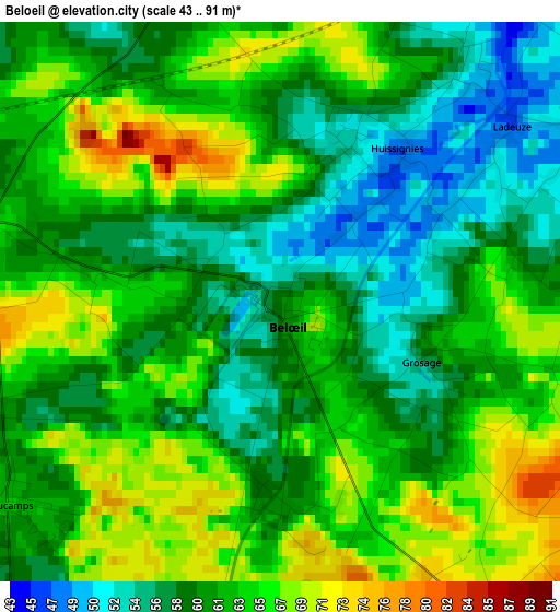
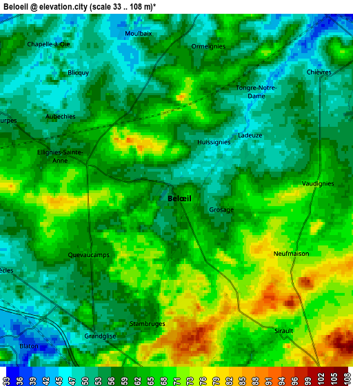
Below is the Elevation map of Beloeil, which displays elevation range with different colors. Scale of the first map is from 43 to 91 m (141 to 299 ft) with average elevation of 61.7 meters (=202 ft) [note 1]
These maps also provides idea of topography and contour of this city, they are displayed at different zoom levels. More info about maps, scale and edge coordinates you can find below images.
| \ | Map #1 | Map #2 | Topo.Map |
| Scale [m] | 43..91 m | 33..108 m | × |
| Scale [ft] | 141..299 ft | 108..354 ft | × |
| Average | 61.7 m = 202 ft | 60.9 m = 200 ft | × |
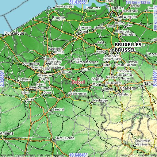
| Width | 6.21 km = 3.9 mi | 12.42 km = 7.7 mi | 198.7 km = 123.5 mi |
| Height | 6.21 km = 3.9 mi | 12.42 km = 7.7 mi | 198.7 km = 123.5 mi |
| ↑Max Latitude | 50.578385° | 50.606282° | 51.43555° |
| Latitude at center | 50.55047° | 50.55047° | 50.55047° |
| ↓Min Latitude | 50.522539° | 50.494591° | 49.64846° |
| ← Min Longitude | 3.690895° | 3.646949° | 2.32859° |
| Longitude center | 3.73484° | 3.73484° | 3.73484° |
| →Max Longitude | 3.778785° | 3.822731° | 5.14109° |
Nearby cities:
Cities around Beloeil sort by population:
• Ath elevation 32 m
9.3 km,  19°
19°
• Saint-Ghislain 27 m
12.8 km,  152°
152°
• Boussu 32 m
13.6 km,  161°
161°
• Quaregnon 35 m
15.3 km,  142°
142°
• Péruwelz 34 m
11 km,  244°
244°
• Bernissart 20 m
10.4 km,  215°
215°
• Frasnes-lez-Buissenal 38 m
15.3 km,  328°
328°
• Jurbise 70 m
12.5 km,  99°
99°
• Hensies 19 m
13.6 km,  195°
195°
• Chièvres 52 m
6.6 km,  50°
50°
• Lens 64 m
11.7 km,  86°
86°
• Brugelette 51 m
9.8 km,  59°
59°
Multilingual:
 En español:
Beloeil elevación 59 m.
 En France:
Beloeil élévation 59 m.


Sources and notes:
- [note 1] Map square and city borders are not equal. Map elevation data is calculated only from area inside that square.
- [src 1] Elevation data from geonames database provided with same terms of usage.
- [src 2] The elevation map of Beloeil is generated using elevation data from NASA's 3 arcsec (90m) resolution SRTM data.
- [src 3] Base (background) map © OpenStreetMap contributors tiles are generated by Geofabrik and OpenTopoMap.
Copyright & License:
This Beloeil Elevation Map is licensed under CC BY-SA. You may reuse any part from this page, if you give a proper credit by linking to this URL:
 More info on terms of use page.