Enghien elevation
Enghien (Wallonia, Province du Hainaut), Belgium elevation is 58 meters and Enghien elevation in feet is 190 ft above sea level [src 1]. Enghien is a seat of a fourth-order administrative division (feature code) with elevation that is 41 meters (135 ft) smaller than average city elevation in Belgium.
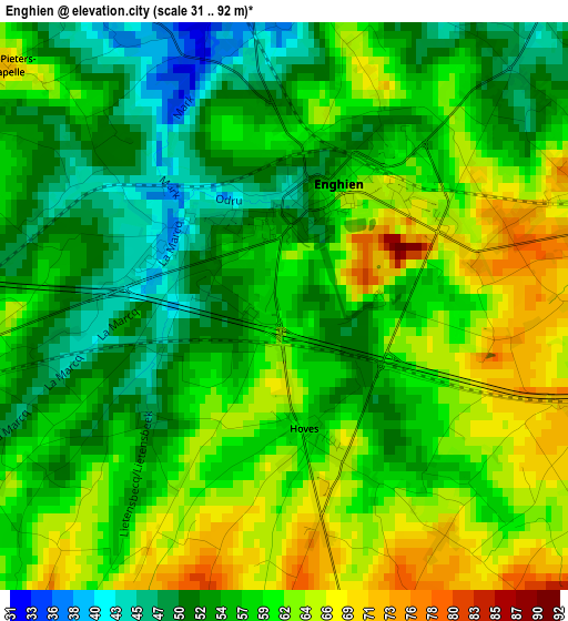
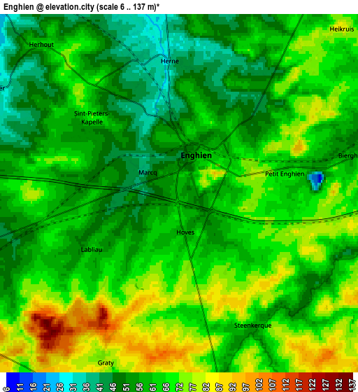
Below is the Elevation map of Enghien, which displays elevation range with different colors. Scale of the first map is from 31 to 92 m (102 to 302 ft) with average elevation of 57.9 meters (=190 ft) [note 1]
These maps also provides idea of topography and contour of this city, they are displayed at different zoom levels. More info about maps, scale and edge coordinates you can find below images.
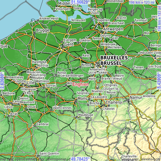
| \ | Map #1 | Map #2 | Topo.Map |
| Scale [m] | 31..92 m | 6..137 m | × |
| Scale [ft] | 102..302 ft | 20..449 ft | × |
| Average | 57.9 m = 190 ft | 63.1 m = 207 ft | × |
| Width | 6.19 km = 3.8 mi | 12.38 km = 7.7 mi | 198.1 km = 123.1 mi |
| Height | 6.19 km = 3.8 mi | 12.38 km = 7.7 mi | 198.1 km = 123.1 mi |
| ↑Max Latitude | 50.711566° | 50.739385° | 51.56629° |
| Latitude at center | 50.68373° | 50.68373° | 50.68373° |
| ↓Min Latitude | 50.655878° | 50.628009° | 49.78425° |
| ← Min Longitude | 3.988895° | 3.944949° | 2.62659° |
| Longitude center | 4.03284° | 4.03284° | 4.03284° |
| →Max Longitude | 4.076785° | 4.120731° | 5.43909° |
Nearby cities:
Cities around Enghien sort by population:
• Halle elevation 34 m
15.3 km,  68°
68°
• Geraardsbergen 32 m
14.6 km,  313°
313°
• Soignies 89 m
12 km,  166°
166°
• Tubize 39 m
11.9 km,  86°
86°
• Braine-le-Comte 96 m
11.5 km,  135°
135°
• Lessines 23 m
14.2 km,  282°
282°
• Rebecq-Rognon 65 m
6.3 km,  124°
124°
• Gooik 39 m
13.6 km,  24°
24°
• Galmaarden 32 m
8.9 km,  330°
330°
• Silly 59 m
8.6 km,  243°
243°
• Herne 43 m
4.5 km,  1°
1°
• Pepingen 52 m
12.3 km,  46°
46°
Multilingual:
 En español:
Enghien elevación 58 m.
 En France:
Enghien élévation 58 m.


Sources and notes:
- [note 1] Map square and city borders are not equal. Map elevation data is calculated only from area inside that square.
- [src 1] Elevation data from geonames database provided with same terms of usage.
- [src 2] The elevation map of Enghien is generated using elevation data from NASA's 3 arcsec (90m) resolution SRTM data.
- [src 3] Base (background) map © OpenStreetMap contributors tiles are generated by Geofabrik and OpenTopoMap.
Copyright & License:
This Enghien Elevation Map is licensed under CC BY-SA. You may reuse any part from this page, if you give a proper credit by linking to this URL:
 More info on terms of use page.