Gingelom elevation
Gingelom (Flanders, Provincie Limburg), Belgium elevation is 83 meters and Gingelom elevation in feet is 272 ft above sea level [src 1]. Gingelom is a populated place (feature code) with elevation that is 16 meters (52 ft) smaller than average city elevation in Belgium.
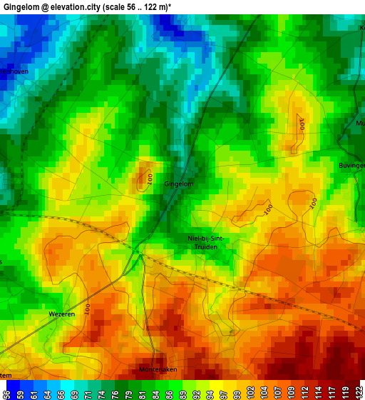
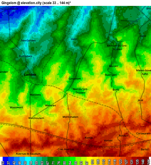
Below is the Elevation map of Gingelom, which displays elevation range with different colors. Scale of the first map is from 56 to 122 m (184 to 400 ft) with average elevation of 90.4 meters (=297 ft) [note 1]
These maps also provides idea of topography and contour of this city, they are displayed at different zoom levels. More info about maps, scale and edge coordinates you can find below images.
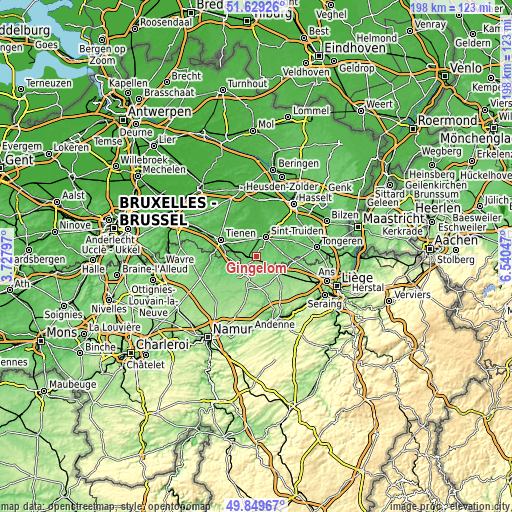
| \ | Map #1 | Map #2 | Topo.Map |
| Scale [m] | 56..122 m | 33..144 m | × |
| Scale [ft] | 184..400 ft | 108..472 ft | × |
| Average | 90.4 m = 297 ft | 91.4 m = 300 ft | × |
| Width | 6.18 km = 3.8 mi | 12.37 km = 7.7 mi | 197.9 km = 123 mi |
| Height | 6.18 km = 3.8 mi | 12.37 km = 7.7 mi | 197.9 km = 123 mi |
| ↑Max Latitude | 50.775717° | 50.803498° | 51.62926° |
| Latitude at center | 50.74792° | 50.74792° | 50.74792° |
| ↓Min Latitude | 50.720106° | 50.692276° | 49.84967° |
| ← Min Longitude | 5.090275° | 5.046329° | 3.72797° |
| Longitude center | 5.13422° | 5.13422° | 5.13422° |
| →Max Longitude | 5.178165° | 5.222111° | 6.54047° |
Nearby cities:
Cities around Gingelom sort by population:
• Sint-Truiden elevation 54 m
8.5 km,  25°
25°
• Landen 72 m
3.7 km,  278°
278°
• Hannut 140 m
9.4 km,  204°
204°
• Waremme 117 m
10.2 km,  123°
123°
• Zoutleeuw 30 m
9.7 km,  347°
347°
• Heers 75 m
11.8 km,  86°
86°
• Nieuwerkerken 44 m
13.6 km,  18°
18°
• Braives 123 m
14.5 km,  180°
180°
• Faimes 140 m
13 km,  136°
136°
• Lincent 97 m
7.9 km,  239°
239°
• Berloz 123 m
7.8 km, 135°
• Geer 129 m
9.1 km,  162°
162°
Multilingual:
 En español:
Gingelom elevación 83 m.
 En France:
Gingelom élévation 83 m.


Sources and notes:
- [note 1] Map square and city borders are not equal. Map elevation data is calculated only from area inside that square.
- [src 1] Elevation data from geonames database provided with same terms of usage.
- [src 2] The elevation map of Gingelom is generated using elevation data from NASA's 3 arcsec (90m) resolution SRTM data.
- [src 3] Base (background) map © OpenStreetMap contributors tiles are generated by Geofabrik and OpenTopoMap.
Copyright & License:
This Gingelom Elevation Map is licensed under CC BY-SA. You may reuse any part from this page, if you give a proper credit by linking to this URL:
 More info on terms of use page.