Lincent elevation
Lincent (Wallonia, Province de Liège), Belgium elevation is 97 meters and Lincent elevation in feet is 318 ft above sea level [src 1]. Lincent is a seat of a fourth-order administrative division (feature code) with elevation that is 2 meters (7 ft) smaller than average city elevation in Belgium.
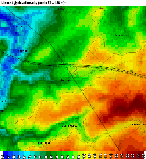
Below is the Elevation map of Lincent, which displays elevation range with different colors. Scale of the first map is from 54 to 138 m (177 to 453 ft) with average elevation of 96.5 meters (=317 ft) [note 1]
These maps also provides idea of topography and contour of this city, they are displayed at different zoom levels. More info about maps, scale and edge coordinates you can find below images.
| \ | Map #1 | Topo.Map |
| Scale [m] | 54..138 m | × |
| Scale [ft] | 177..453 ft | × |
| Average | 96.5 m = 317 ft | × |
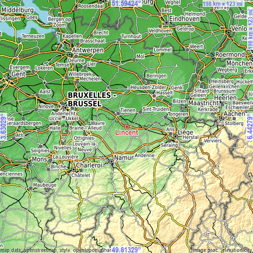
| Width | 6.19 km = 3.8 mi | 198 km = 123 mi |
| Height | 6.19 km = 3.8 mi | 198 km = 123 mi |
| ↑Max Latitude | 50.740039° | 51.59424° |
| Latitude at center | 50.71222° | 50.71222° |
| ↓Min Latitude | 50.684385° | 49.81329° |
| ← Min Longitude | 4.992595° | 3.63029° |
| Longitude center | 5.03654° | 5.03654° |
| →Max Longitude | 5.080485° | 6.44279° |
Nearby cities:
Cities around Lincent sort by population:
• Tienen elevation 46 m
12.7 km,  326°
326°
• Landen 72 m
5.5 km,  35°
35°
• Hannut 140 m
5.4 km,  146°
146°
• Jodoigne 74 m
11.9 km,  276°
276°
• Gingelom 83 m
7.9 km,  59°
59°
• Zoutleeuw 30 m
14.3 km,  19°
19°
• Hoegaarden 54 m
12.5 km,  304°
304°
• Ramillies 150 m
12.9 km,  227°
227°
• Braives 123 m
12.5 km, 147°
• Berloz 123 m
12.5 km,  97°
97°
• Geer 129 m
10.7 km,  115°
115°
• Wasseiges 133 m
10.3 km,  192°
192°
Multilingual:
 En español:
Lincent elevación 97 m.
 En France:
Lincent élévation 97 m.


Sources and notes:
- [note 1] Map square and city borders are not equal. Map elevation data is calculated only from area inside that square.
- [src 1] Elevation data from geonames database provided with same terms of usage.
- [src 2] The elevation map of Lincent is generated using elevation data from NASA's 3 arcsec (90m) resolution SRTM data.
- [src 3] Base (background) map © OpenStreetMap contributors tiles are generated by Geofabrik and OpenTopoMap.
Copyright & License:
This Lincent Elevation Map is licensed under CC BY-SA. You may reuse any part from this page, if you give a proper credit by linking to this URL:
 More info on terms of use page.