Maasmechelen elevation
Maasmechelen (Flanders, Provincie Limburg), Belgium elevation is 39 meters and Maasmechelen elevation in feet is 128 ft above sea level [src 1]. Maasmechelen is a populated place (feature code) with elevation that is 60 meters (197 ft) smaller than average city elevation in Belgium.
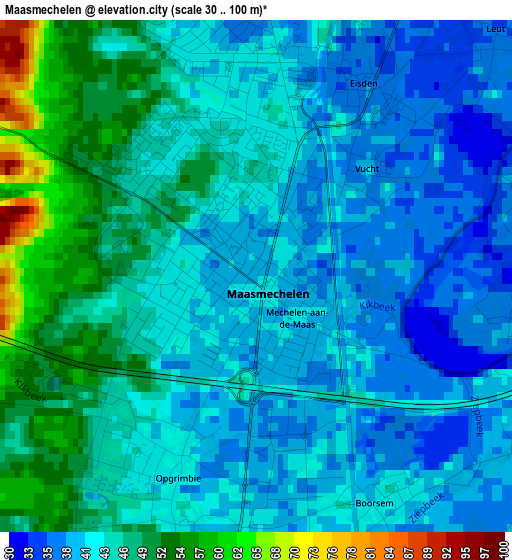
Below is the Elevation map of Maasmechelen, which displays elevation range with different colors. Scale of the first map is from 30 to 100 m (98 to 328 ft) with average elevation of 43.9 meters (=144 ft) [note 1]
These maps also provides idea of topography and contour of this city, they are displayed at different zoom levels. More info about maps, scale and edge coordinates you can find below images.
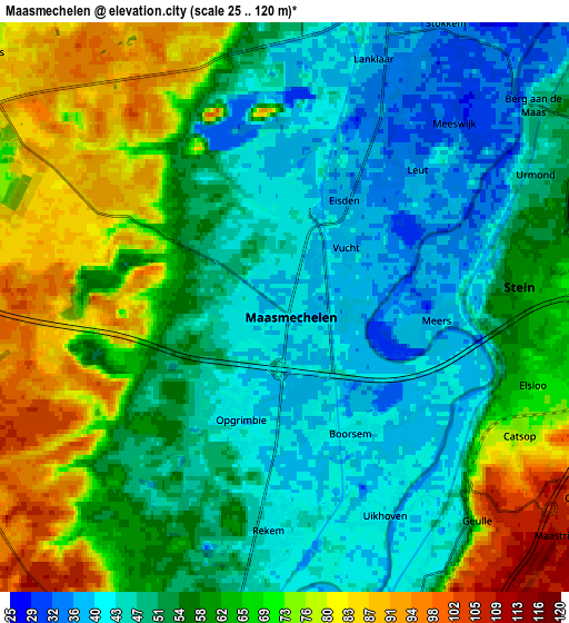
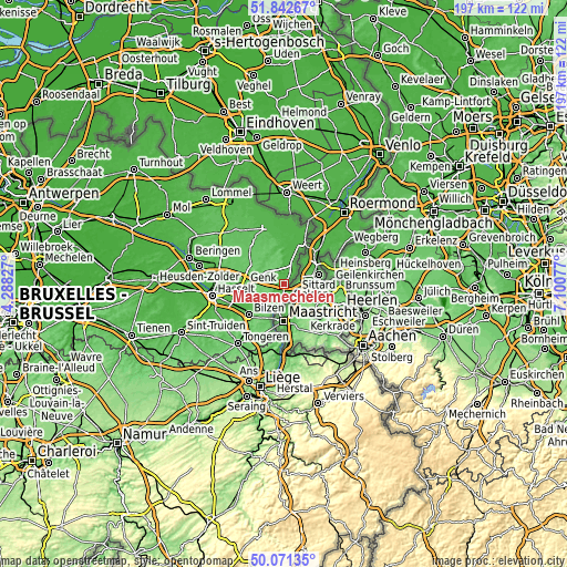
| \ | Map #1 | Map #2 | Topo.Map |
| Scale [m] | 30..100 m | 25..120 m | × |
| Scale [ft] | 98..328 ft | 82..394 ft | × |
| Average | 43.9 m = 144 ft | 58.4 m = 192 ft | × |
| Width | 6.15 km = 3.8 mi | 12.31 km = 7.6 mi | 197 km = 122.4 mi |
| Height | 6.15 km = 3.8 mi | 12.31 km = 7.6 mi | 196.9 km = 122.3 mi |
| ↑Max Latitude | 50.993118° | 51.02077° | 51.84267° |
| Latitude at center | 50.96545° | 50.96545° | 50.96545° |
| ↓Min Latitude | 50.937765° | 50.910064° | 50.07135° |
| ← Min Longitude | 5.650575° | 5.606629° | 4.28827° |
| Longitude center | 5.69452° | 5.69452° | 5.69452° |
| →Max Longitude | 5.738465° | 5.782411° | 7.10077° |
Nearby cities:
Cities around Maasmechelen sort by population:
• Genk elevation 66 m
13.6 km,  269°
269°
• Bilzen 53 m
16 km,  230°
230°
• Lanaken 63 m
8.7 km,  202°
202°
• Maaseik 30 m
16 km,  22°
22°
• Diepenbeek 50 m
20.4 km,  251°
251°
• Riemst 105 m
18.5 km, 200°
• Bree 48 m
20.7 km,  340°
340°
• Kinrooi 33 m
20.3 km,  9°
9°
• Opglabbeek 72 m
11.6 km,  317°
317°
• Hoeselt 77 m
19.6 km, 227°
• As 81 m
9 km,  301°
301°
• Zutendaal 84 m
9.1 km, 246°
Multilingual:
 En español:
Maasmechelen elevación 39 m.
 En France:
Maasmechelen élévation 39 m.
 Auf Deutsch:
Maasmechelen höhe über dem Meeresspiegel ist 39 m.
 На русском:
Маасмехелене, Маасмехелен высота над уровнем моря 39 м
Sources and notes:
- [note 1] Map square and city borders are not equal. Map elevation data is calculated only from area inside that square.
- [src 1] Elevation data from geonames database provided with same terms of usage.
- [src 2] The elevation map of Maasmechelen is generated using elevation data from NASA's 3 arcsec (90m) resolution SRTM data.
- [src 3] Base (background) map © OpenStreetMap contributors tiles are generated by Geofabrik and OpenTopoMap.
Copyright & License:
This Maasmechelen Elevation Map is licensed under CC BY-SA. You may reuse any part from this page, if you give a proper credit by linking to this URL:
 More info on terms of use page.