Seraing elevation
Seraing (Wallonia, Province de Liège), Belgium elevation is 185 meters and Seraing elevation in feet is 607 ft above sea level [src 1]. Seraing is a populated place (feature code) with elevation that is 86 meters (282 ft) bigger than average city elevation in Belgium.
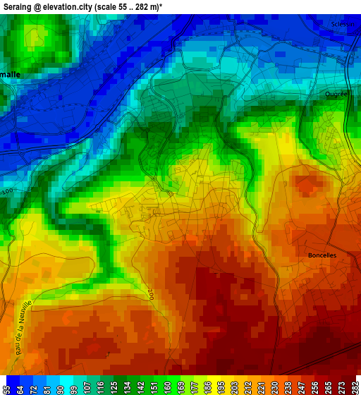
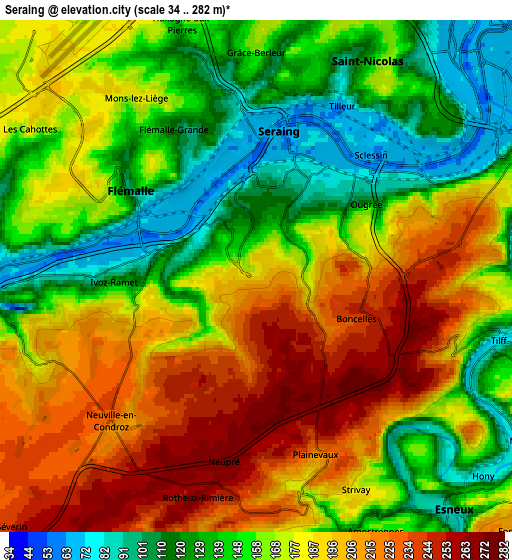
Below is the Elevation map of Seraing, which displays elevation range with different colors. Scale of the first map is from 55 to 282 m (180 to 925 ft) with average elevation of 171.2 meters (=562 ft) [note 1]
These maps also provides idea of topography and contour of this city, they are displayed at different zoom levels. More info about maps, scale and edge coordinates you can find below images.
| \ | Map #1 | Map #2 | Topo.Map |
| Scale [m] | 55..282 m | 34..282 m | × |
| Scale [ft] | 180..925 ft | 112..925 ft | × |
| Average | 171.2 m = 562 ft | 170.7 m = 560 ft | × |
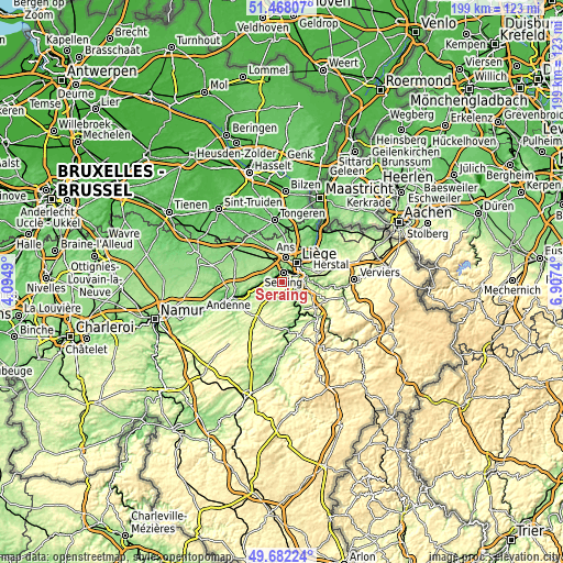
| Width | 6.21 km = 3.9 mi | 12.41 km = 7.7 mi | 198.6 km = 123.4 mi |
| Height | 6.21 km = 3.9 mi | 12.41 km = 7.7 mi | 198.6 km = 123.4 mi |
| ↑Max Latitude | 50.611515° | 50.639393° | 51.46807° |
| Latitude at center | 50.58362° | 50.58362° | 50.58362° |
| ↓Min Latitude | 50.555709° | 50.527781° | 49.68224° |
| ← Min Longitude | 5.457205° | 5.413259° | 4.0949° |
| Longitude center | 5.50115° | 5.50115° | 5.50115° |
| →Max Longitude | 5.545095° | 5.589041° | 6.9074° |
Nearby cities:
Cities around Seraing sort by population:
• Liège elevation 66 m
7.3 km,  40°
40°
• Ans 181 m
8.9 km,  8°
8°
• Flémalle-Haute 175 m
4.4 km,  294°
294°
• Saint-Nicolas 96 m
5.4 km,  23°
23°
• Chaudfontaine 218 m
9.4 km,  90°
90°
• Esneux 115 m
7.1 km,  138°
138°
• Awans 152 m
9.7 km,  344°
344°
• Engis 80 m
7.2 km,  268°
268°
• Nandrin 218 m
10.3 km,  214°
214°
• Anthisnes 275 m
11.2 km,  173°
173°
• Mons-lez-Liège 137 m
4.4 km,  326°
326°
• Fexhe-le-Haut-Clocher 156 m
11.6 km,  321°
321°
Multilingual:
 En español:
Seraing elevación 185 m.
 En France:
Seraing élévation 185 m.


Sources and notes:
- [note 1] Map square and city borders are not equal. Map elevation data is calculated only from area inside that square.
- [src 1] Elevation data from geonames database provided with same terms of usage.
- [src 2] The elevation map of Seraing is generated using elevation data from NASA's 3 arcsec (90m) resolution SRTM data.
- [src 3] Base (background) map © OpenStreetMap contributors tiles are generated by Geofabrik and OpenTopoMap.
Copyright & License:
This Seraing Elevation Map is licensed under CC BY-SA. You may reuse any part from this page, if you give a proper credit by linking to this URL:
 More info on terms of use page.