Verlaine elevation
Verlaine (Wallonia, Province de Liège), Belgium elevation is 171 meters and Verlaine elevation in feet is 561 ft above sea level [src 1]. Verlaine is a populated place (feature code) with elevation that is 72 meters (236 ft) bigger than average city elevation in Belgium.
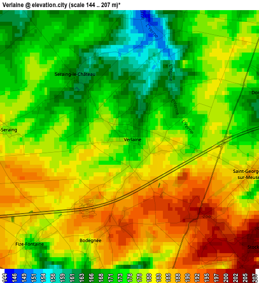
Below is the Elevation map of Verlaine, which displays elevation range with different colors. Scale of the first map is from 144 to 207 m (472 to 679 ft) with average elevation of 178 meters (=584 ft) [note 1]
These maps also provides idea of topography and contour of this city, they are displayed at different zoom levels. More info about maps, scale and edge coordinates you can find below images.
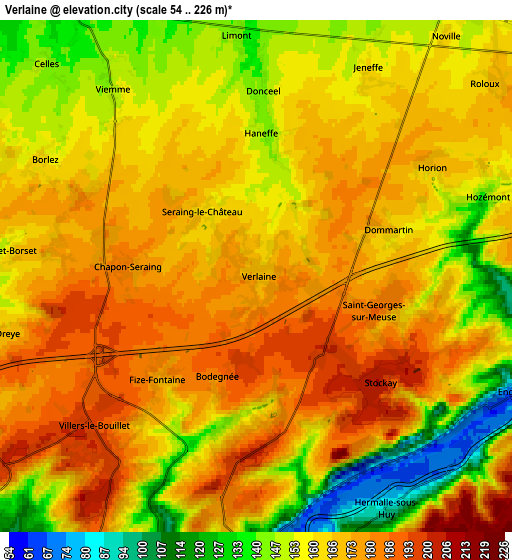
| \ | Map #1 | Map #2 | Topo.Map |
| Scale [m] | 144..207 m | 54..226 m | × |
| Scale [ft] | 472..679 ft | 177..741 ft | × |
| Average | 178 m = 584 ft | 163.9 m = 538 ft | × |
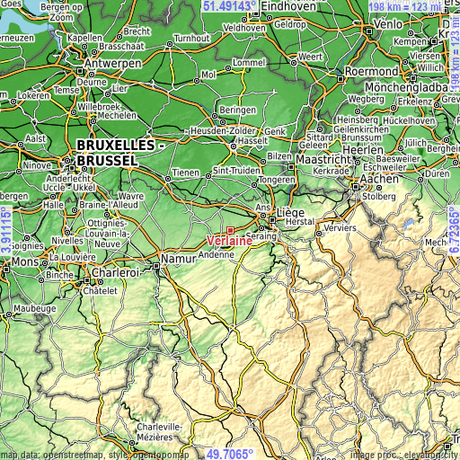
| Width | 6.2 km = 3.9 mi | 12.4 km = 7.7 mi | 198.5 km = 123.3 mi |
| Height | 6.2 km = 3.9 mi | 12.4 km = 7.7 mi | 198.5 km = 123.3 mi |
| ↑Max Latitude | 50.635311° | 50.663175° | 51.49143° |
| Latitude at center | 50.60743° | 50.60743° | 50.60743° |
| ↓Min Latitude | 50.579533° | 50.551619° | 49.7065° |
| ← Min Longitude | 5.273455° | 5.229509° | 3.91115° |
| Longitude center | 5.3174° | 5.3174° | 5.3174° |
| →Max Longitude | 5.361345° | 5.405291° | 6.72365° |
Nearby cities:
Cities around Verlaine sort by population:
• Flémalle-Haute elevation 175 m
9 km,  95°
95°
• Huy 75 m
11.5 km,  211°
211°
• Waremme 117 m
10.9 km,  336°
336°
• Amay 131 m
6.6 km,  184°
184°
• Wanze 96 m
10.8 km,  225°
225°
• Villers-le-Bouillet 194 m
5.3 km, 230°
• Engis 80 m
6.4 km,  116°
116°
• Remicourt 126 m
8.2 km,  5°
5°
• Mons-lez-Liège 137 m
10.6 km,  84°
84°
• Faimes 140 m
7.3 km,  326°
326°
• Fexhe-le-Haut-Clocher 156 m
8.7 km,  42°
42°
• Donceel 146 m
4.5 km,  2°
2°
Multilingual:
 En español:
Verlaine elevación 171 m.
 En France:
Verlaine élévation 171 m.
 Auf Deutsch:
Verlaine höhe über dem Meeresspiegel ist 171 m.

Sources and notes:
- [note 1] Map square and city borders are not equal. Map elevation data is calculated only from area inside that square.
- [src 1] Elevation data from geonames database provided with same terms of usage.
- [src 2] The elevation map of Verlaine is generated using elevation data from NASA's 3 arcsec (90m) resolution SRTM data.
- [src 3] Base (background) map © OpenStreetMap contributors tiles are generated by Geofabrik and OpenTopoMap.
Copyright & License:
This Verlaine Elevation Map is licensed under CC BY-SA. You may reuse any part from this page, if you give a proper credit by linking to this URL:
 More info on terms of use page.