Hotonj elevation
Hotonj (Federation of B&H), Bosnia and Herzegovina elevation is 571 meters and Hotonj elevation in feet is 1873 ft above sea level [src 1]. Hotonj is a populated locality (feature code) with elevation that is 208 meters (682 ft) bigger than average city elevation in Bosnia and Herzegovina.
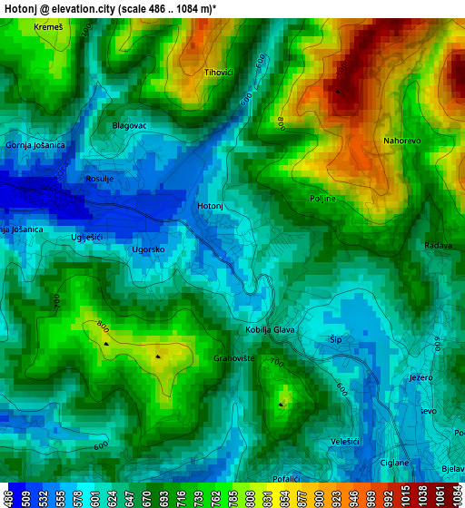
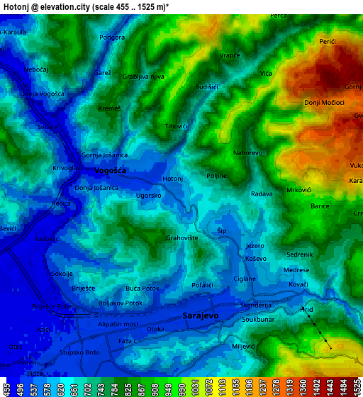
Below is the Elevation map of Hotonj, which displays elevation range with different colors. Scale of the first map is from 486 to 1084 m (1594 to 3556 ft) with average elevation of 680.9 meters (=2234 ft) [note 1]
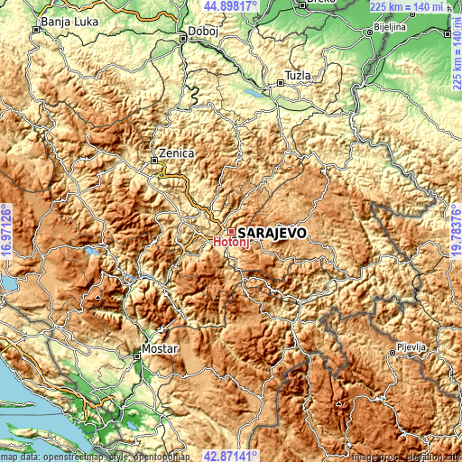
These maps also provides idea of topography and contour of this city, they are displayed at different zoom levels. More info about maps, scale and edge coordinates you can find below images.
| \ | Map #1 | Map #2 | Topo.Map |
| Scale [m] | 486..1084 m | 455..1525 m | × |
| Scale [ft] | 1594..3556 ft | 1493..5003 ft | × |
| Average | 680.9 m = 2234 ft | 740.2 m = 2428 ft | × |
| Width | 7.04 km = 4.4 mi | 14.08 km = 8.7 mi | 225.4 km = 140.1 mi |
| Height | 7.04 km = 4.4 mi | 14.08 km = 8.7 mi | 225.3 km = 140 mi |
| ↑Max Latitude | 43.92507° | 43.956713° | 44.89817° |
| Latitude at center | 43.89341° | 43.89341° | 43.89341° |
| ↓Min Latitude | 43.861733° | 43.83004° | 42.87141° |
| ← Min Longitude | 18.333565° | 18.289619° | 16.97126° |
| Longitude center | 18.37751° | 18.37751° | 18.37751° |
| →Max Longitude | 18.421455° | 18.465401° | 19.78376° |
Nearby cities:
Cities around Hotonj sort by population:
• Sarajevo elevation 509 m
5.3 km,  198°
198°
• Vogošća 509 m
2.8 km,  290°
290°
• Pale 834 m
17.6 km,  119°
119°
• Hadžići 555 m
15.8 km,  239°
239°
• Ilijaš 463 m
10.7 km,  307°
307°
• Mahala 485 m
16.4 km,  323°
323°
• Kobilja Glava 605 m
1.6 km,  145°
145°
• Koran 853 m
18 km, 120°
• Breza 497 m
16.8 km,  326°
326°
• Hreša 1063 m
9.7 km,  100°
100°
• Ilidža 497 m
9.4 km,  221°
221°
• Lukavica 546 m
7.4 km,  176°
176°
Multilingual:
 En español:
Hotonj elevación 571 m.
 En France:
Hotonj élévation 571 m.


Sources and notes:
- [note 1] Map square and city borders are not equal. Map elevation data is calculated only from area inside that square.
- [src 1] Elevation data from geonames database provided with same terms of usage.
- [src 2] The elevation map of Hotonj is generated using elevation data from NASA's 3 arcsec (90m) resolution SRTM data.
- [src 3] Base (background) map © OpenStreetMap contributors tiles are generated by Geofabrik and OpenTopoMap.
Copyright & License:
This Hotonj Elevation Map is licensed under CC BY-SA. You may reuse any part from this page, if you give a proper credit by linking to this URL:
 More info on terms of use page.