Banovići elevation
Banovići (Federation of B&H, Tuzlanski Kanton), Bosnia and Herzegovina elevation is 335 meters and Banovići elevation in feet is 1099 ft above sea level [src 1]. Banovići is a seat of a third-order administrative division (feature code) with elevation that is 28 meters (92 ft) smaller than average city elevation in Bosnia and Herzegovina.
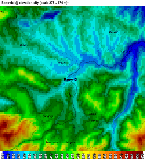
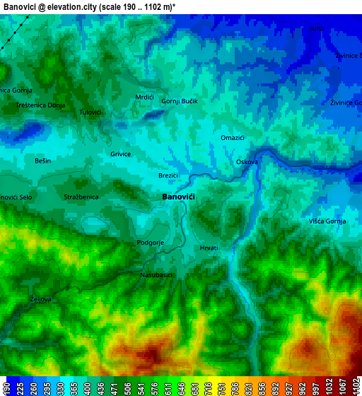
Below is the Elevation map of Banovići, which displays elevation range with different colors. Scale of the first map is from 275 to 674 m (902 to 2211 ft) with average elevation of 397 meters (=1302 ft) [note 1]
These maps also provides idea of topography and contour of this city, they are displayed at different zoom levels. More info about maps, scale and edge coordinates you can find below images.
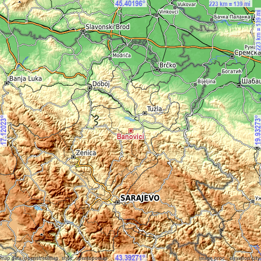
| \ | Map #1 | Map #2 | Topo.Map |
| Scale [m] | 275..674 m | 190..1102 m | × |
| Scale [ft] | 902..2211 ft | 623..3615 ft | × |
| Average | 397 m = 1302 ft | 450.5 m = 1478 ft | × |
| Width | 6.98 km = 4.3 mi | 13.96 km = 8.7 mi | 223.4 km = 138.8 mi |
| Height | 6.98 km = 4.3 mi | 13.96 km = 8.7 mi | 223.4 km = 138.8 mi |
| ↑Max Latitude | 44.437346° | 44.468715° | 45.40196° |
| Latitude at center | 44.40596° | 44.40596° | 44.40596° |
| ↓Min Latitude | 44.374557° | 44.343137° | 43.39271° |
| ← Min Longitude | 18.482535° | 18.438589° | 17.12023° |
| Longitude center | 18.52648° | 18.52648° | 18.52648° |
| →Max Longitude | 18.570425° | 18.614371° | 19.93273° |
Nearby cities:
Cities around Banovići sort by population:
• Živinice elevation 216 m
10.9 km,  63°
63°
• Gornje Živinice 285 m
7.6 km,  70°
70°
• Stupari 398 m
16.2 km,  129°
129°
• Careva Ćuprija 384 m
17.3 km,  206°
206°
• Dubrave Donje 295 m
15.9 km, 58°
• Barice 221 m
15.4 km,  346°
346°
• Šerići 221 m
7.4 km,  23°
23°
• Svojat 307 m
16.9 km,  93°
93°
• Puračić 188 m
16 km, 346°
• Kiseljak 210 m
9.9 km, 20°
• Vozuća 326 m
14.7 km,  249°
249°
• Lukavac 194 m
15.2 km,  359°
359°
Multilingual:
 En español:
Banovići elevación 335 m.
 En France:
Banovići élévation 335 m.
 Auf Deutsch:
Banovići höhe über dem Meeresspiegel ist 335 m.

Sources and notes:
- [note 1] Map square and city borders are not equal. Map elevation data is calculated only from area inside that square.
- [src 1] Elevation data from geonames database provided with same terms of usage.
- [src 2] The elevation map of Banovići is generated using elevation data from NASA's 3 arcsec (90m) resolution SRTM data.
- [src 3] Base (background) map © OpenStreetMap contributors tiles are generated by Geofabrik and OpenTopoMap.
Copyright & License:
This Banovići Elevation Map is licensed under CC BY-SA. You may reuse any part from this page, if you give a proper credit by linking to this URL:
 More info on terms of use page.