Bila elevation
Bila (Federation of B&H), Bosnia and Herzegovina elevation is 732 meters and Bila elevation in feet is 2402 ft above sea level [src 1]. Bila is a populated locality (feature code) with elevation that is 369 meters (1211 ft) bigger than average city elevation in Bosnia and Herzegovina.
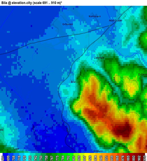
Below is the Elevation map of Bila, which displays elevation range with different colors. Scale of the first map is from 691 to 910 m (2267 to 2986 ft) with average elevation of 740.1 meters (=2428 ft) [note 1]
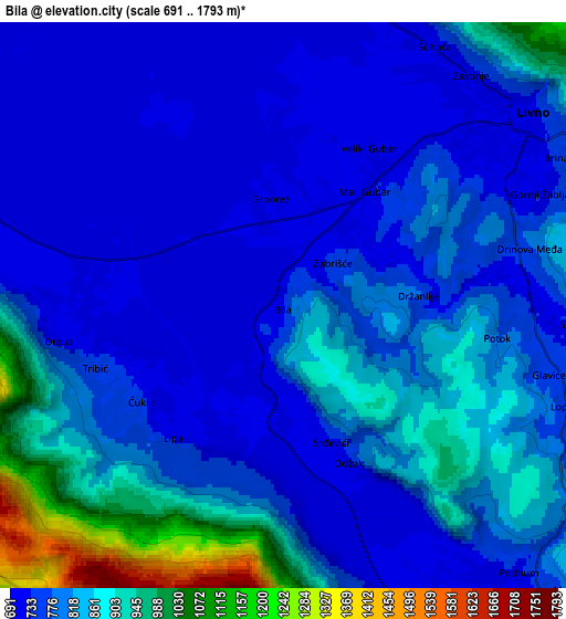
These maps also provides idea of topography and contour of this city, they are displayed at different zoom levels. More info about maps, scale and edge coordinates you can find below images.
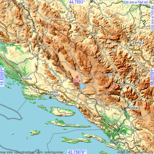
| \ | Map #1 | Map #2 | Topo.Map |
| Scale [m] | 691..910 m | 691..1793 m | × |
| Scale [ft] | 2267..2986 ft | 2267..5883 ft | × |
| Average | 740.1 m = 2428 ft | 802.5 m = 2633 ft | × |
| Width | 7.06 km = 4.4 mi | 14.11 km = 8.8 mi | 225.8 km = 140.3 mi |
| Height | 7.06 km = 4.4 mi | 14.11 km = 8.8 mi | 225.8 km = 140.3 mi |
| ↑Max Latitude | 43.814369° | 43.846071° | 44.7893° |
| Latitude at center | 43.78265° | 43.78265° | 43.78265° |
| ↓Min Latitude | 43.750914° | 43.719162° | 42.75876° |
| ← Min Longitude | 16.882815° | 16.838869° | 15.52051° |
| Longitude center | 16.92676° | 16.92676° | 16.92676° |
| →Max Longitude | 16.970705° | 17.014651° | 18.33301° |
Nearby cities:
Cities around Bila sort by population:
• Livno elevation 745 m
8.1 km,  52°
52°
• Tomislavgrad 904 m
25 km,  106°
106°
• Podhum 730 m
8.8 km,  138°
138°
• Orguz 721 m
5.2 km,  259°
259°
• Zabrišće 743 m
1.6 km, 49°
• Glamoč 950 m
29.9 km,  347°
347°
• Drežnica 841 m
40.1 km,  134°
134°
• Vidoši 836 m
8.2 km,  98°
98°
• Rumboci 712 m
46.5 km,  83°
83°
• Posušje 667 m
47.1 km, 136°
• Novo Selo 1121 m
37.8 km,  28°
28°
• Kupres 1175 m
36.5 km, 50°
Multilingual:
 En español:
Bila elevación 732 m.
 En France:
Bila élévation 732 m.


Sources and notes:
- [note 1] Map square and city borders are not equal. Map elevation data is calculated only from area inside that square.
- [src 1] Elevation data from geonames database provided with same terms of usage.
- [src 2] The elevation map of Bila is generated using elevation data from NASA's 3 arcsec (90m) resolution SRTM data.
- [src 3] Base (background) map © OpenStreetMap contributors tiles are generated by Geofabrik and OpenTopoMap.
Copyright & License:
This Bila Elevation Map is licensed under CC BY-SA. You may reuse any part from this page, if you give a proper credit by linking to this URL:
 More info on terms of use page.